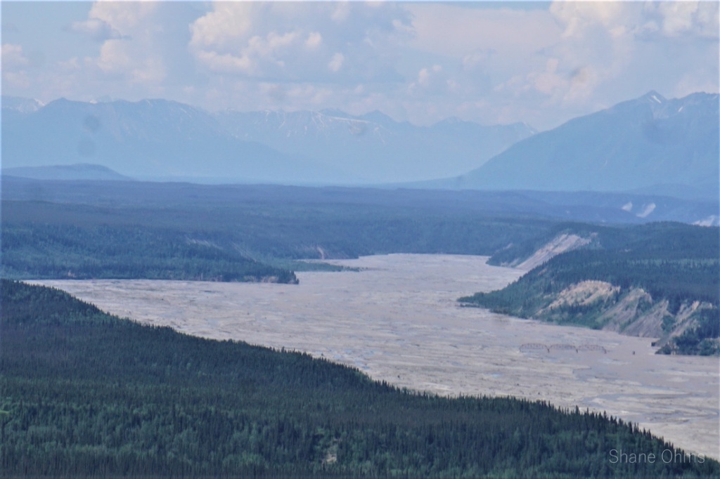
How it all began: At the elevation of ~4800′ on some ridgeline between Tok and Glenallen, I had made camp at an odd occurrence of cell reception. With a company dipnetting trip in Chitna coming up in a few days I was already hoping to skew the following weekend plans toward something in McCarthy (gas prices were high in 2022 and I wanted to capitalize on my already being in the Copper River Basin). After checking the weather forecast and sentinel imaging, it was looking very promising for a bigger trip I’d had bookmarked and had been waiting on the right conditions for two years. I checked charter flight availability and texted solicitations to a few hardy friends who might have free enough schedules for a sporadic trip. After doing a circuit of peaks, I returned to my cell/internet service campsite and got a “yes” out of Sophie. I locked in our flights to/from the May Creek Landing Strip that night. My phone died the next morning, but everything was already in motion for Peak 8910 (also called East Pyramid Peak in a 1988 AAC publication of its first ascent by Danny Kost).
June 23rd, 2022
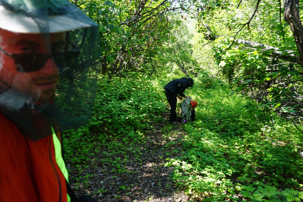
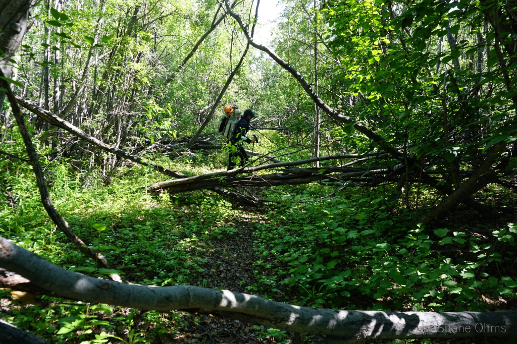
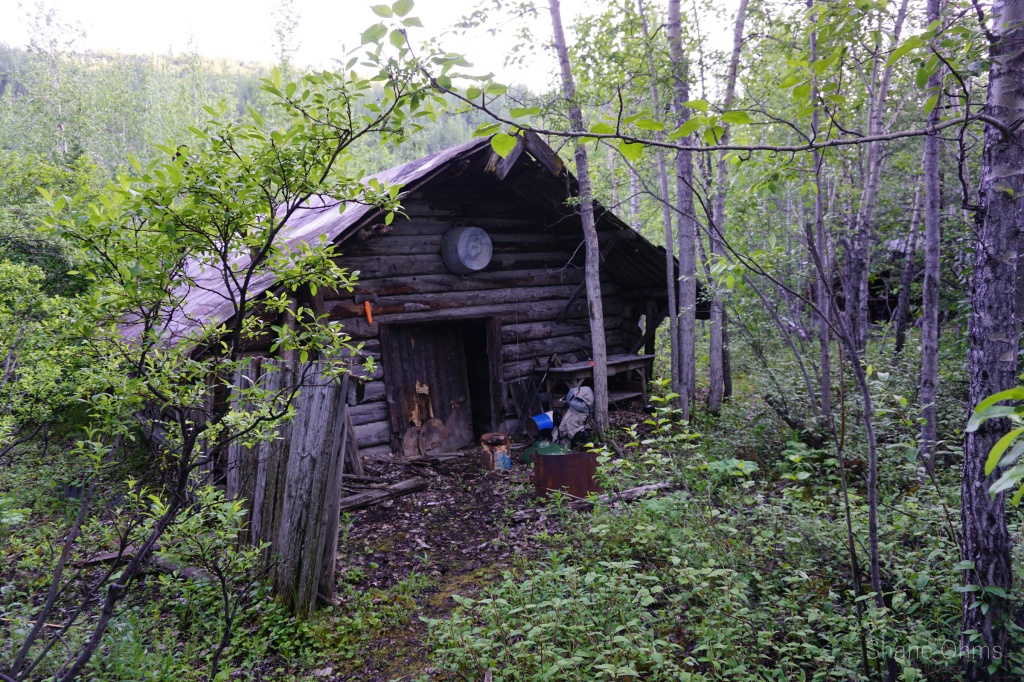
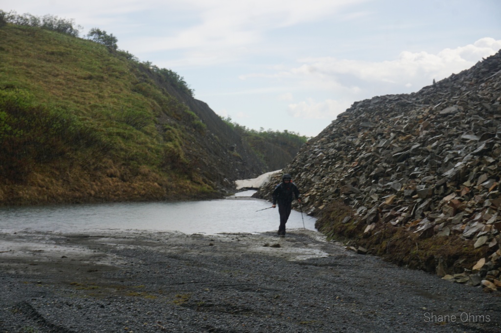
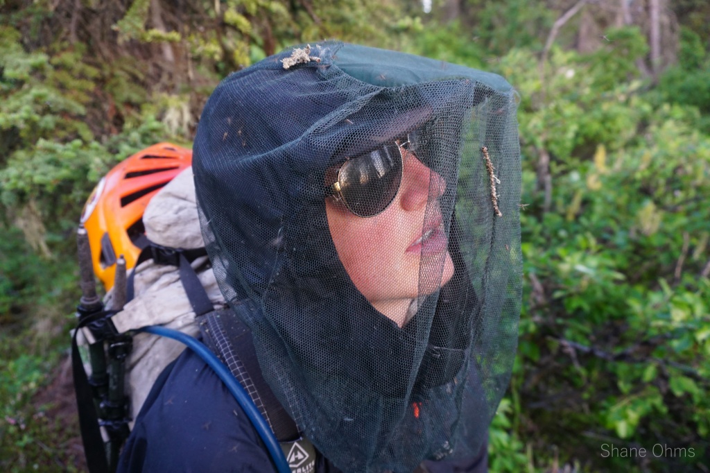
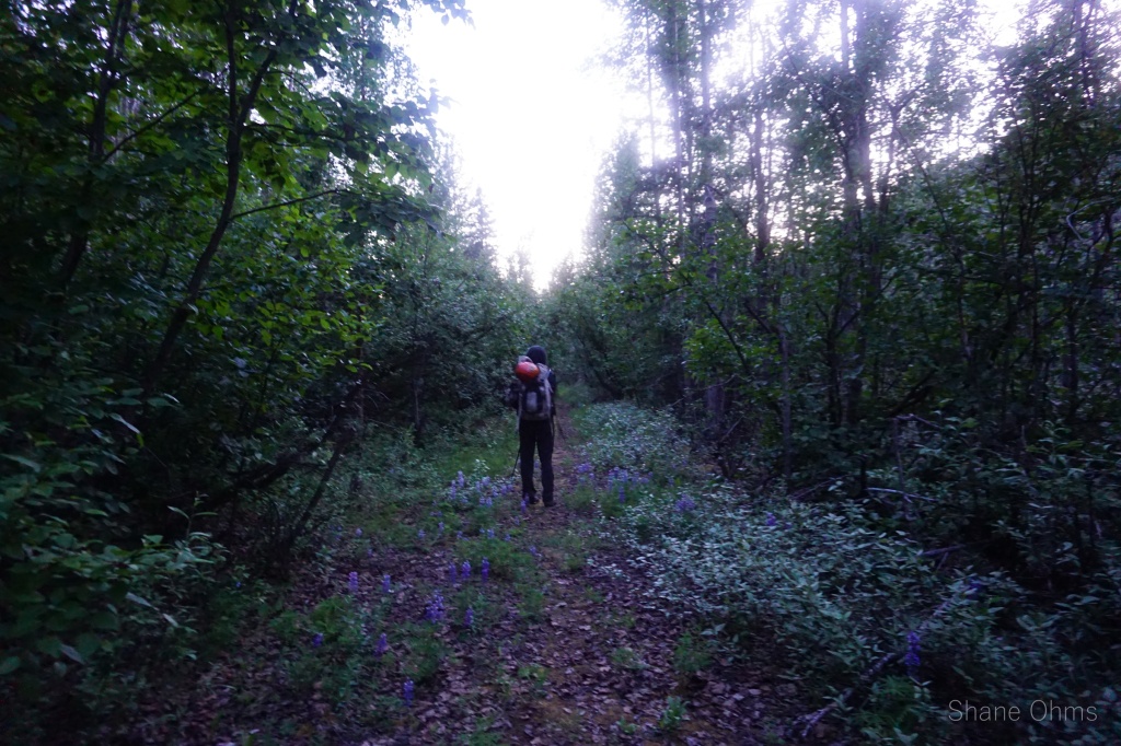
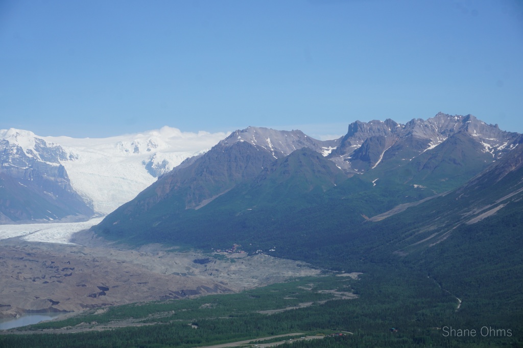
Don’t let the pretty cover image deceive you! Before (and after) reaching this incredible alpine beauty we had to get through the most brutal and demoralizing approach I’ve ever had. McCarthy longtime locals were calling this the worst mosquito summer they could remember -and I don’t think they were lying. To minimize losses to our precious sanity and blood reserves, we had to wear our long-sleeve wind breakers and gloves. Which wouldn’t be that bad by itself, but under the hot summer sun these layers were way too much. The sweating was a mess. The buzz of mosquitos was incessant. And the 5 mile “road to Chititu” is anything but a road after the first mile. Alders and vegetation invade the airspace above the trail. You loose the trail and then find it because it is so difficult to distinguish. By the end of the fourth mile we were quite sweat drenched, but then a heavy flash rain for the last mile determined that every square inch of our clothing and bodies should be dripping wet. The rain, had astonishingly little effect on the mosquitos. Hoping to find shelter from the rain in Chititu, we quickened our already fast pace. We found such shelter at a horse stable in Chititu at 5:30pm. We were only 3 hours into the trip and I was already ready for it to be over. But the testing of patience was far from over.


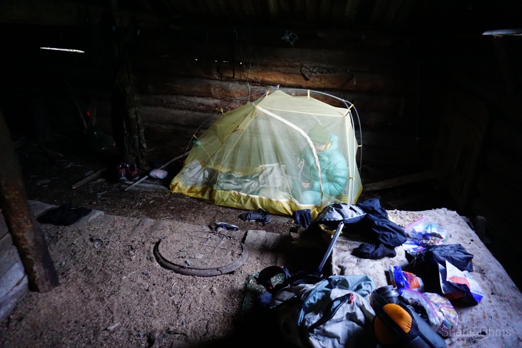
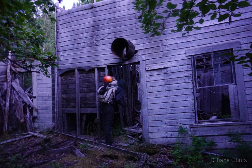
Wet, muddy, and tired, we rolled into this horse stable with a gang of mosquitos hot on our tail (or maybe they were already there first, or both). Out of the rain finally, we quickly set to pitching the tent’s bugnet, quickly wrung water out of our clothes and hung them to dry, and then most quicklyest of all: zipped into the tent. Finally, we were able to feel safe and bits of our sanity came back, albeit slowly. Now that our more imminent needs had been resolved (being in a dry and mosquito safe-place), we were now able to take in the full unpleasantry that comes along with sleeping in a horse stable. I’ll start with the elephant in the room: it smelt like shit and piss. Musty porcupine excrement to be exact. Since the exodus of the miners 90 years ago, generations of porcupines have claimed this stable for themselves. The force of mosquitos was so threatening, that for 12 hours I refused to drink any of my water (which laid untemptingly outside the tent) because of how badly I did not want to leave the mosquito-free sanctuary to pee. And my final gripe is boredom. Under less hostile conditions we would have liked to spend the afternoon exploring the old town of Chititu. Instead, we listened to the pitter-pat of rain on the metal roof, the hum of mosquitos, and the creaking of the building. A single window let in just enough light to observe rusty artifacts, but still dark enough that mushrooms saw fit to take root in the horses’ old water trough. I penned the first half of a poem that is now finished.
The Road to Chititu
Chititu, Chititu.
Curse the road to Chititu.
Its as far from a 'road' as its far from new.
I'd rather walk to Timbuktu
-(Hell, i'd probably get there faster too)-
"What is a view?"
I wouldn't know; I'm on the road to Chititu!
There is only heat, sweat, rain, and soaking shoes.
Mosquitos, mud, and alders too.
But still the gold rush whispers "if you make it, it'll make you."

Chititu, Chititu.
"What even is in Chititu?"
The list is short, but its the truth:
Rust. Mushrooms. And porcupine poop.
In the only building that has a roof:
a stinkin' stable unfit for horses' hooves.
So no; there isn't shit to do in Chititu.
-(Known by some as 'Shititu')-
Next time I'm there I'll pass right on through.
I still curse the sweat, and the rain, and the soaking shoes,
the mosquitos, and the mud, and the alders too.
Because survivors don't talk about their days in Chititu.
They curse them.
Eventually we tired enough to try a hand at sleeping… But behold: a rogue porcupine with an equivalent desire to occupy the stable. Sophie attempted to flush the porcupine out, but it refused. In the resulting stalemate; neither us nor the porcupine were able to get much rest that night. The porcupine mostly kept to the opposite corner of the stable, but would frequently shift about and make noise. We had to sleep with one eye open just to make sure he was not walking toward our corner or getting into our things. And since I’m a heavier sleeper, what I really mean by “we” is that Sophie slept with one eye open. Me, I slept like a little baby. (Thanks for taking on “porcupine watch duty” Sophie).

June 24th, 2022
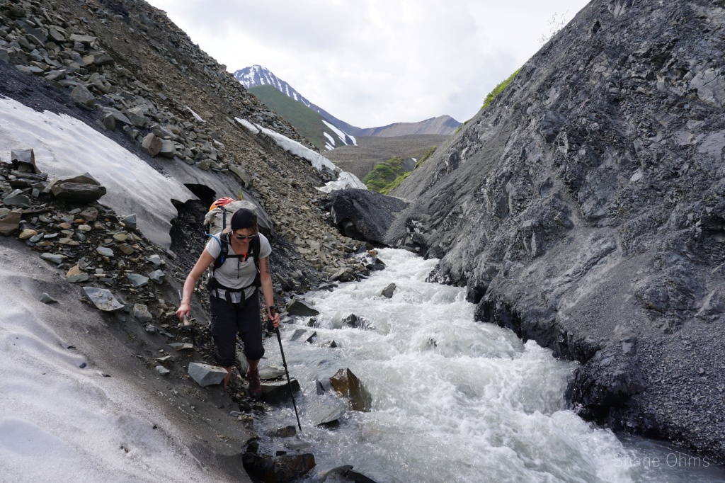
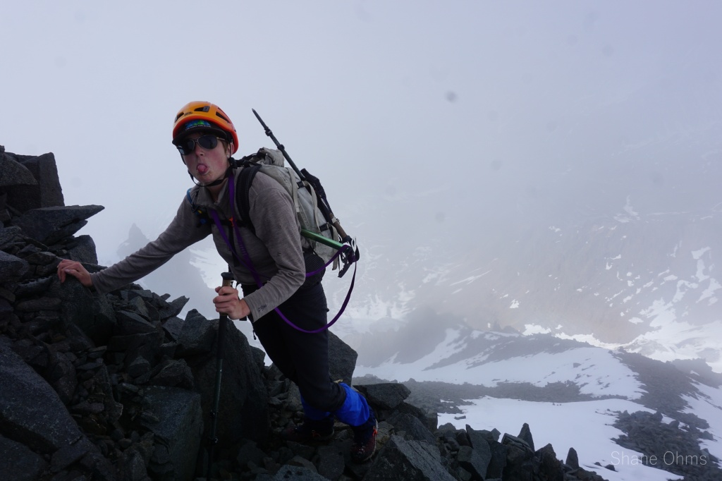
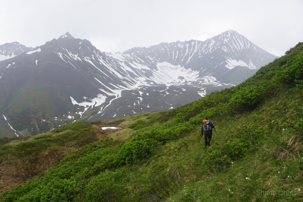
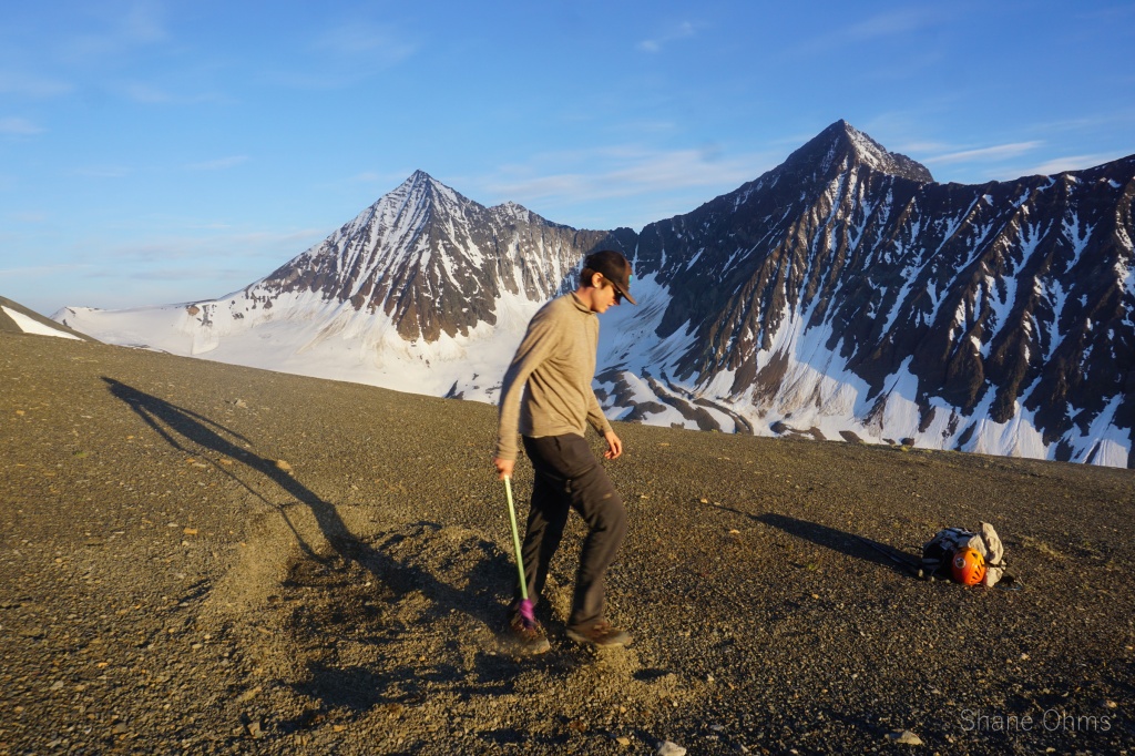
At 6am we started moving again. Packing up our things, and putting on our half-wet-still suits of mosquito armor. The rain had stopped, but the alders still rained when shaken -and they were oft shaken. After crossing the powerful flow coming from White Creek on a conveniently pinned 20′ length of metal pipe, we pushed up Rex Creek, sticking entirely to it’s right side because it too had strong flow and no good means to criss-cross it. It is my belief that in July/August with less snowmelt feeding the creeks, they might be less forceful and access much easier when you can utilize both sides of the river for travel. I had chosen June as the month for this trip based on estimated ideal snow cramponing conditions in Peak 8910’s south couloir. You can’t have the best of both worlds I guess.
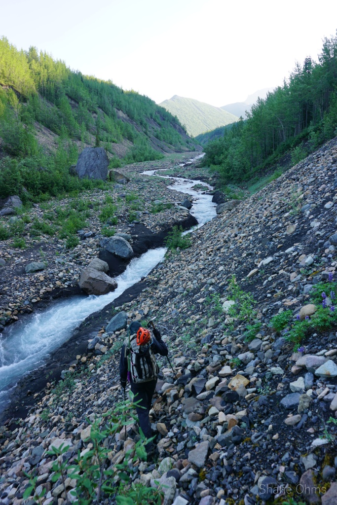

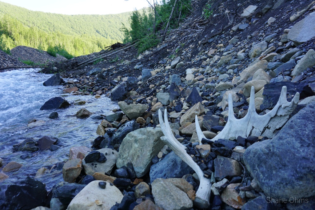


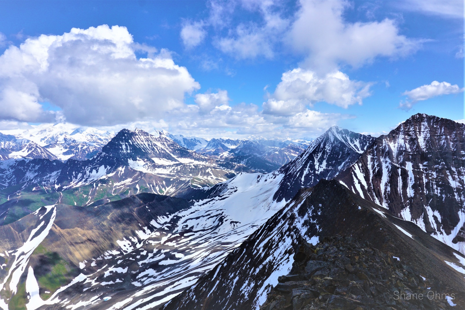
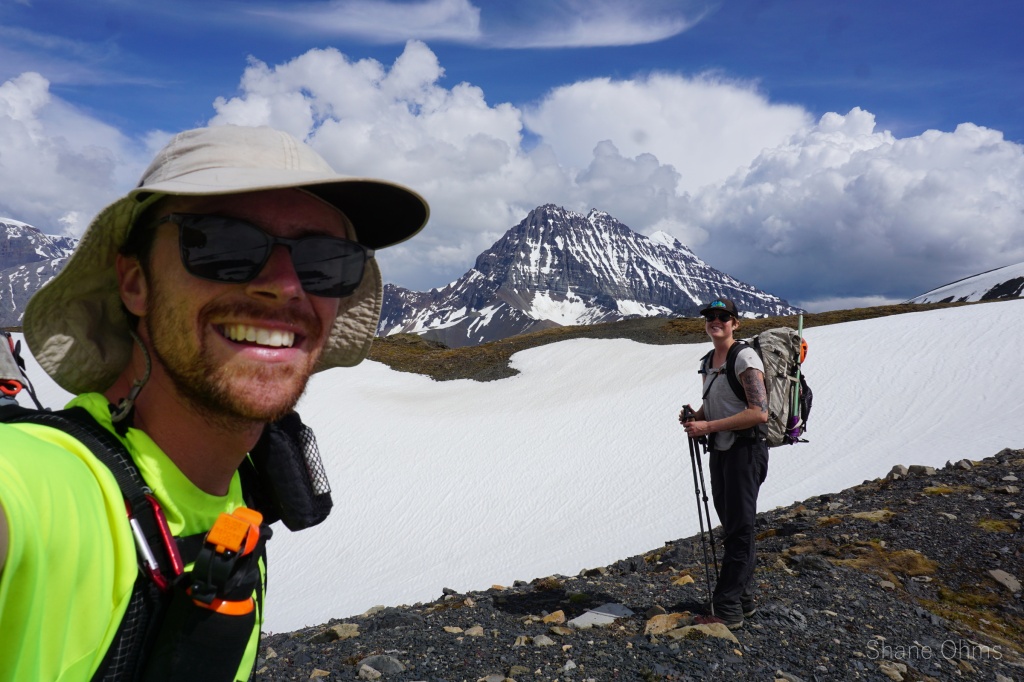
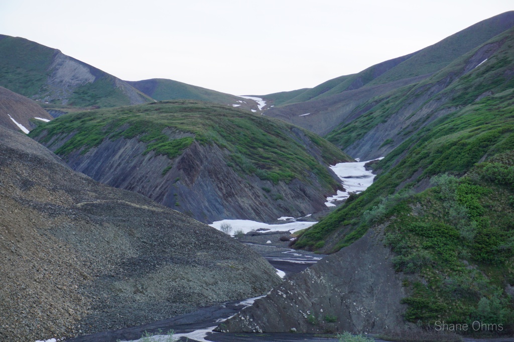
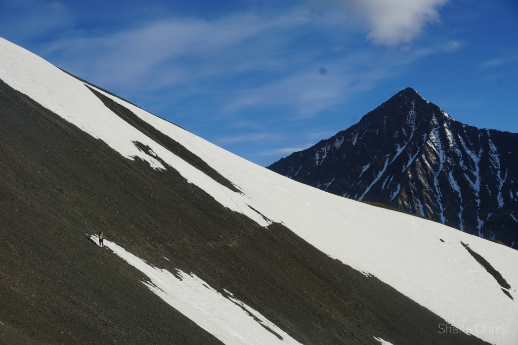
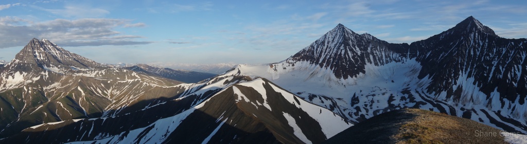
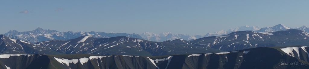
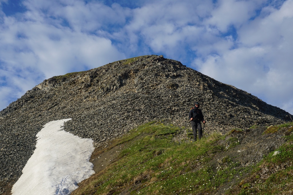
The day quickly got hot and there was some more sweat misery, but as we made slow and steady progress toward Rex Pass, as we got on the remnants of Rex Glacier, the mosquitos finally did subside. We removed our wind breakers and morale improved. We were out of the trees and in the alpine, things were looking up! But no part of the trip could feel as great as the moment we reached rex pass and could finally put eyes on our goal; Peak 8910 (this is where Sophie’s video begins). At rex pass, we also found many super cool, large clam fossils. Rex pass could be a trip destination in it of itself.


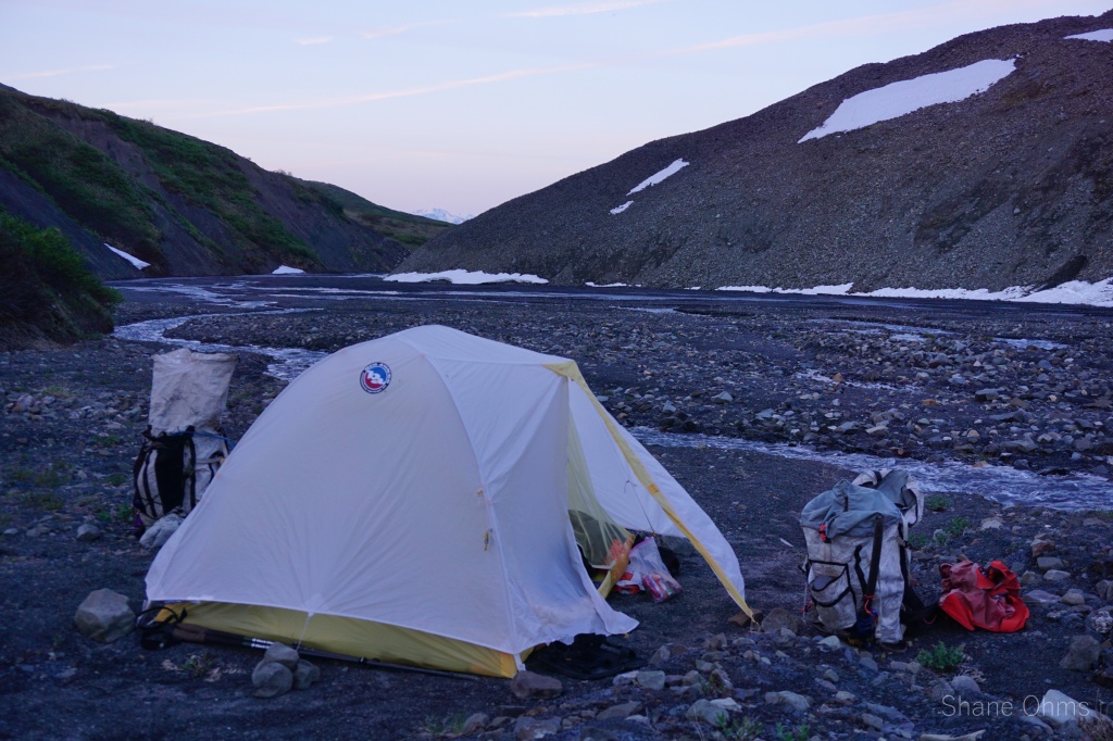
We descended into Young Creek first on a ridge, then along some flowing water at the terminus of one of Andrus’ rock glaciers. We reached down to 4500′, where we made camp at 5pm, ate food, and retired shortly after. After the restless night at Chititu, we were sleepy, and we’d be waking early the next day to reach the snow in the couloir before the day got warm again. I remind you, at this point we’d never seen the couloir except from satellite imagery. We had undertaken a substantial amount of suffering to get here, and the main goal of the trip, peak 8910, might have to be abandoned if even one impassable cliff section interrupted the couloir system. Anxious, excited, and tired, we fell asleep to the welcomed noises of Young Creek gushing by.
_________________________________________________________________________________________________
June 25th 2022
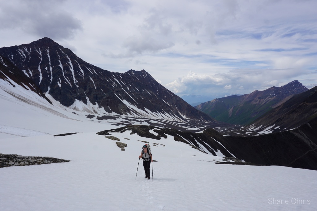
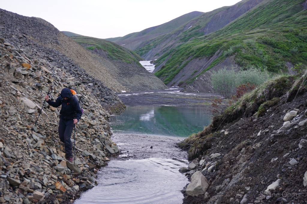
We woke up early and corralled minimal gear into our bags for a fast and light summit bid; crampons, gaitors, helmet, ice axe, food, water, layers. We set off downstream a short ways, navigating around a small lake damed by a second of Andrus’ rock glaciers pressing against the opposite hillside. At this pinch point lake, we started our ascent into the valley south of Peak 8910.


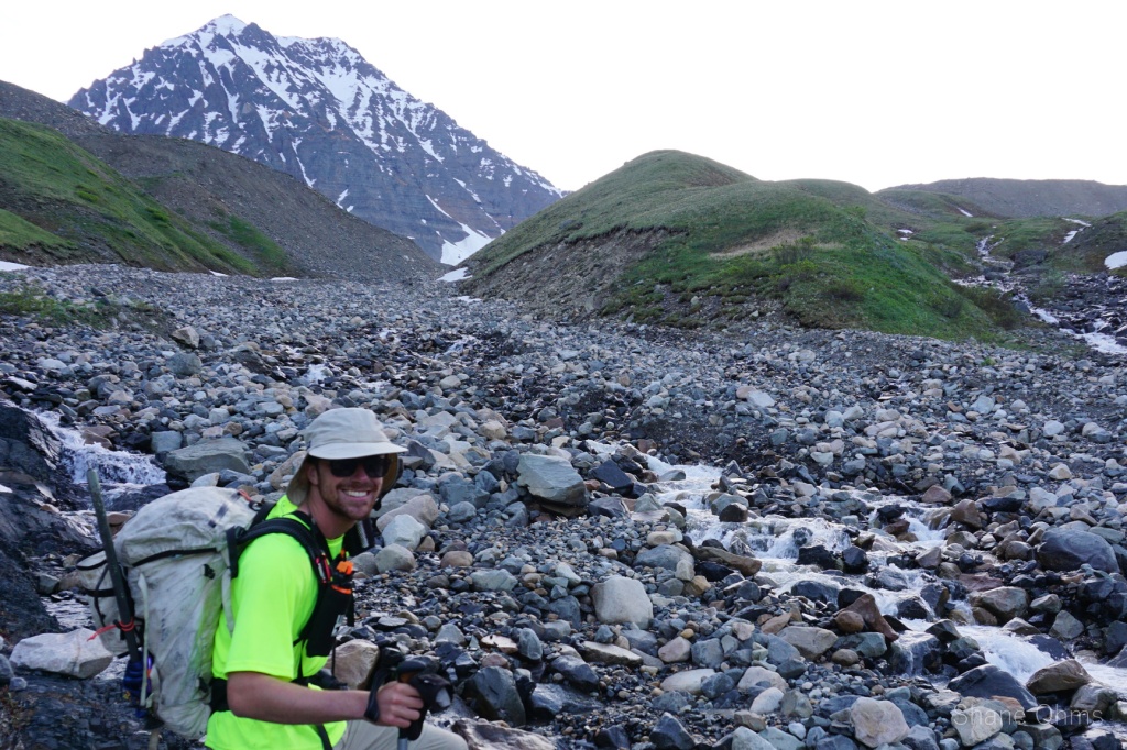
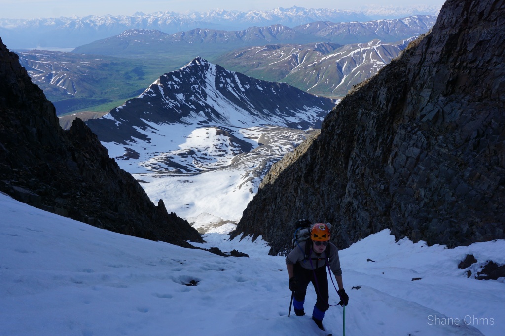
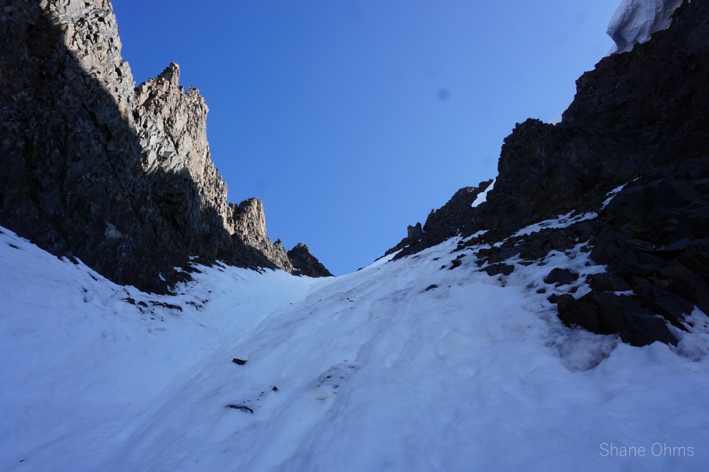
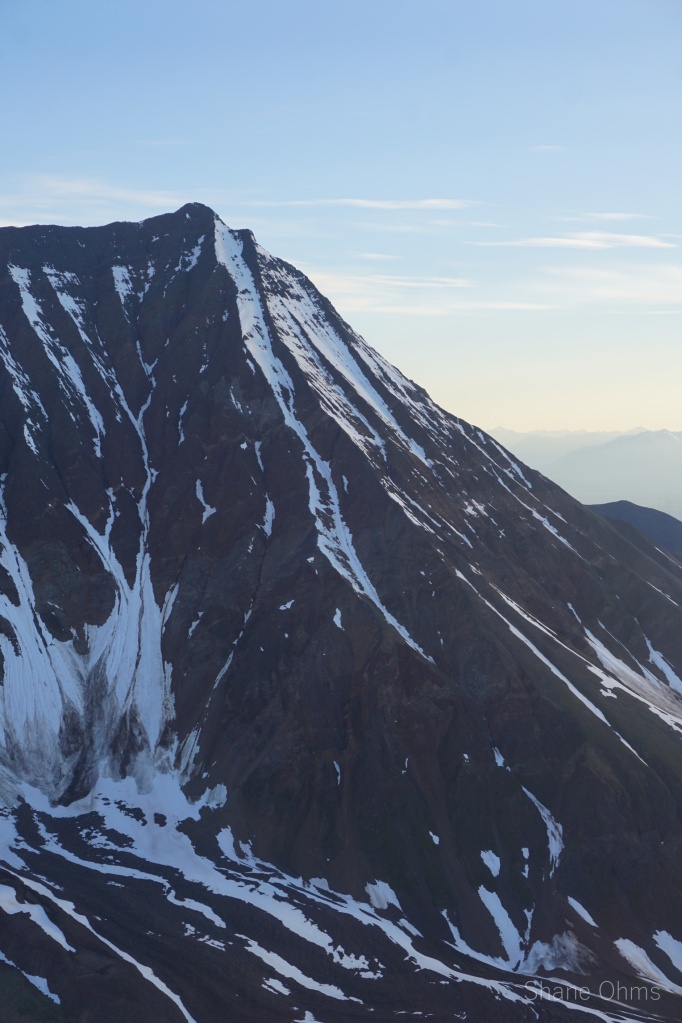
Eventually, we laid eyes on the upper half of the 2000′ couloir. With my camera I inspected it; clean. We got closer and eventually could see the bottom half: also clean! The final 500′ to the summit would be improvised when we got there, but likely also was a go.


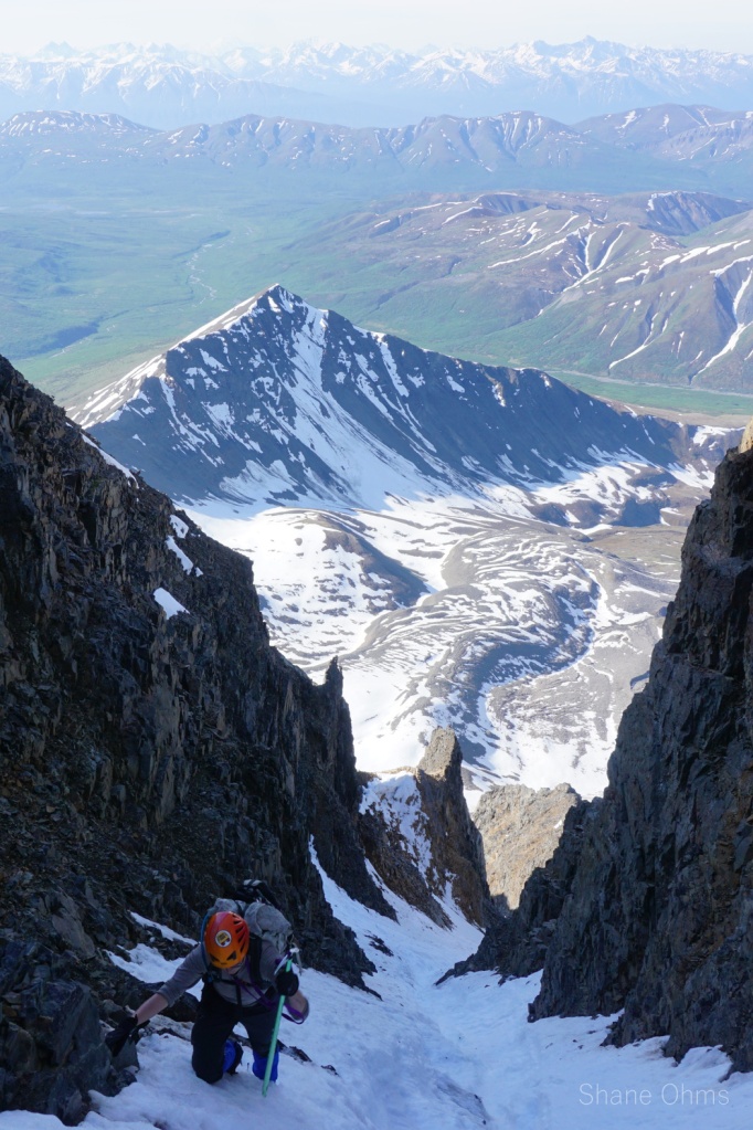
The snow in the couloir was perfect for cramponing. Hard glazed snow only in a few areas. A prominent runnel funnel down the middle. Views were on point. And at one spot it necked down to measly 6′ wide. But it went fantastically. The couloir opened up to a face, and here we hopped onto Peak 8910’s southwest ridge for the final ~500′. Happy with our exploit thus far, we hoped to reach the summit and get back down before the snow in the couloir got too slushy.


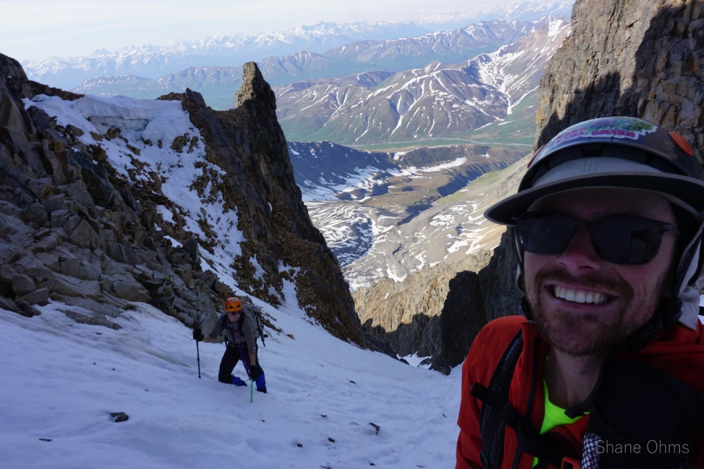
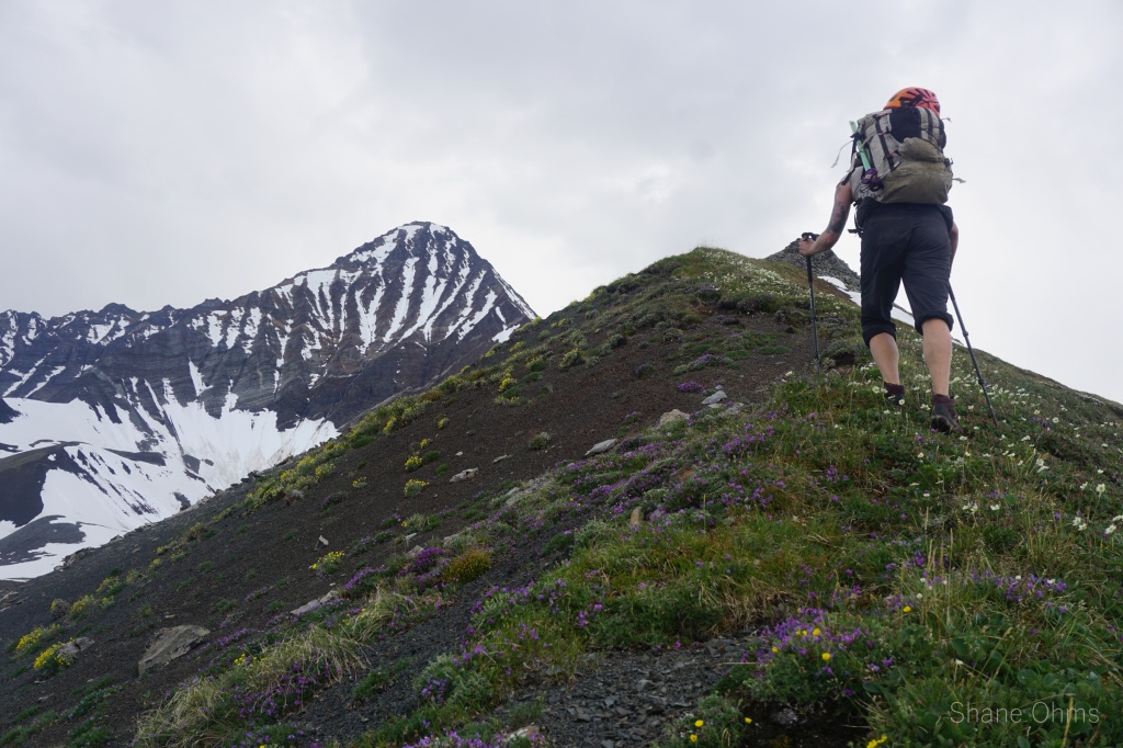
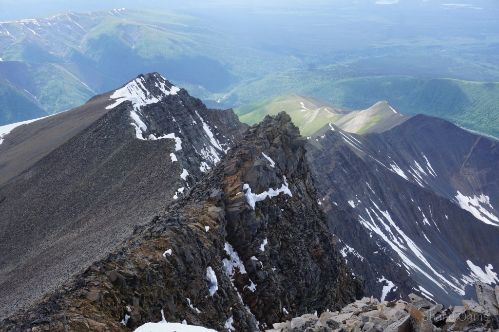
Getting on the ridge was easy, the ridge itself was steep and crumbly, but straightforeward class 2 or 3 scrambling. Some clouds rolled in on the ascent.


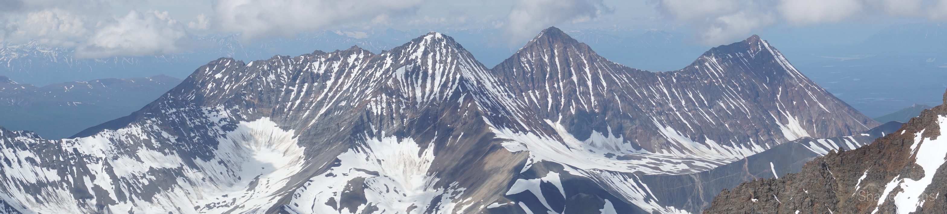
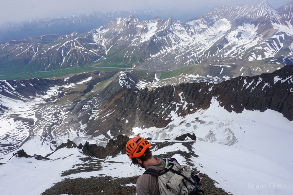
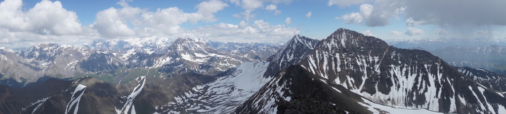
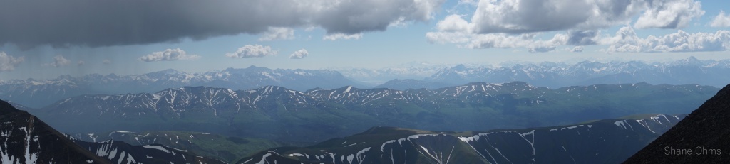
10:30am on the Summit of Peak 8910 it was mostly socked in, though we stayed long enough to be afforded some gaps in the clouds. One nice view was to the north, and the other came to the east. Visually, it appeared as though some points to the east of Peak 8910 might actually be the summit, but by water bottle level the Peak 8910 we sat on was found to be comfortably higher. No signs of other parties was found on top, this could be only the second ascent of Peak 8910 and by a new (easier) route.


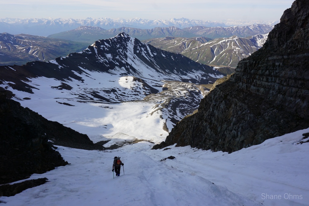
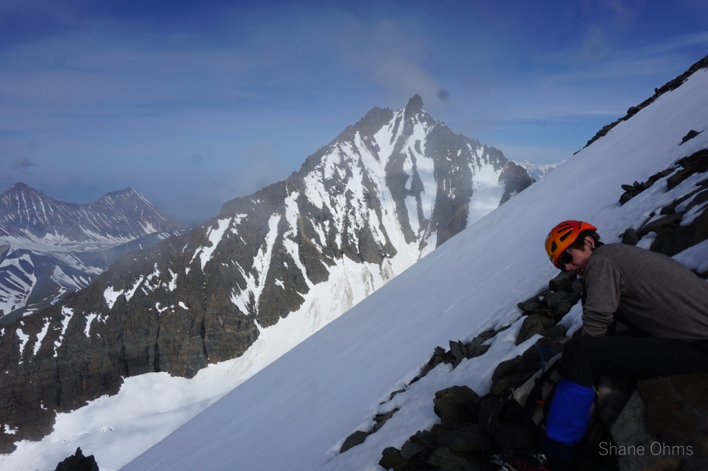
After eating and drinking and a short rest, we tromped back down the SW ridge, taking turns moving so the person below could watch out for the rocks sent by the person above. We hopped back into the couloir for the descent. Indeed it had slushed up a bit, super-saturated is the word. It balled up crampons and was settling locally around the feet as we neared the bottom, but nothing propagated far. I’ve been a mere 1 second of inaction away from being raked down a mountain in a slush avalanche once before (up above the Thayer Hut), so I’m keen to not feel that snow consistency ever again.

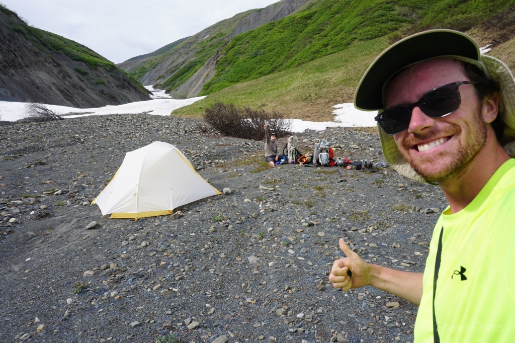
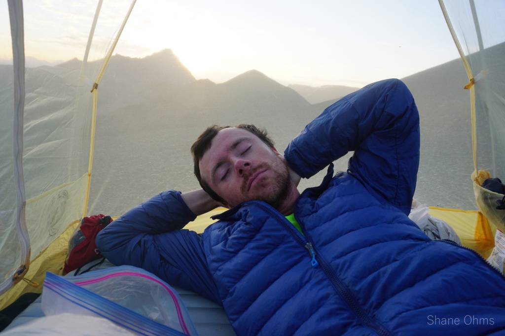
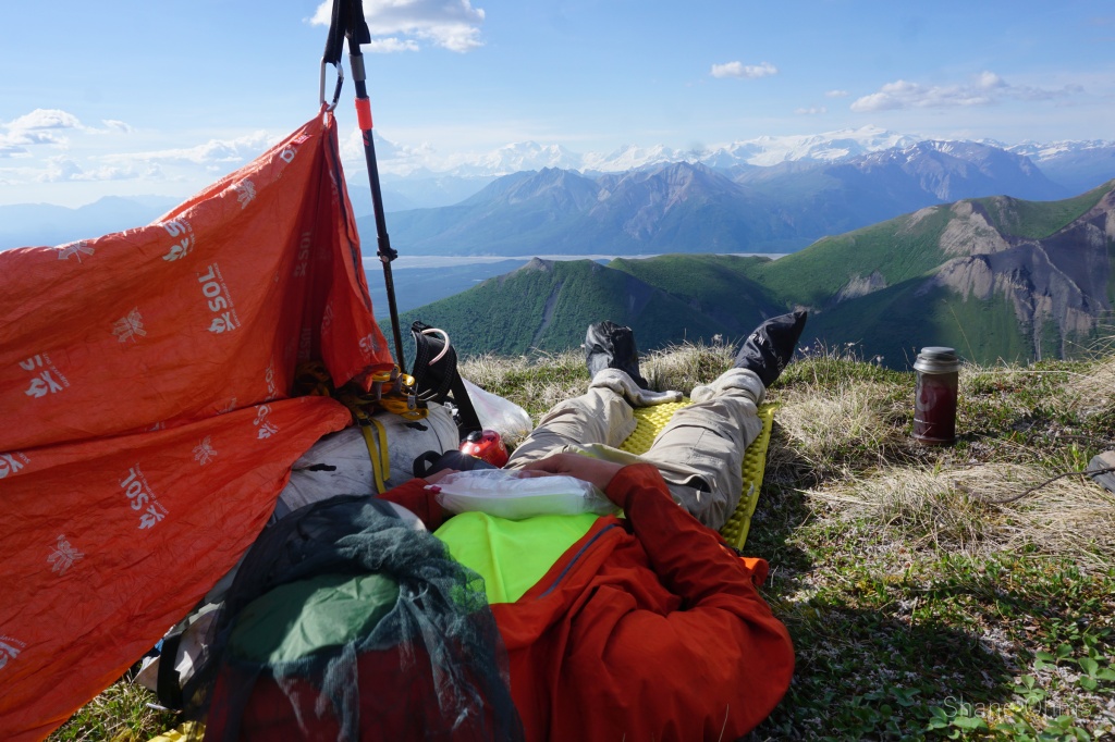
Then, as immenent rain clouds threatened a midday downpour, we quickly got back to the tents. The rain would indeed pour hard, but this observation came safely from inside a dry tent listening to it hit the rain fly. We stayed at camp, mostly sleeping, from 3-5:30pm.


Then we awoke to the second half of an amazing day. We packed up camp and retraced our steps back up to Rex Pass.


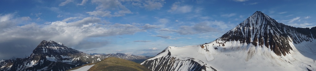
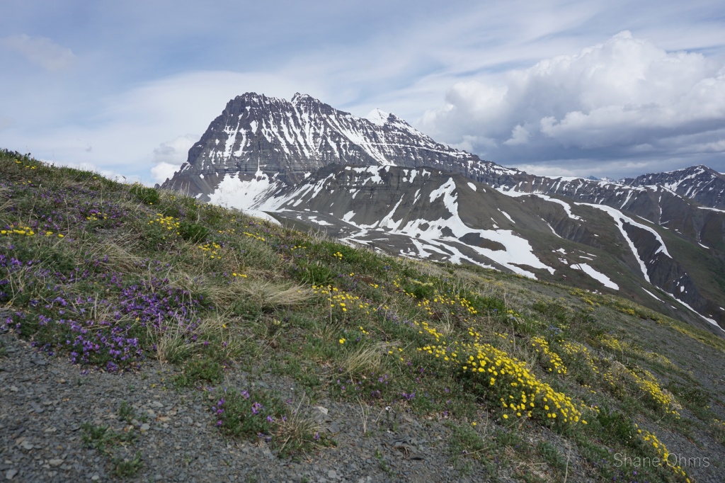
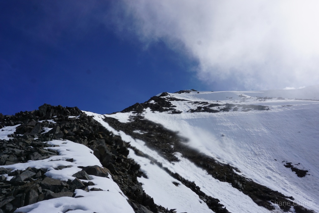
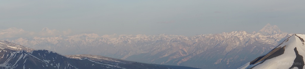
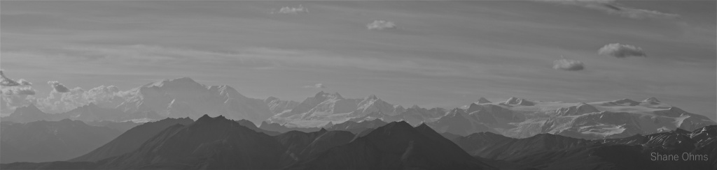
At Rex Pass we reflected upon the displeasures of Rex Creek and decided, instead, to parallel the ridgeline to Peak 6435. For an extra 1000′ of gain, we would summit another peak, and then be able to camp up on a ridgeline, out of the worst bugs. For water, we could melt snow and go a little on the thirsty side. This turned out to be a good choice for a third reason; the evening lighting was absolutely delectable!
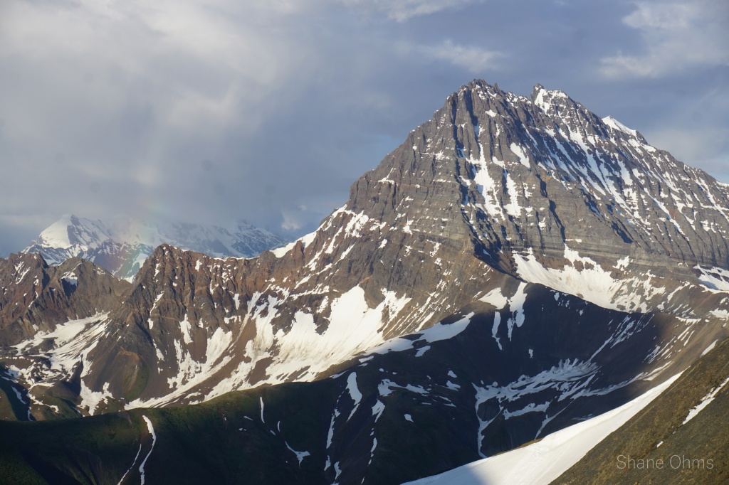

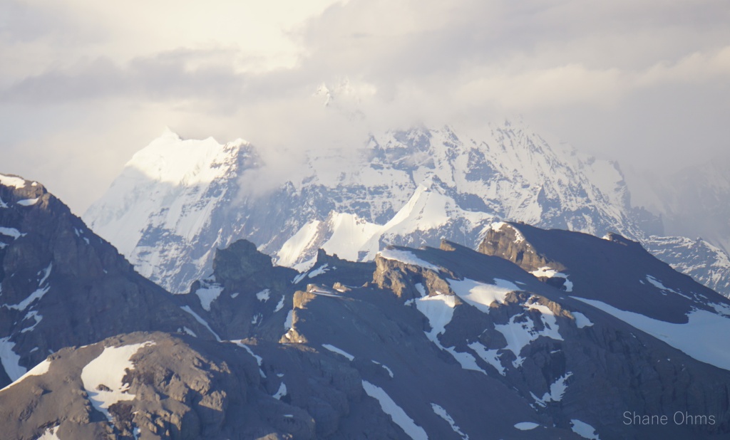
At the summit of Peak 6435 we found no signs of previous ascent, besides sheep footprints. After many pictures of the inspiring mountains, we descended 200′ to the west of the summit, camping on a bench made flat with the help of our ice axes’ shovel head. The skies looked trustworthy, so we slept with the rain fly off. And that concluded my biggest day of the year; 7500′ elevation gain.


_________________________________________________________________________________________________
June 26th, 2022
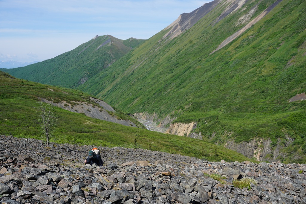
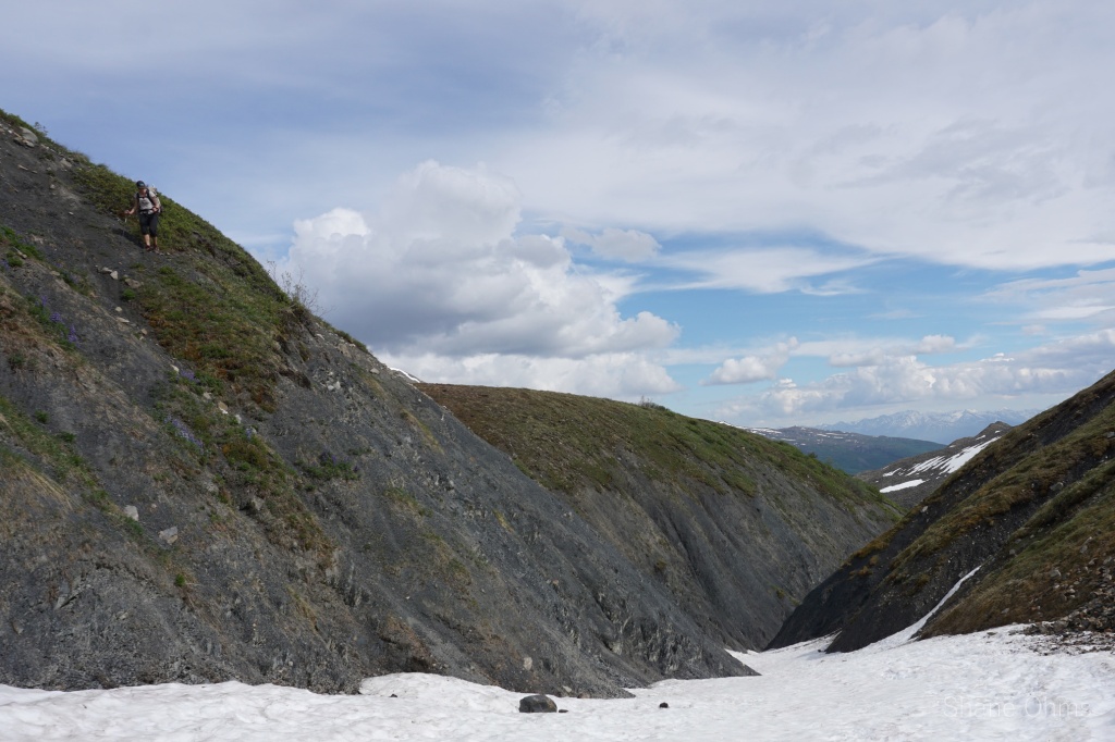
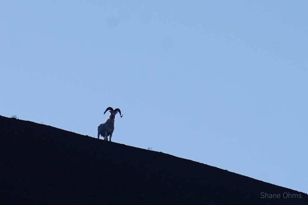
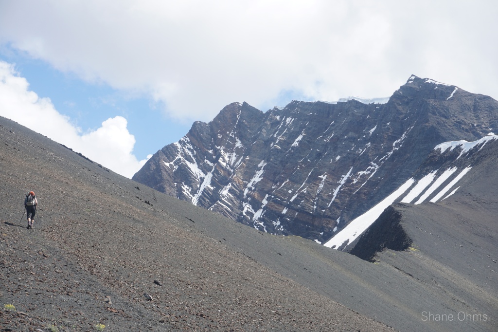
In the morning, we had our first and only wildlife encounter of the whole trip; a sheep silhouetted on the summit of Peak 6435. We packed up camp and descended to Rex Creek via Peak 6435’s west ridge. Before this trip, I had red-lined plausibly side-tripping Mt. Holmes’ northeast ridge-gully. Looking at it in person, it looked doable. But it was more energy than we had left to expend. So we decided on doing the more simple west ridge since we’d be able to cache and abandon the majority of our pack weight 2000′ below the summit, and we could also skip some of the awfulness (bugs and schwacking) of Rex Creek.


We took a mellow north sub-ridge to its interception on Mount Holmes’ main west ridge at 5700′. From here, we cached everything but food, water, and layers, and headed up the west ridge to Mount Holmes.


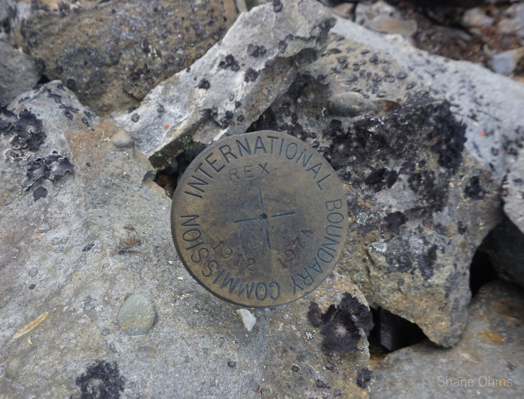
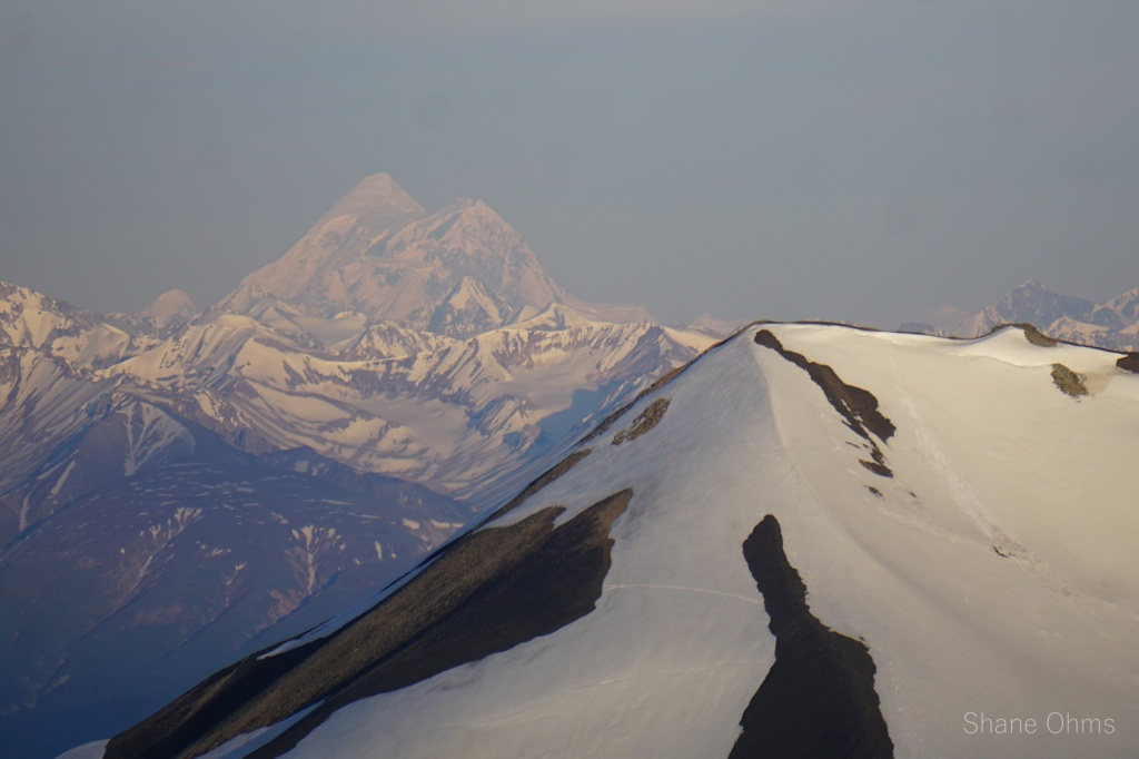
At 7300′, we found 3 surveyor markers on a small point. Dating back to 1912, these are the oldest survey markers I’ve come across. A 1974 IBC party also re-visited the markers, but by helicopter. Neither party mentions making the remaining 400′ to the top of Mount Holmes. At 3pm we summited, finding no signs of anyone else having done so either. The sky sprinkled some on the summit, but it was a passing rain so we worried not.
Mount Holmes was named in 1967 after the late Walt Holmes, a local resident who helped with the transportation of USGS materials and was the chief of the AK DOT maintenance station at May Creek… (Hey, uh Walt, your Chititu ‘Road’ could use some love).
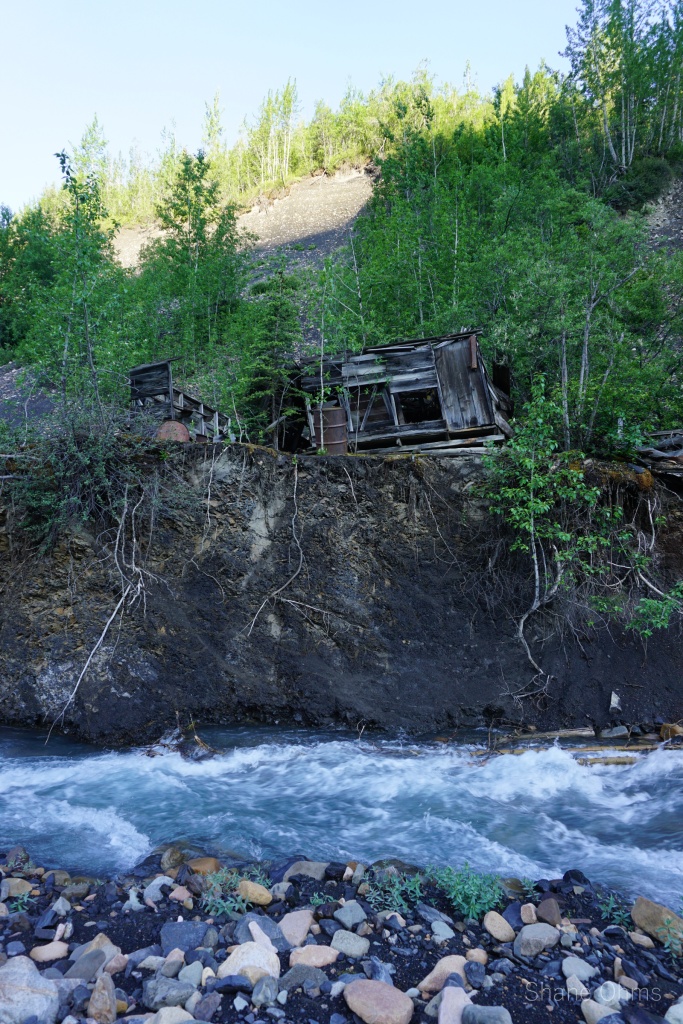
Goodman Peak’s name comes from Dan Creek local Cliff Wright, whom I had the pleasure of meeting as I was parking the vehicle in McCarthy for this trip. After informing him of our trips intentions, he lit up. Apparently these mountains are very close to home for him. He told me he named Goodman Peak (the 8120′ peak between Mount Holmes and Andrus Peak) after Mark Goodman, a miner who had worked at Chititu Camp, Glacier Creek, and Dan Creek back in their operating years. Cliff had set out to climb Goodman Peak once, but only got above tree level before turning around, either overdue on time or not up for the difficult scrambling that the mountain presents. (Not to be forgotten, that the miles below treeline present their own difficulty).
Andrus Peak’s name origin is not known, but it was already in use locally when USGS topographer David C. Witherspoon reported its use in 1908.


We descended uneventfully to our gear cache, added it to our backs, then descended a little further to 5500′. All we had to do now was get to the May Creek airstrip, but if our first experience on the road to Chititu taught us anything, it was that bugs and hot sun are a detestable combination best avoided at the expense of anything other than human life. So, we strategized; if we wait for the sun to start setting, then we will have only a single foe (bugs) to contend with, and the wind breakers and gloves won’t be so bad to wear.
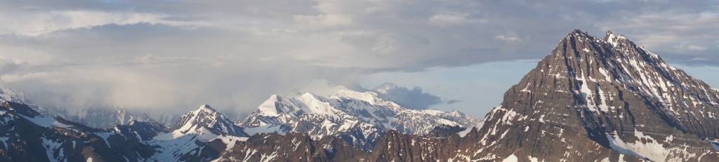
This would prove correct and a good call, although the schwack down TO the road to Chititu proved absolutely hellacious. But from 5:30 till nearly 8pm, we enjoyed world-class views and supreme napping weather. I took many pictures while mentally preparing myself for round 2 with Chititu.


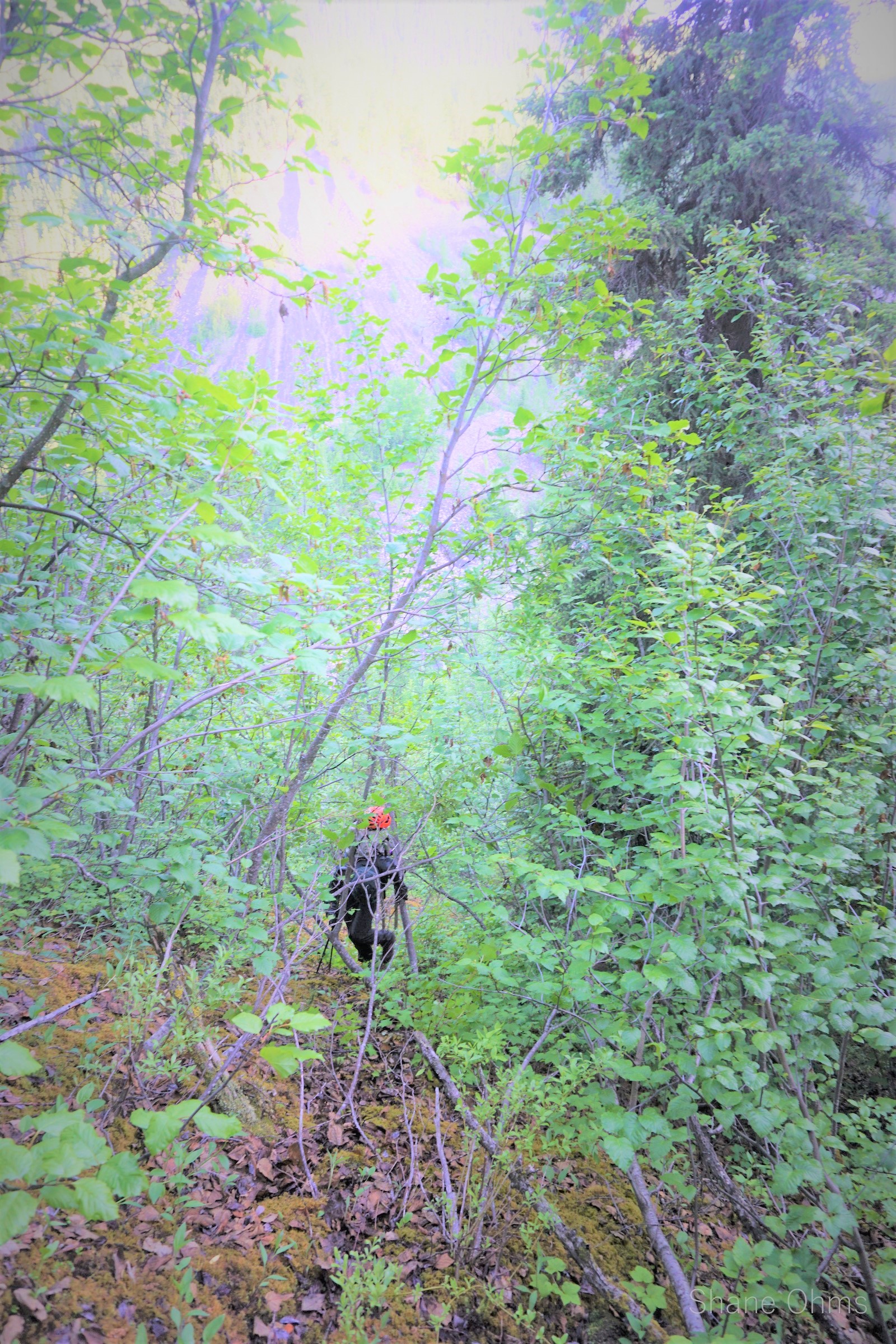
And then the descent began. It was thick. Soooo thick the alders were. Overgrown memories of moose trails with giant trees fallen all across them. Some wet ground in the plateauish feature. But mostly the mosquitos. I’m not kidding, we might have choked if it wasn’t for our headnets. At one point I poked light of our situation in a verbal skit to Sophie wherein I first imitated 2 excited grandkids “Grandpa, Grandpa, Grandpa, tell us about Chititu camp!” And then belting out -“we don’t talk about our days in Chititu!”- so loud that the ghosts of Chititu surely heard it (and they probably thought it was hilarious too).


Somehow (by virtue of GPS) we landed right on top of the White Creek / Rex Creek nose. Hopped back across that 20′ pipe bridge, and without even a second glance or a break in stride; plowed right on past Chititu. The road from Chititu was the same ‘road’ still, but without the heat of the daytime it was much more tolerable. After having had to manage on the terrible moose trails, our elevated schacking prowess made it easier to stay on the road to Chititu. We stumbled upon the Nizina Post Office on the way out, a two story building we never even saw on the way in! Just goes to show how hard it is to stay on the old road. At 2am we reached some NPS cabins at the May Creek airstrip and sent a message for pick-up the next day. I set up the tent inside the cabin because the bugs were no better inside than outside.


June 27th, 2022
In the morning we had packed up and confirmed the flight time, at 10:30am. I was just finishing up writing in the log book when our plane could be heard landing. Writing quickly now, I asked Sophie if she had anything to add to it: “Curse that road to Chititu! + it was a terrible place to spend her birthday. -Although, I might add; at least in not the worst of company.”


Chititu Chititu I’m glad it experienced the two of you!
LikeLiked by 1 person
You are doing some great stuff Shane!!
LikeLiked by 1 person
Thanks for sharing your adventure story and pics, Shane! I think I’ll not put “Shititu” on my bucket list!
LikeLiked by 1 person
Really enjoyed reading about your amazing hike! Please continue sharing your stories and pictures of future adventures. Stay safe!
LikeLiked by 1 person
Dear Shane, thank you for sharing this inspiring travelogue and the beautiful collection of photos that tell the story. It is uncommon for people to get such an intimate and informative view of adventures like these. I am now, unfortunately, too old to try and hike many of the summits described here but your notes have allowed me to feel like I was with you in spirit. Thanks for allowing me to live vicariously through you and congratulations on these awesome experiences. Best, Francis Sommer
LikeLiked by 1 person
Wow . Fantastic photo Shane
LikeLiked by 1 person
Amazing storytelling and photography Shane! While Chititu looks beautiful, I’ll keep the mosquito population in mind if I ever get the chance to do this hike.
LikeLiked by 1 person
What a great story, through both words and pictures! Glad you have found something to be so passionate about!
LikeLiked by 1 person
Really enjoyed this adventure! Thanks Shane and Sophie for telling your story —both from Shane’s log and Sophie’s video. The excitement and challenges really came off the page for me—I experienced an expedition I will never actually physically do—a treat for me. And I will never go to Chititu—ever!
LikeLiked by 1 person
Cool trip! You can keep the mosquitoes!
LikeLiked by 1 person
Awesome read on your adventure. The pictures really put it into perspective! I’m sure the pictures don’t do it justice though.
LikeLiked by 1 person
Amazing!
Thank You for sharing your adventures!
🙂
LikeLiked by 1 person
Great to be with you & Sophie again! Your dad gave me this website. 🙂
LikeLiked by 1 person