Tombstone Territorial Park has been on my “someday” list of places to visit, and it could’ve easily sat on that list for 10 years more before I’d actually have done it. But in 2024, after our plan A on the Dalton Highway was shut down by the grapefruit forest fire road closure, and as plan B to the Wrangles fell due to a dismal weather forecast; Tombstone Territorial Park materialized as a rapidly concocted plan C for Nathan, Justine, and my’s 4th of July week. We were able to get camping spots at each of the 3 lakes (Grizzly, Divide, and Talus Lake) on short notice because Canada was having some fires on their own road systems, which prevented others from fulfilling their own reservations.
Meanwhile, the Top of the World Highway, which is the most direct road connecting Alaska to Canada’s Tombstone Territorial Park, was unaffected and open for driving. We’d later learn that Tombstone Territorial Park is also fine with people doing backcountry camping (some stipulations, and you still need to check in and get a permit), but what this means is that even if the lake campsites are all reserved, you can still do a last minute trip by hiking along the main trail and doing your camping at alternative locations along the way. If the campsites are available though, then you really want to use them because their amenities are so nice and their locations best situated for beauty.
Tombstone Territorial Park seriously needs to be on more Alaskan’s to-do lists. Hopefully the following photos (and video) will speak for themselves and this blog will have helpful tips. Tombstone Territorial Park is not some lofty pipe dream; the terrain nor the park system are difficult to deal with and it is just one driving day away. You can reserve backcountry campsites here, or (even better) call their Yukon Park office at: 867-667-5648.
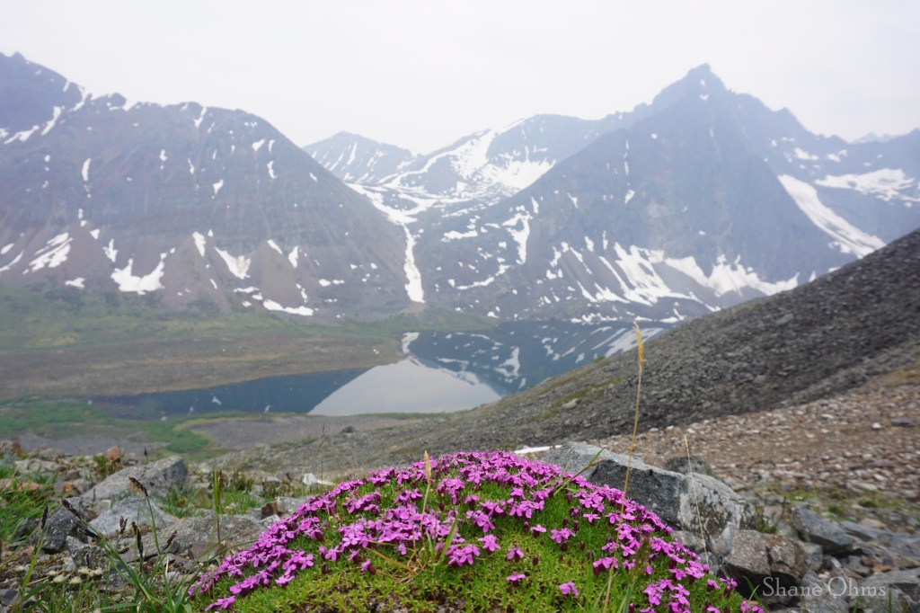
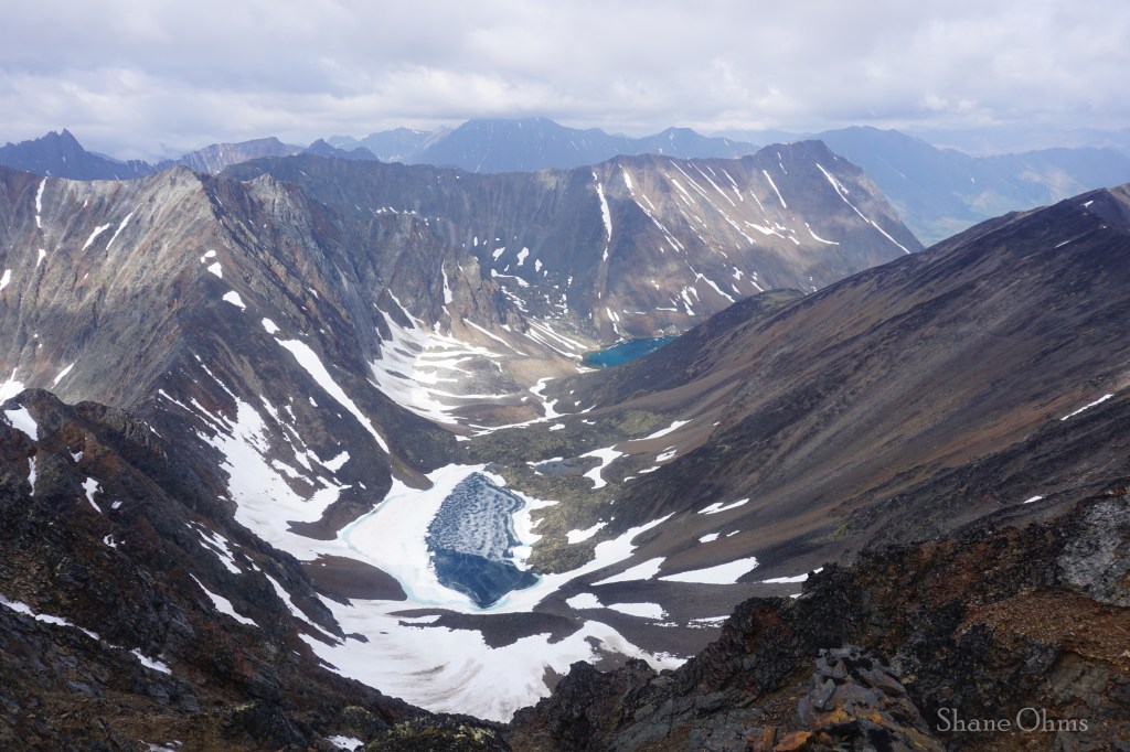
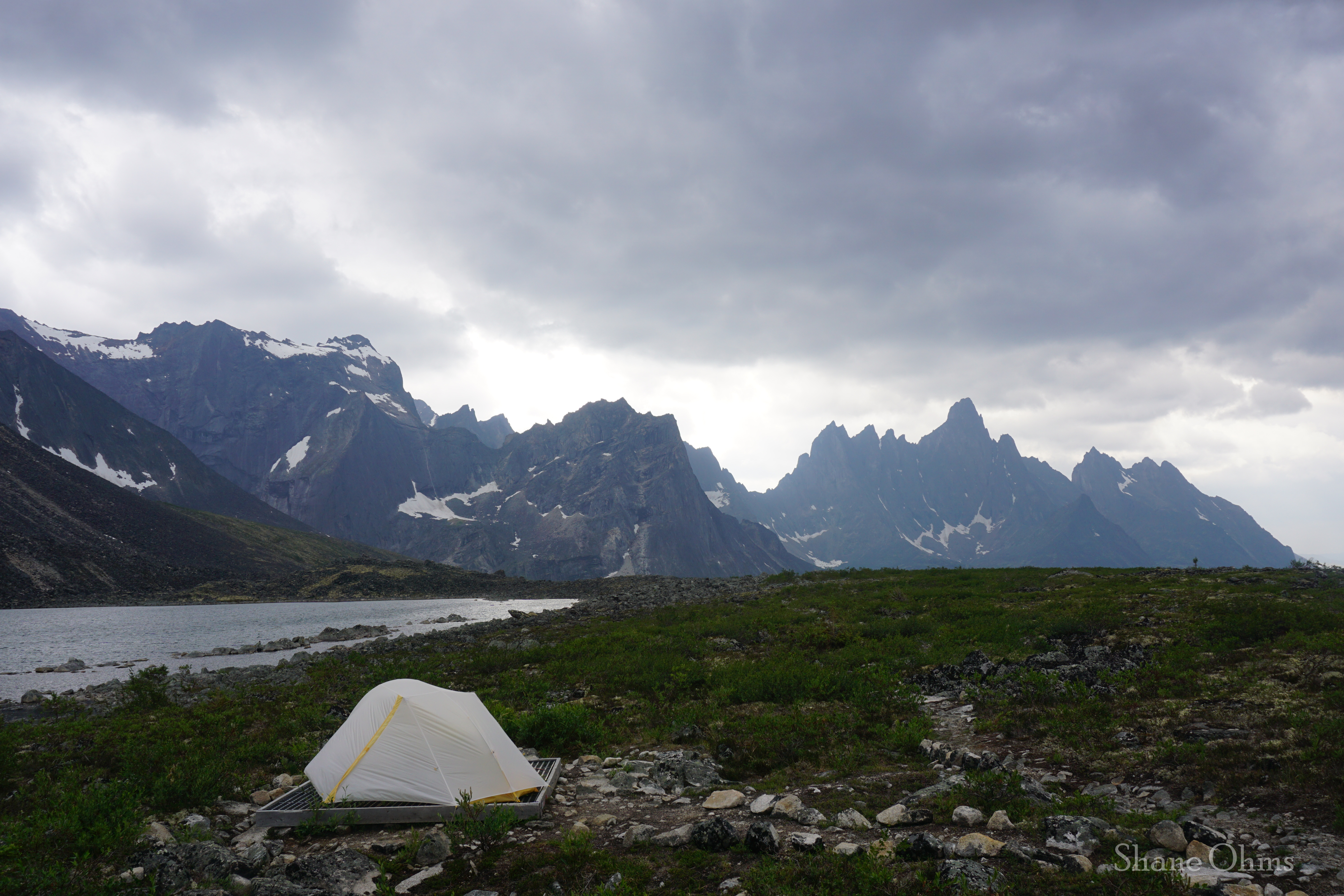
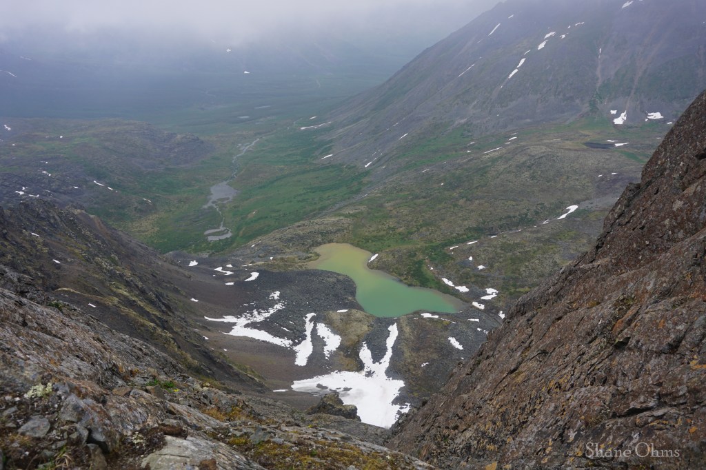
My favorite spot of the trip; at an unnamed lake along the trail between Divide Lake and Talus Lake. Rain clouds are about to roll in.
Saturday, June 29th 2024
The drive from Fairbanks took just 10 hours of driving with 2 hours of stops, for a total time of 12 hours. Not even bad by Fairbanks adventure standards. Two notes for the US-Canada border crossing; make 100% certain that everyone has their passports before leaving home, or you will have a very disappointed drive back. And make sure you have clearly labeled “BEAR” spray, and don’t you dare say the P-word “Pepper spray”. Apparently, these are two very different things in the eyes of Canada, and saying the later gets you flagged as having a weapon.


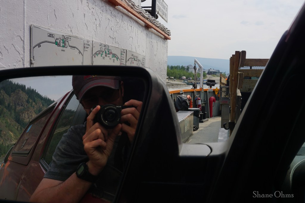
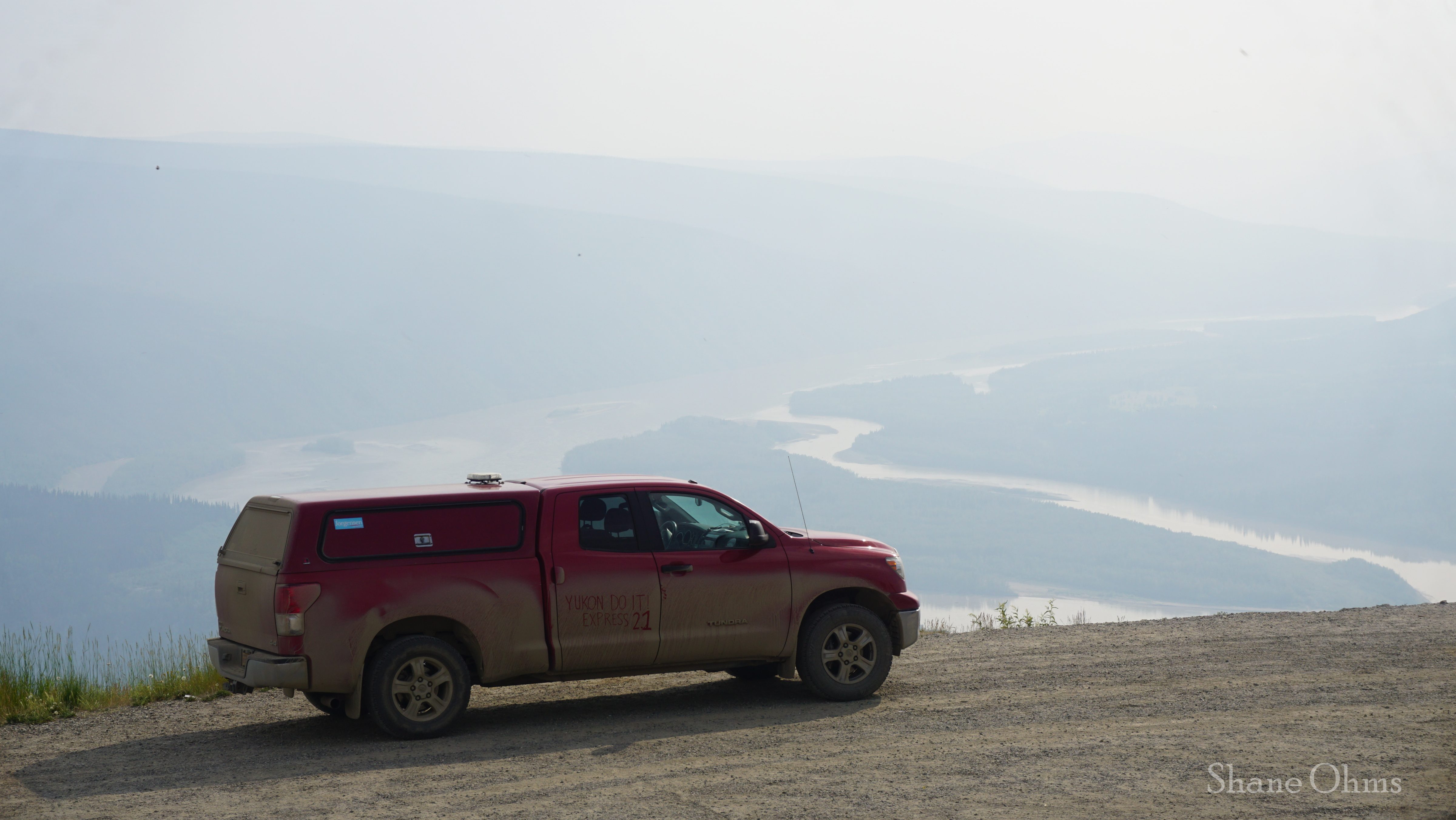
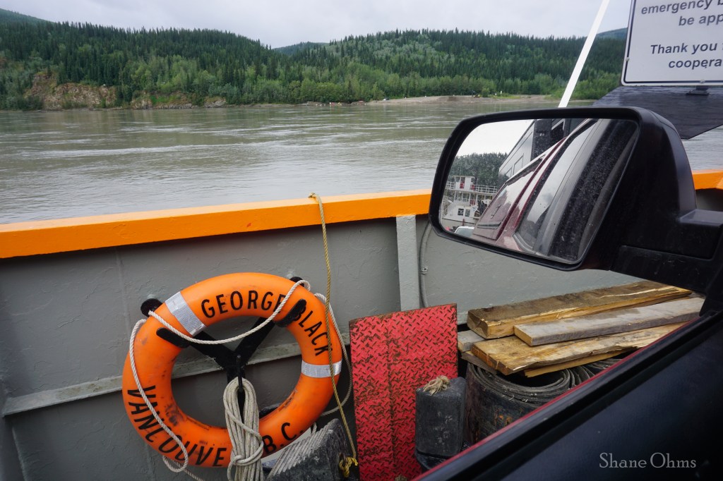
In Dawson city you will cross the Yukon River using a free shuttle barge service that runs back and forth. Shorter vehicles are easier to play Tetris with, and so they get boarded quicker than longer ones (like motorhomes). We didn’t have to wait long.
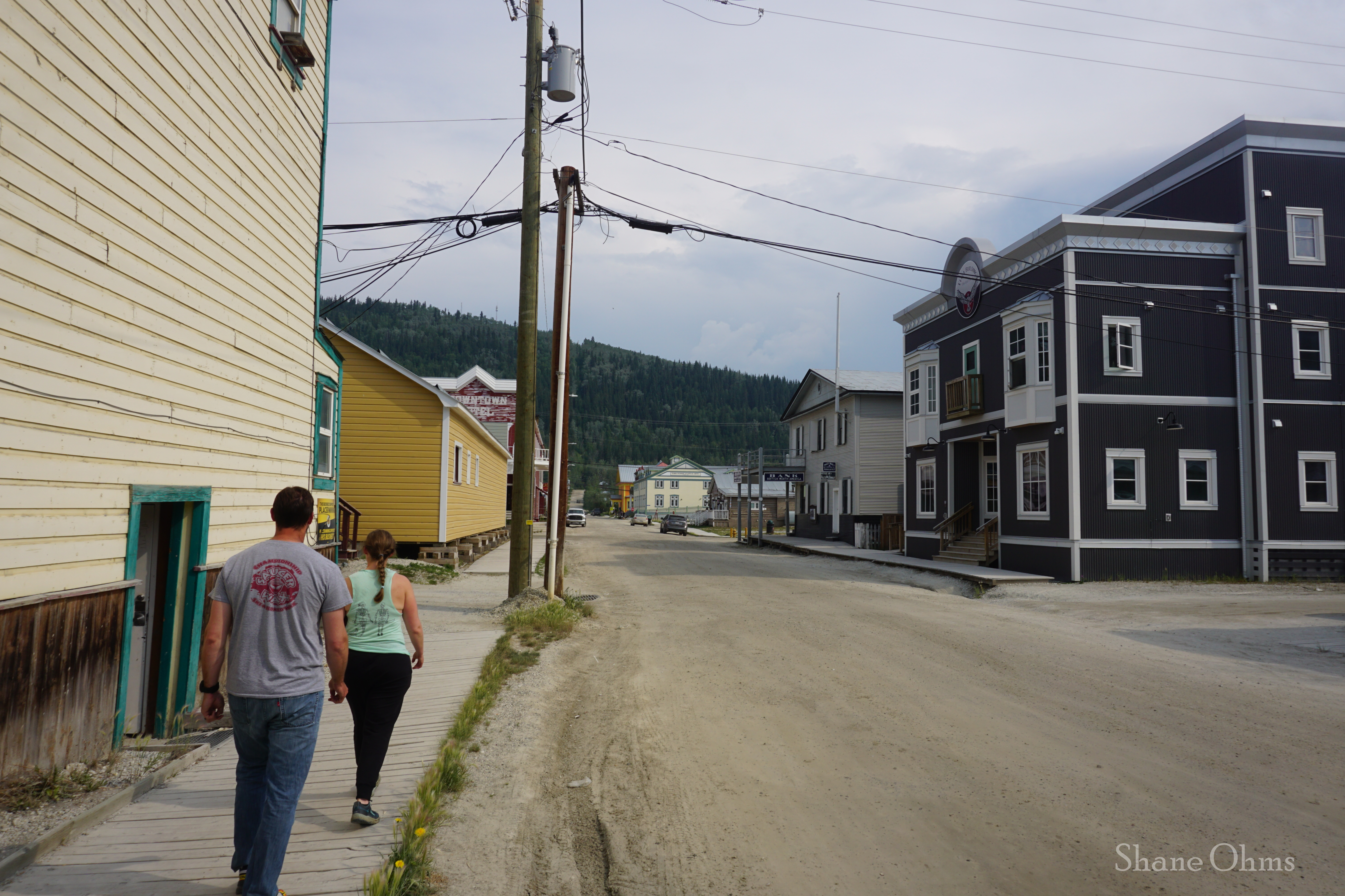
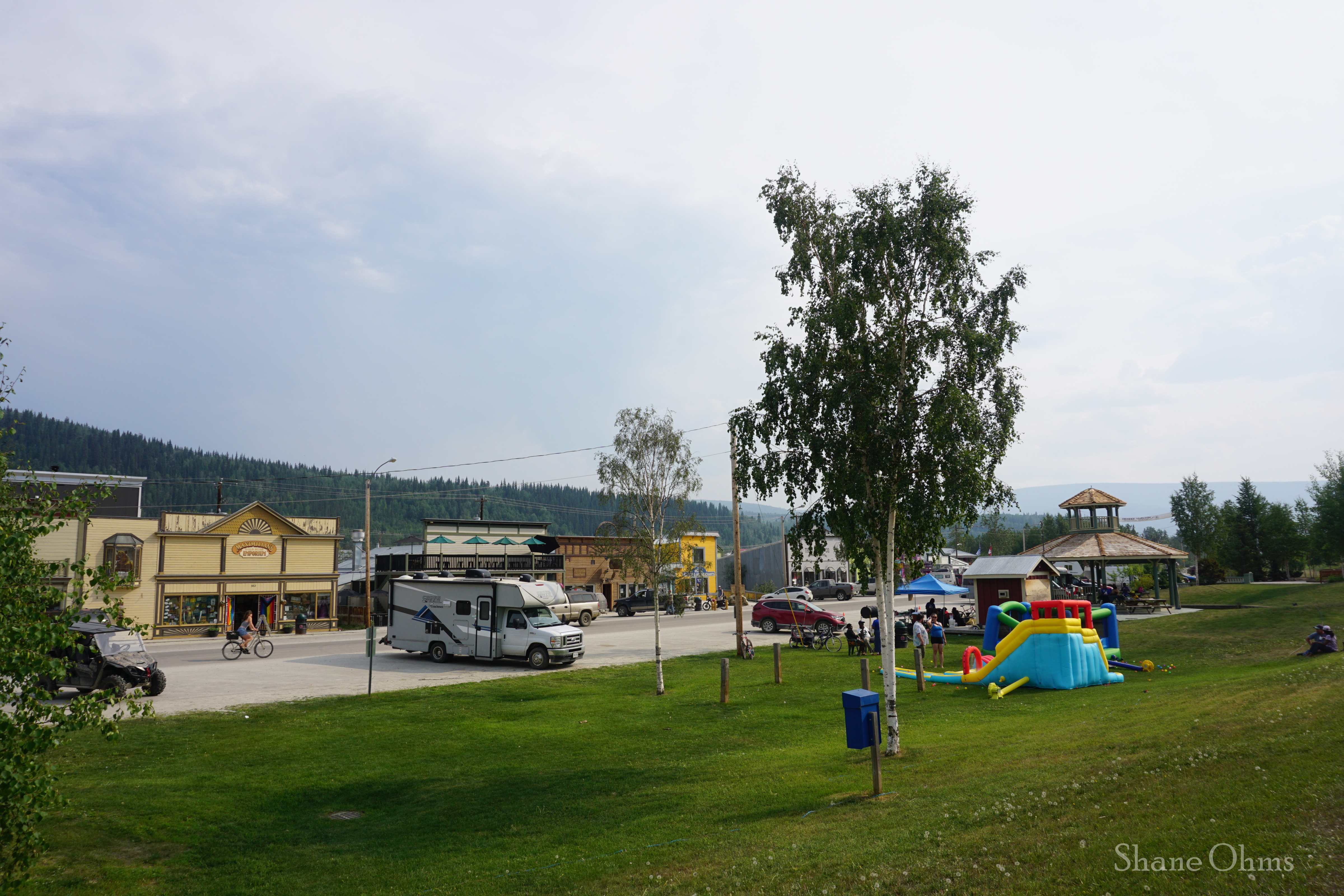
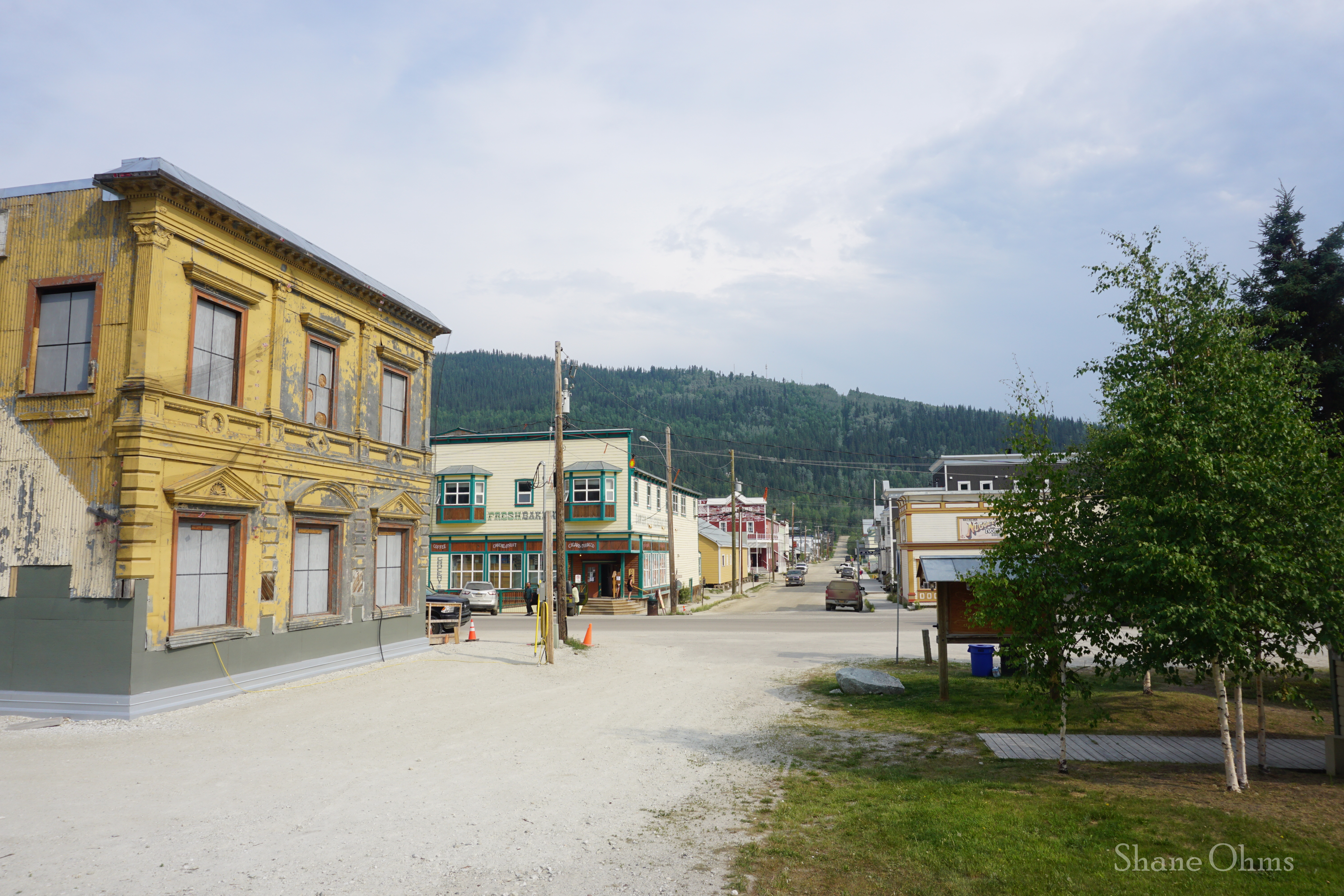
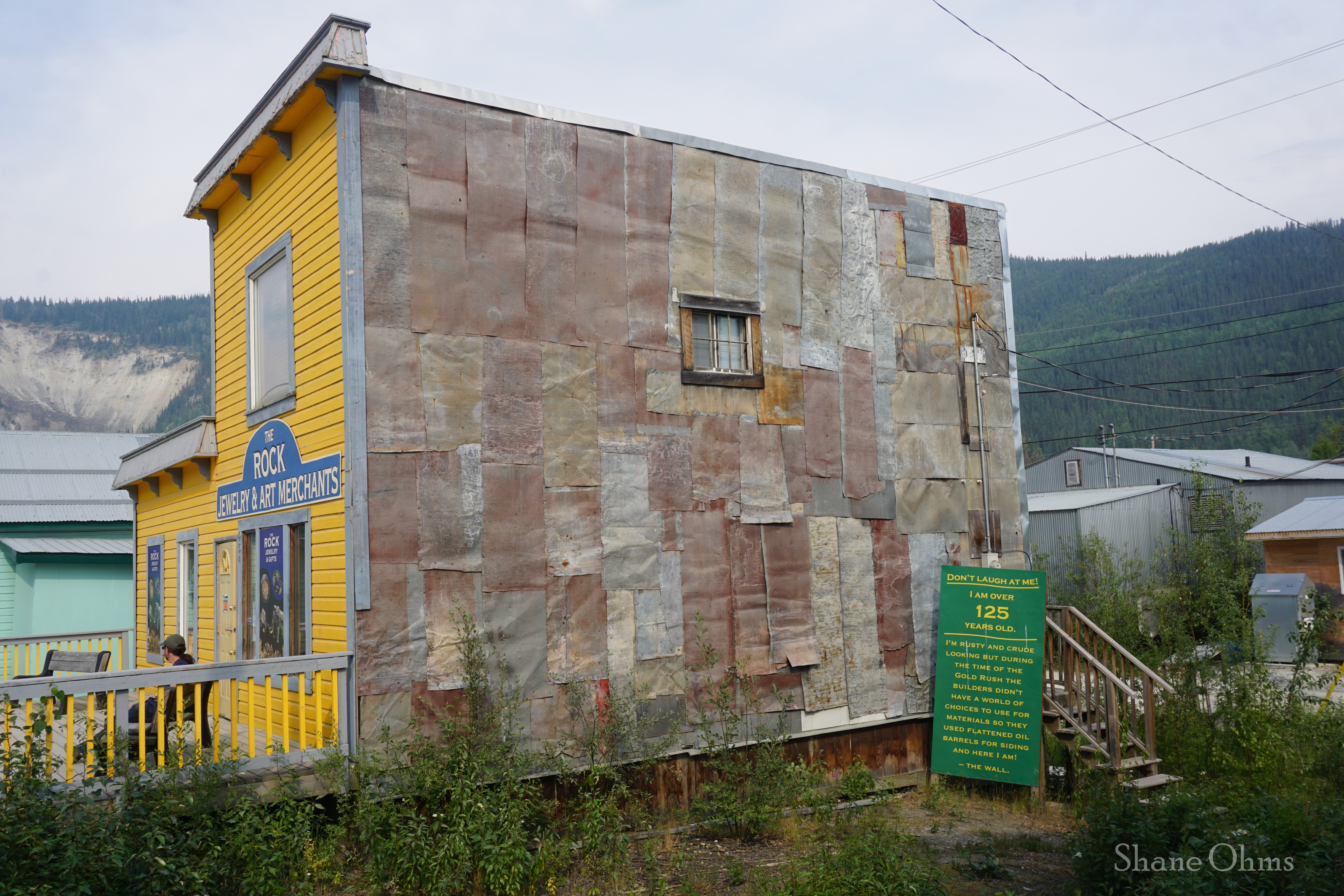
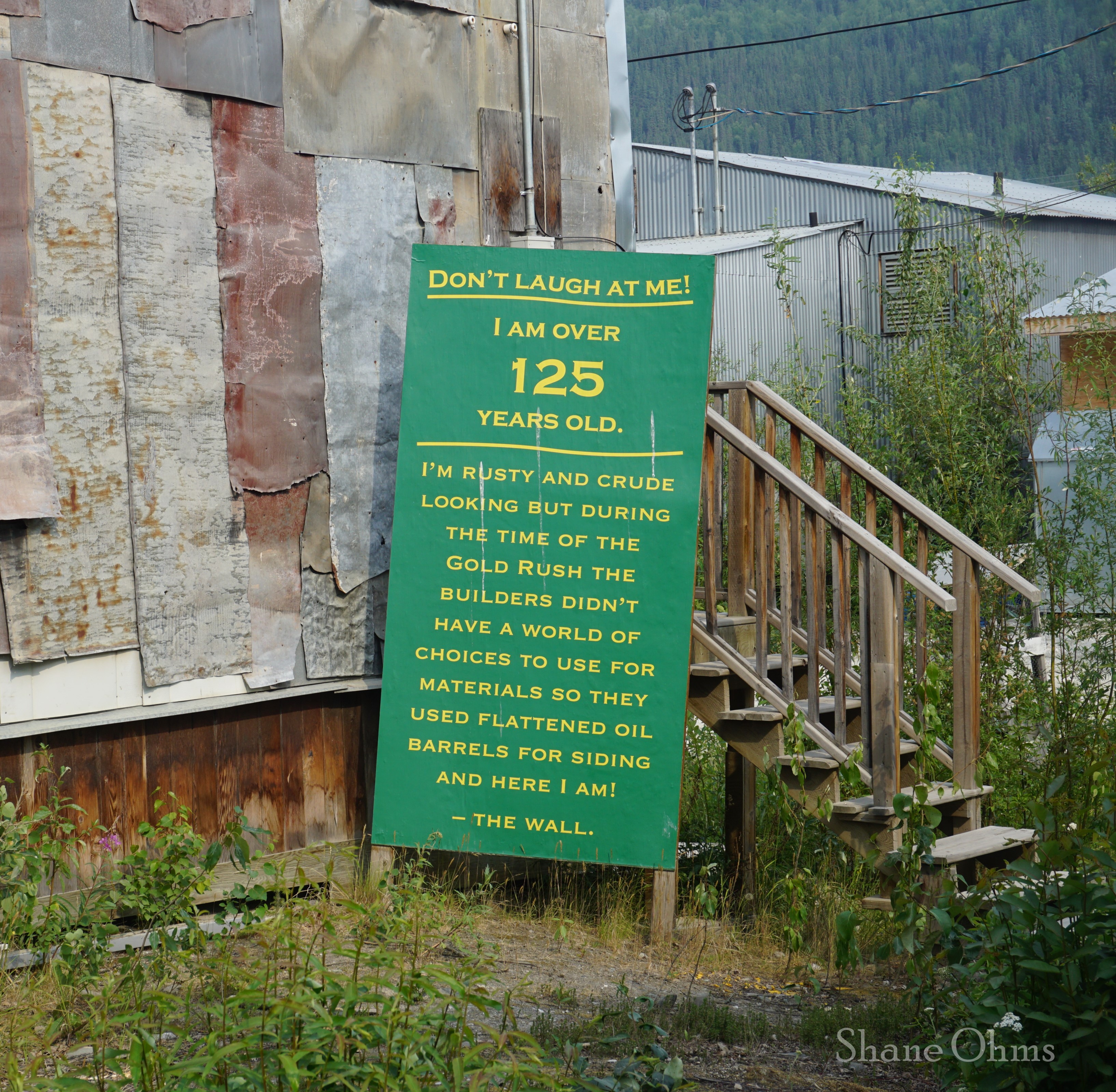
Dawson City has a very cute downtown, and after the long drive you should deserve to walk it’s boardwalks a bit. If you don’t have bear barrels (or in our case; if you don’t have enough bear barrels), you can rent them ($20 for a week) from The Klondike Experience located at 954 Second Avenue. Tombstone Territorial Park doesn’t allow the kevlar Ursacks because there aren’t any trees large enough to tie them around, and honestly, the main threat to your food cache will be the unruly ground rodents anyways, so the bear barrel is the only efficable option.
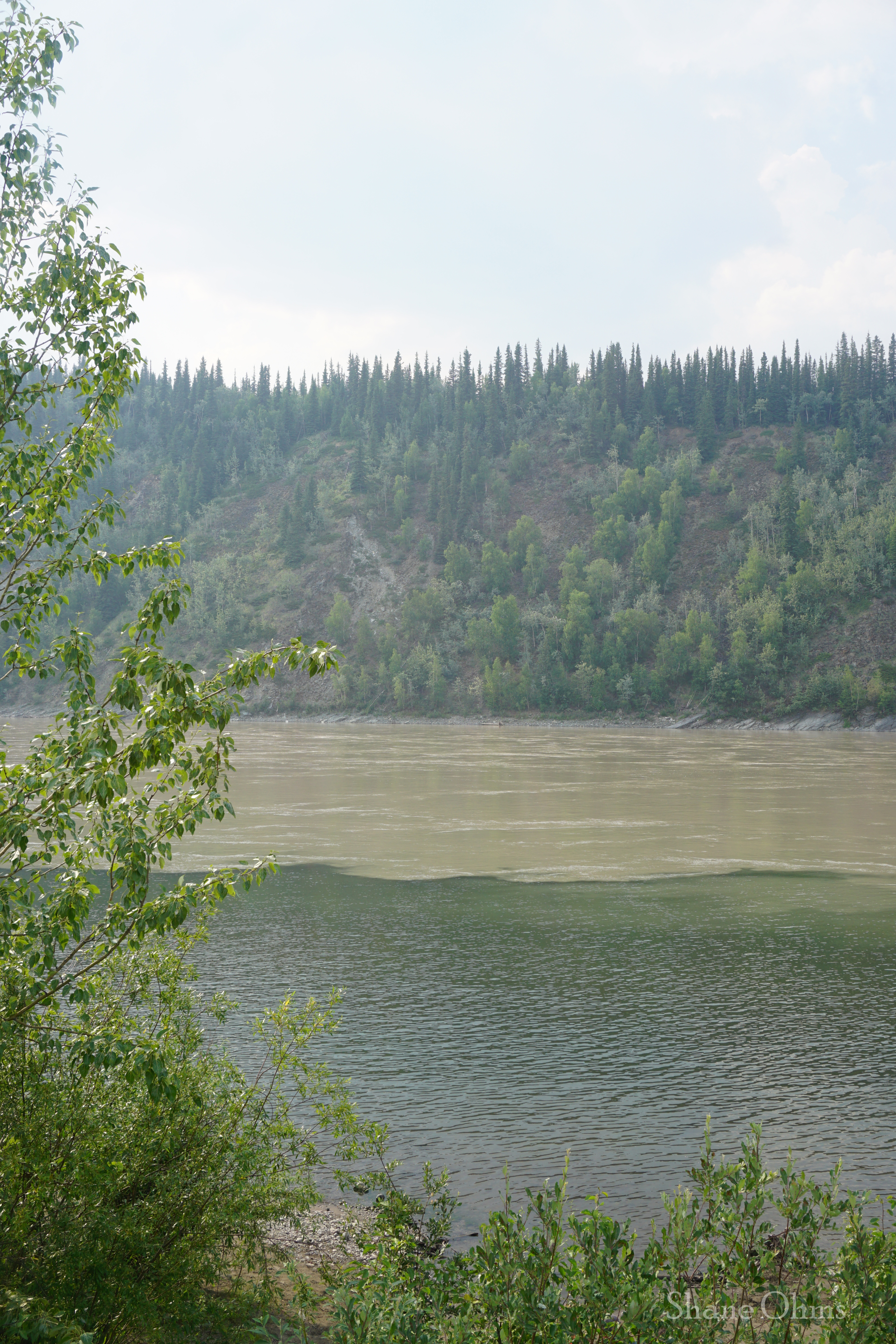
Above the town is a hill (Midnight Dome) that you can drive up for photos, and it even has mountain bike trails that you could self-shuttle up if you are into mtn biking and have a spare driver. Our views from atop this hill were… smoky, but you’d normally see where the clear Klondike River enters and mixes with the silty Yukon River.
Sunday June 30th, 2024
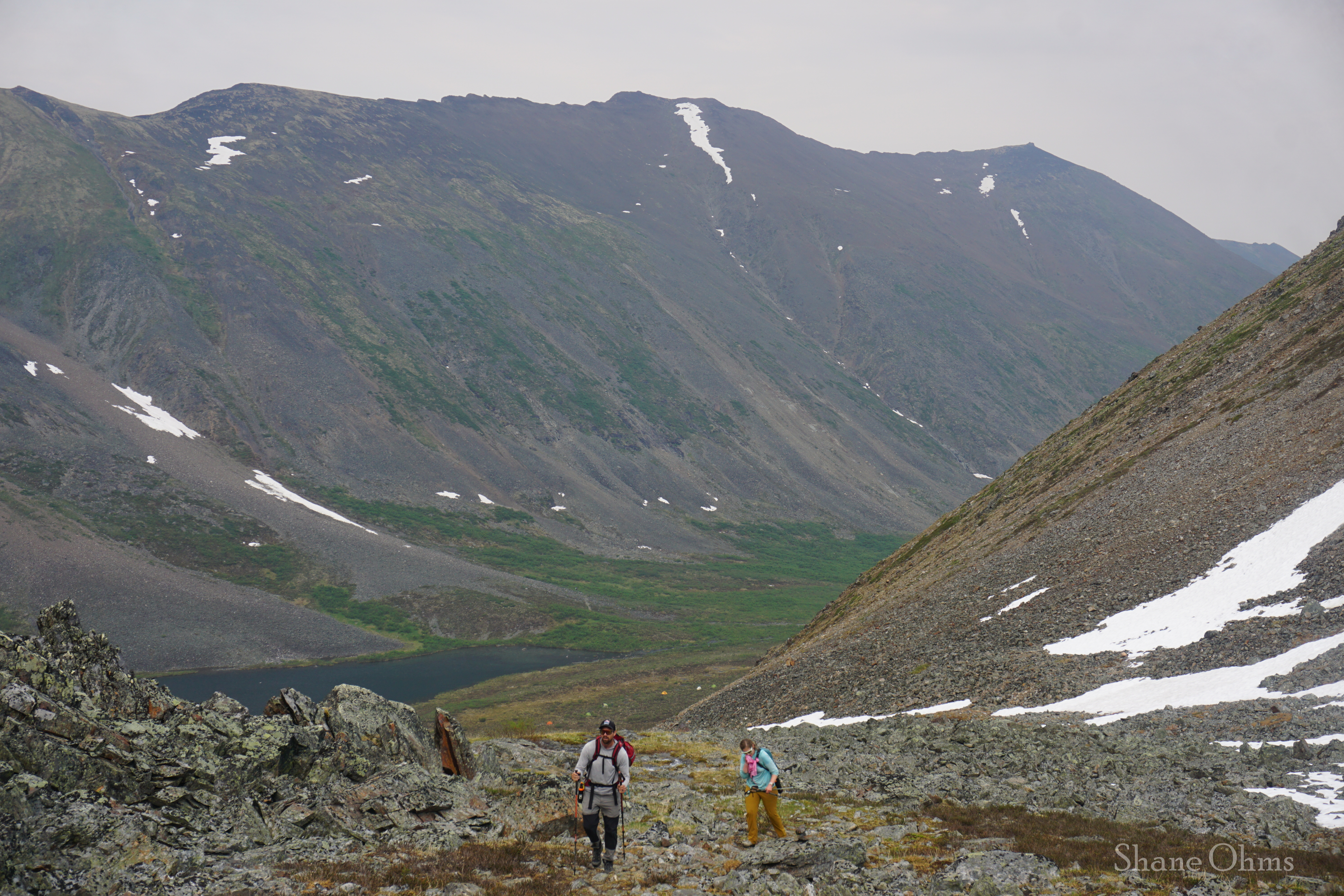
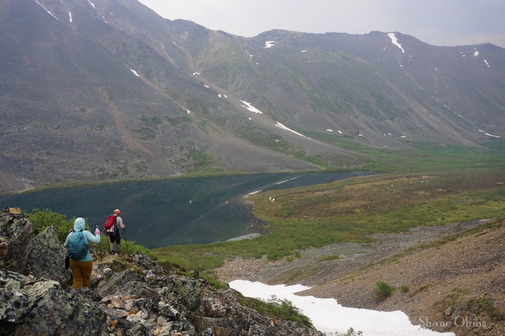
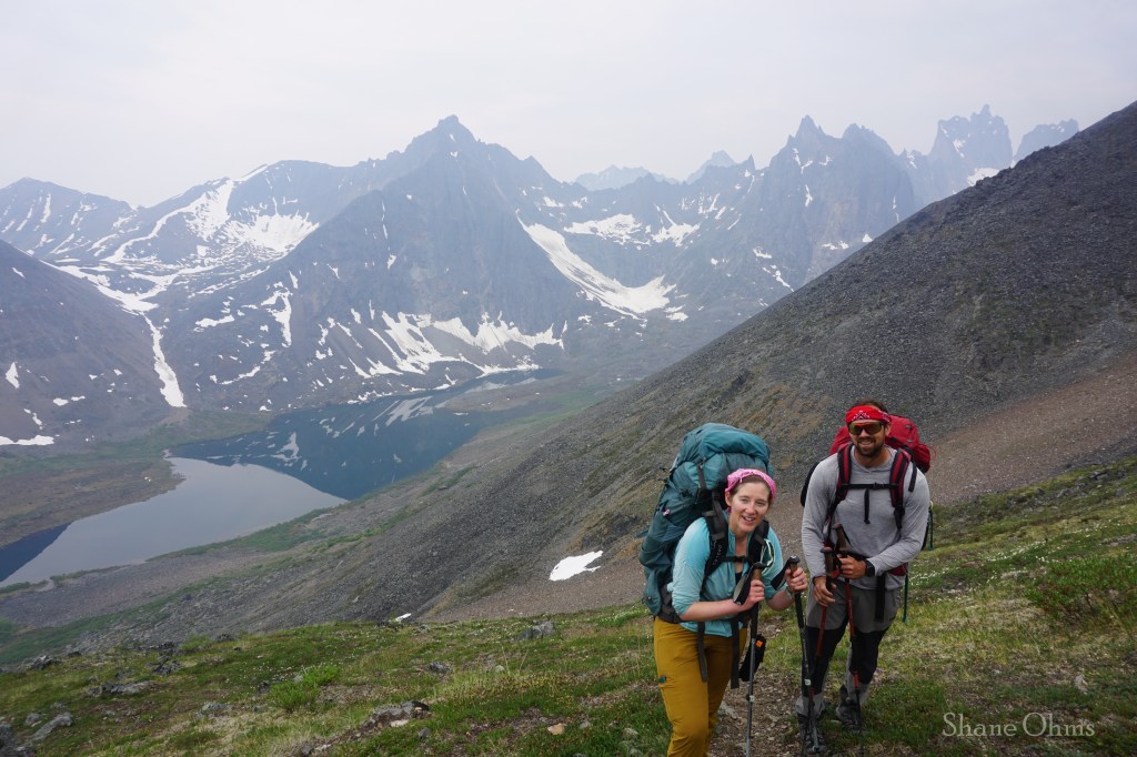
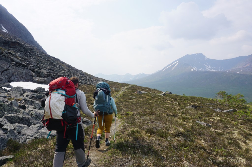
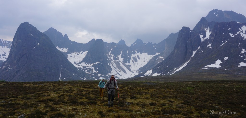
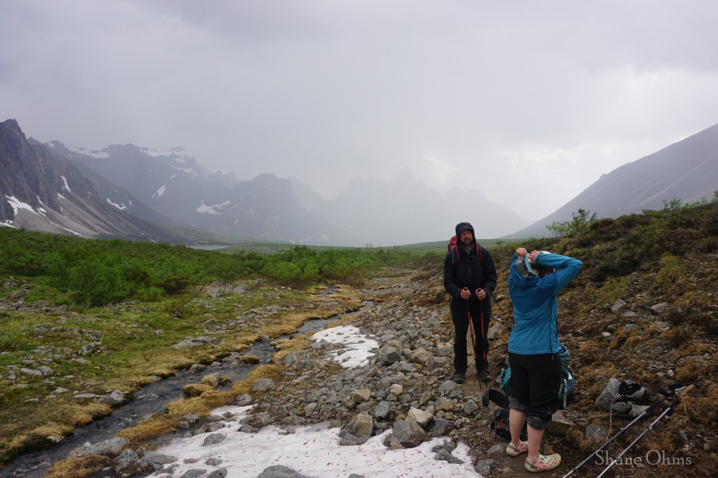
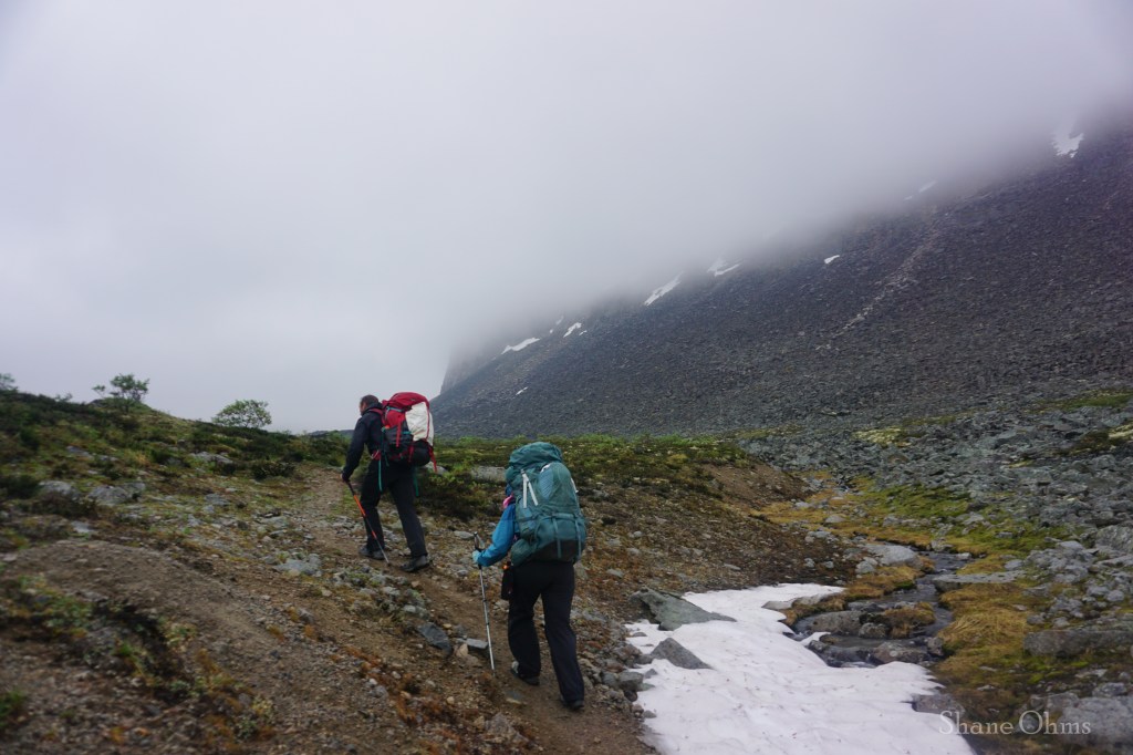
We woke up from our campsite at the Tombstone Interpretive Centre and Campground and went for a super quick orientation at the ranger station before setting out on the Grizzly Lake trail.

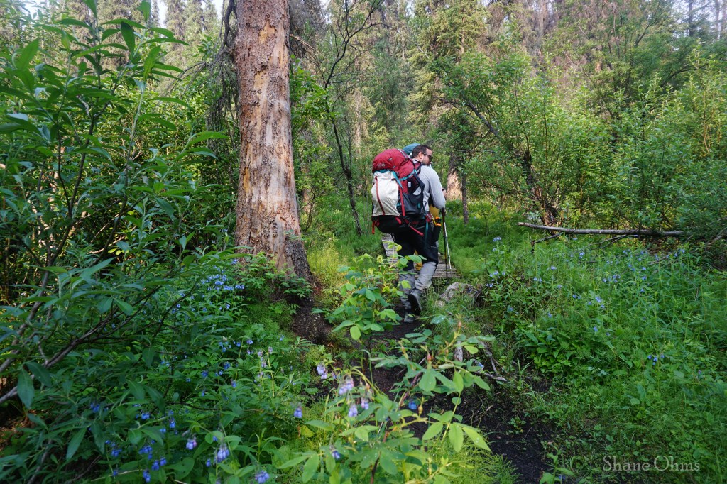
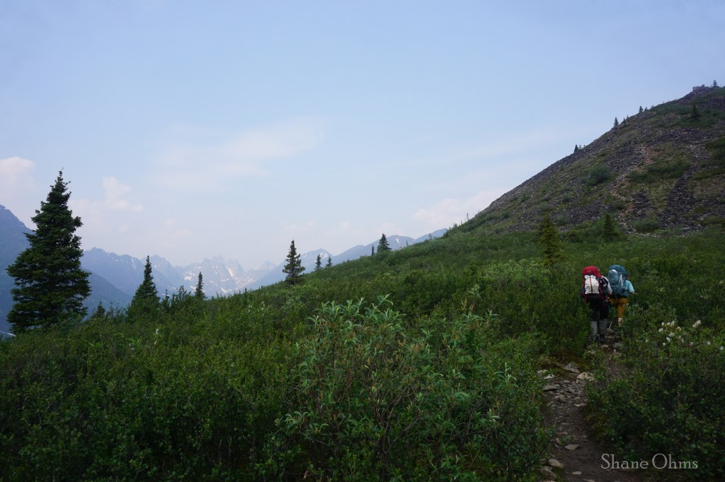
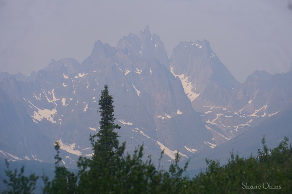
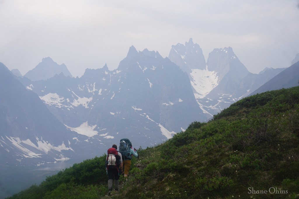
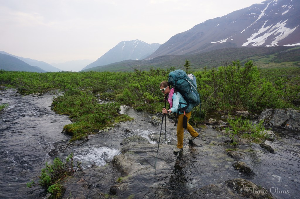
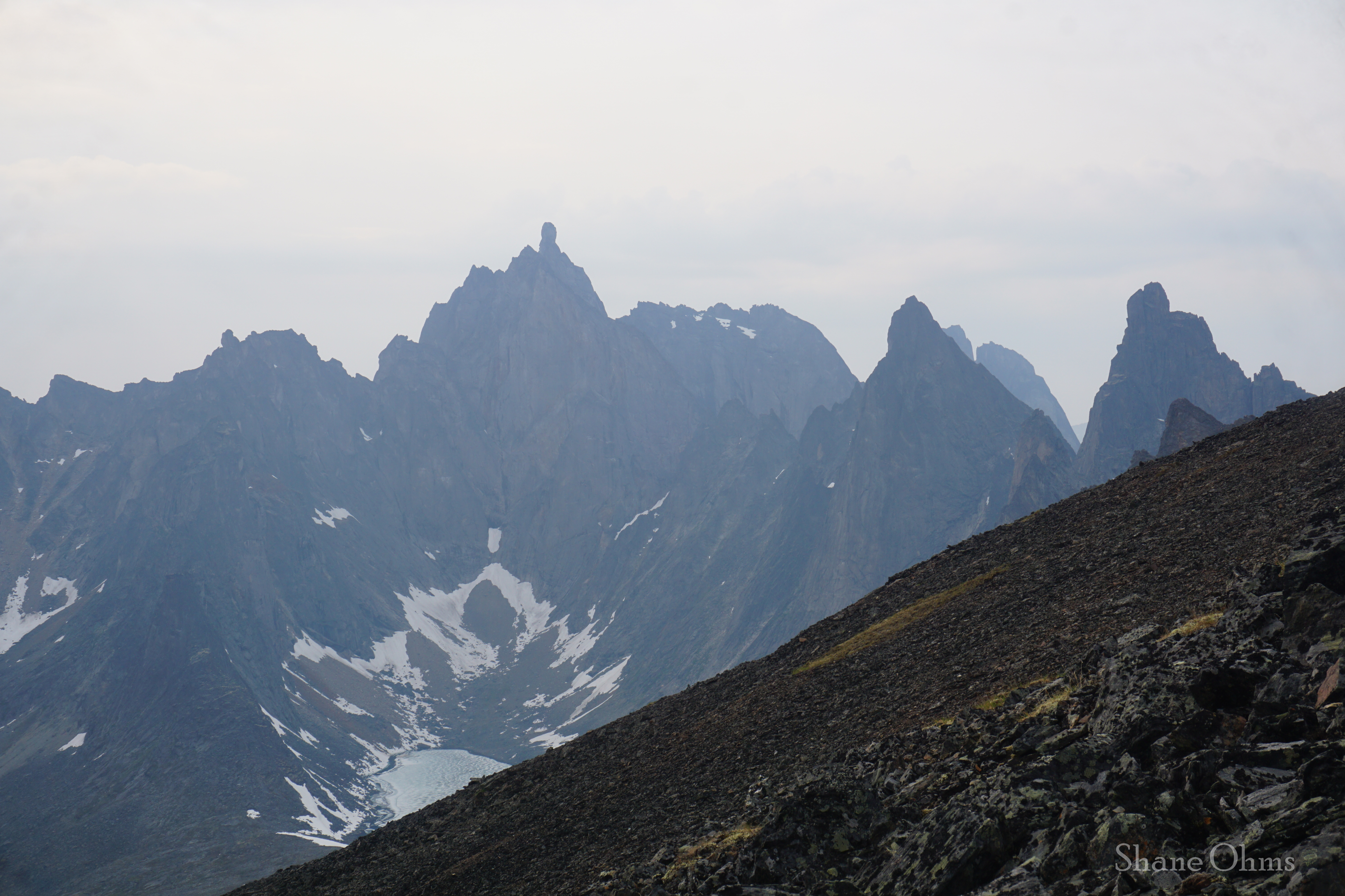
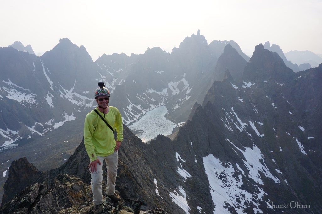
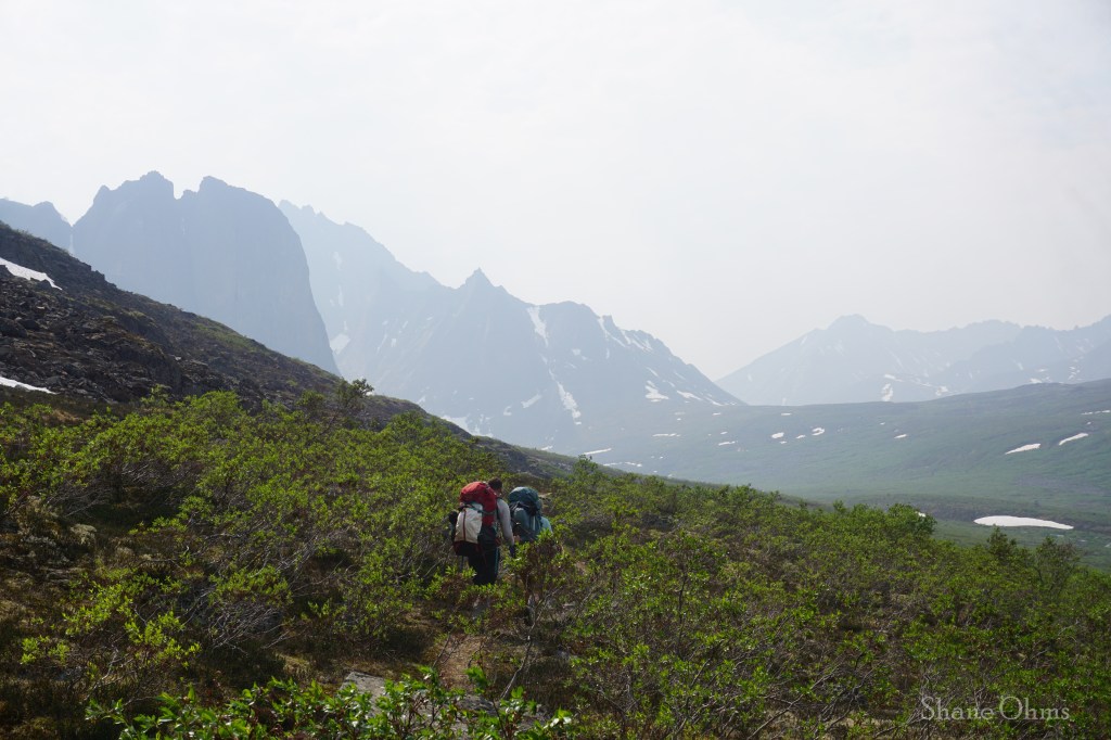
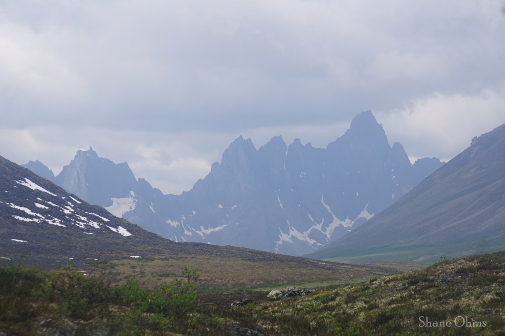
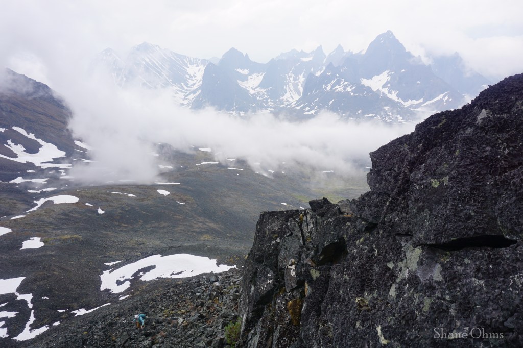
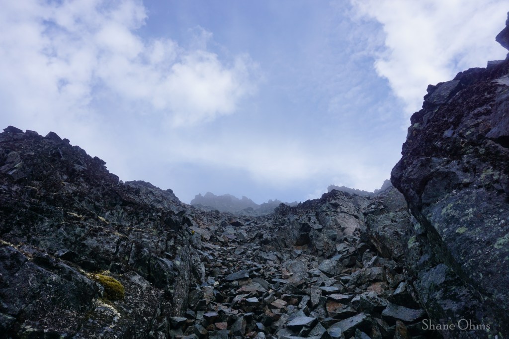
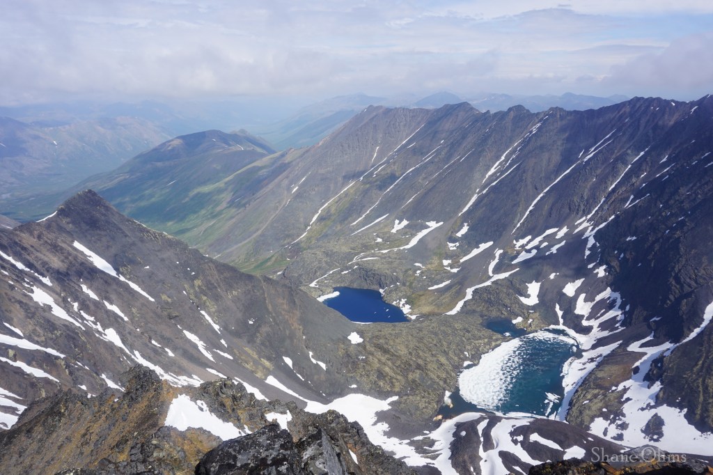
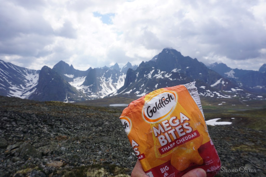
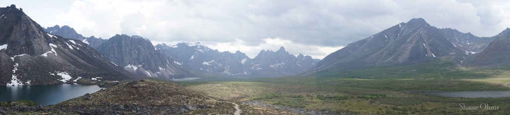
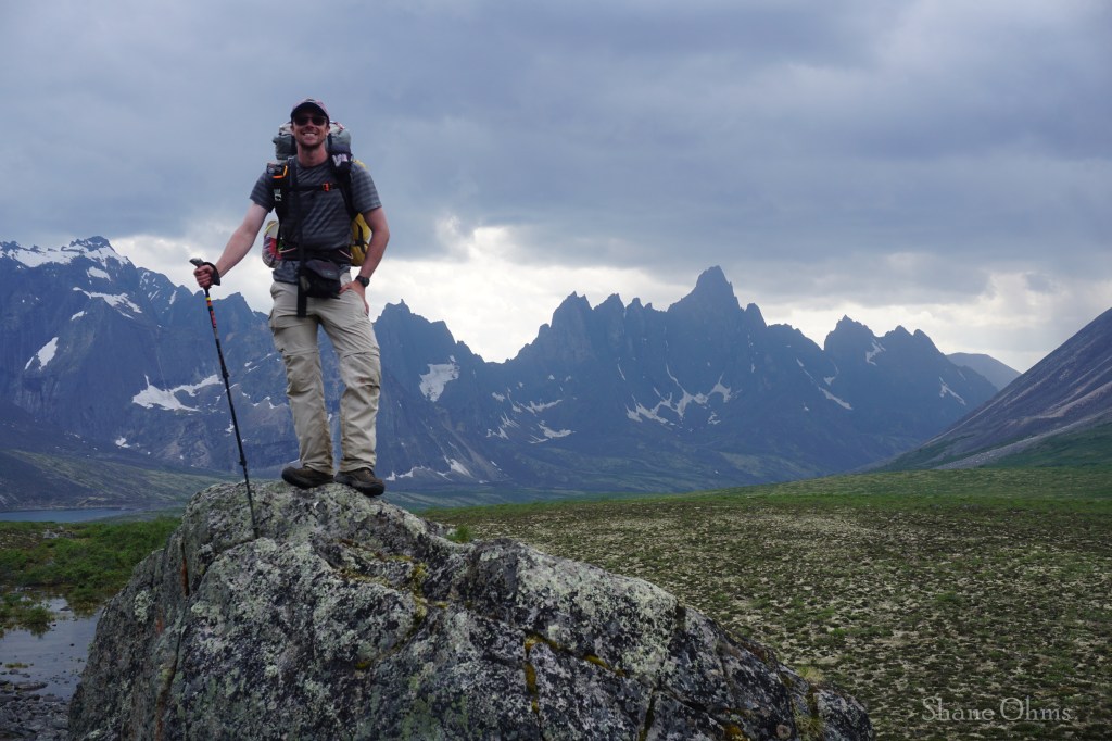
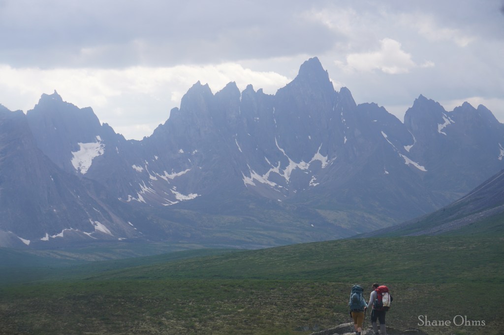
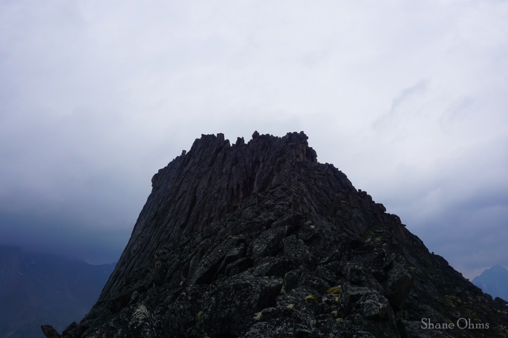
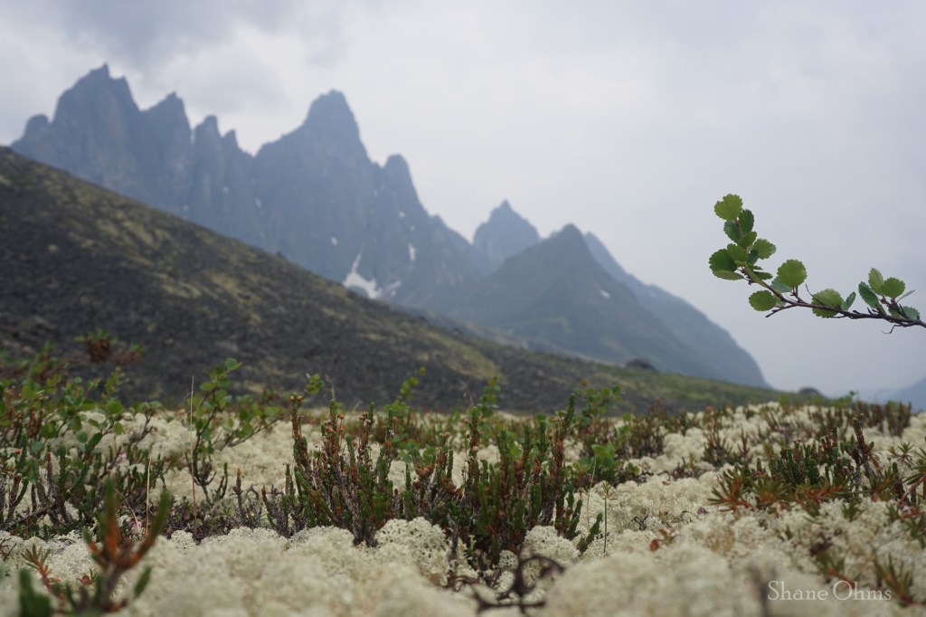
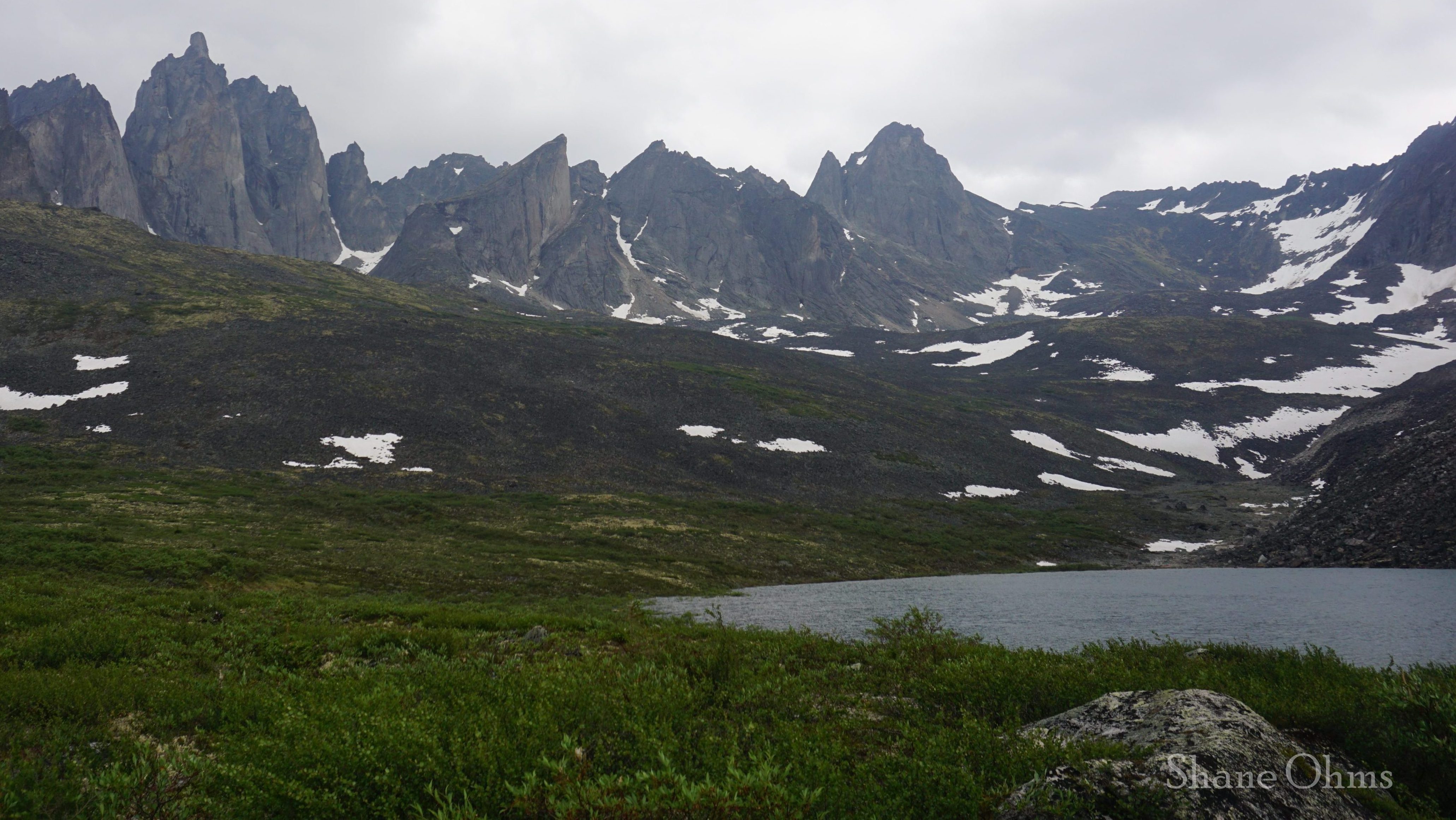
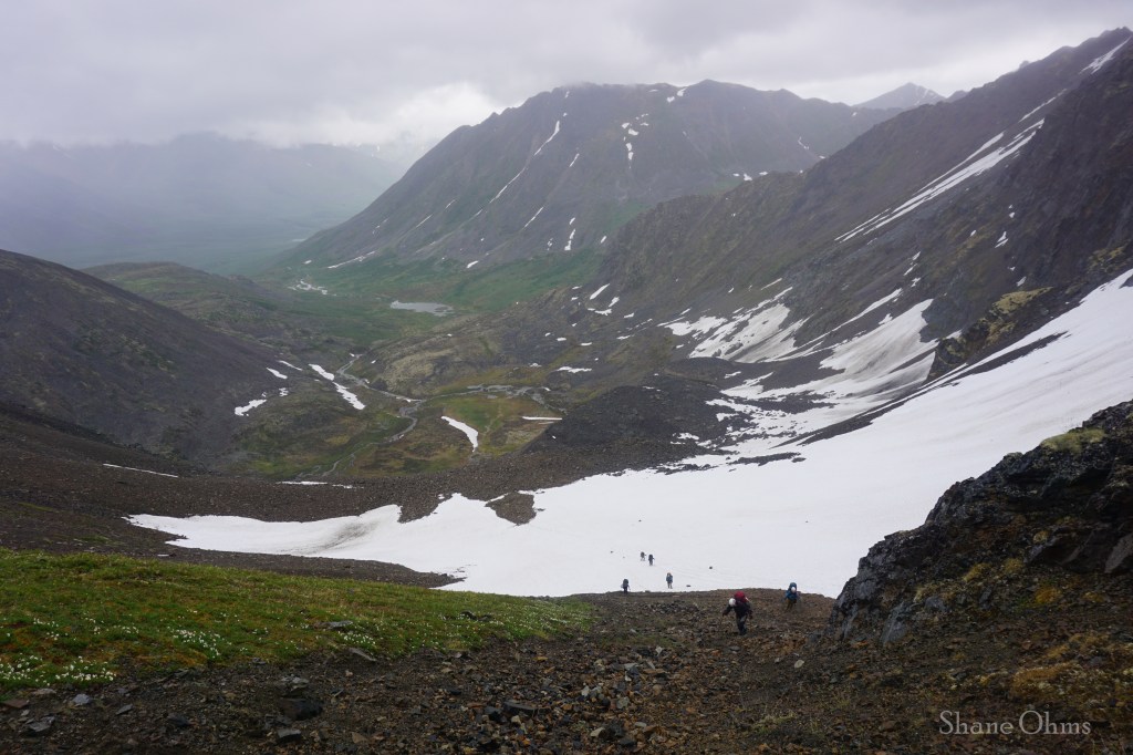
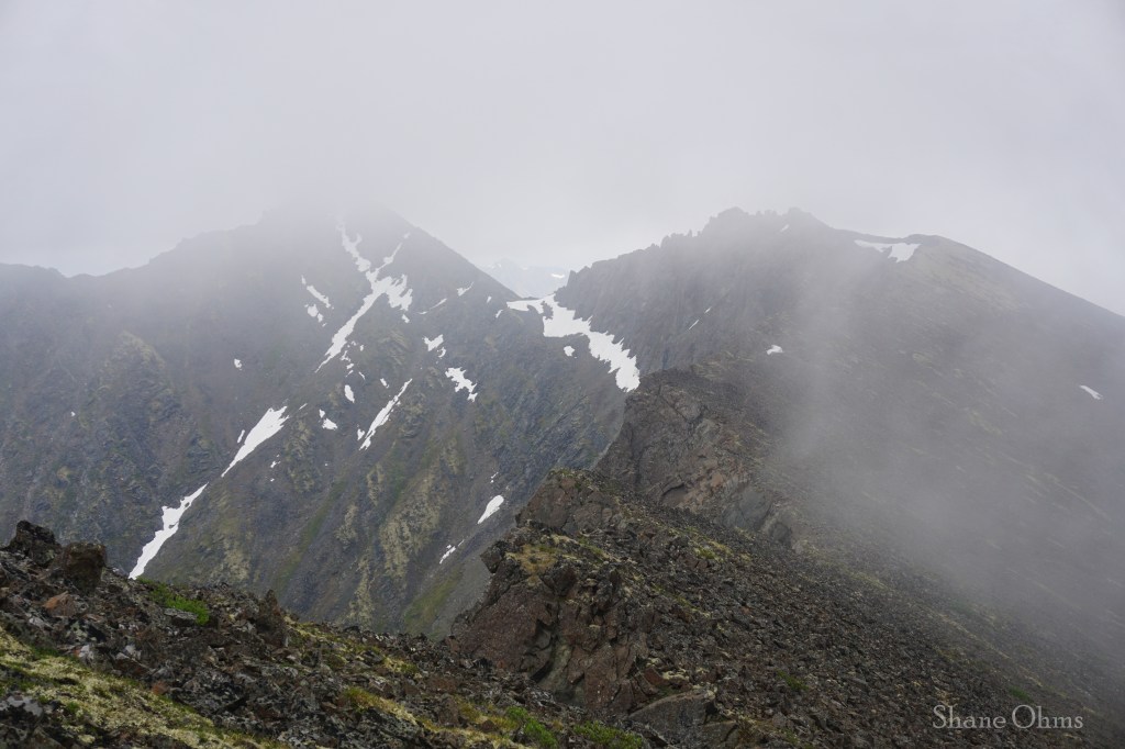
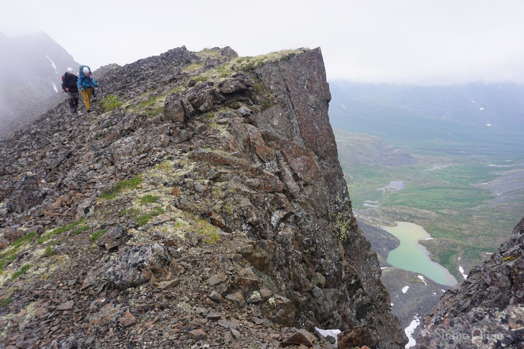
The Grizzly Lake trail is 6.5 miles and 3200′ elevation gain. All of the elevation gain is done at the beginning of the trail, and then you coast downhill toward Grizzly Lake loosing ~1500′. Once you get out of treeline, you’ll see Mount Monolith above Grizzly Lake and the closer you get, the more definition you will glean in an ever-increasing marvel of the impossible summit block and the formidable faces around it. I found Mount Monolith actually more striking than the Park’s namesake; Tombstone Mountain. If all you had was time for one dayhike in this area, I would hike the 3000′ up to the Grizzly Lake Trail’s high point and eat lunch with a most incredible view (and hopefully less smoky than ours).


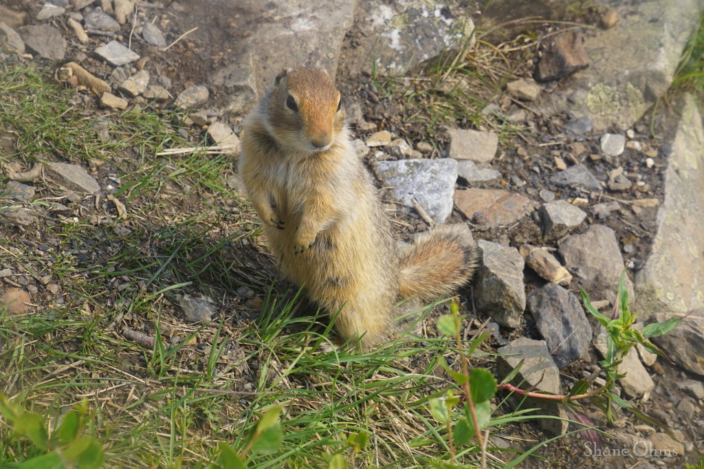
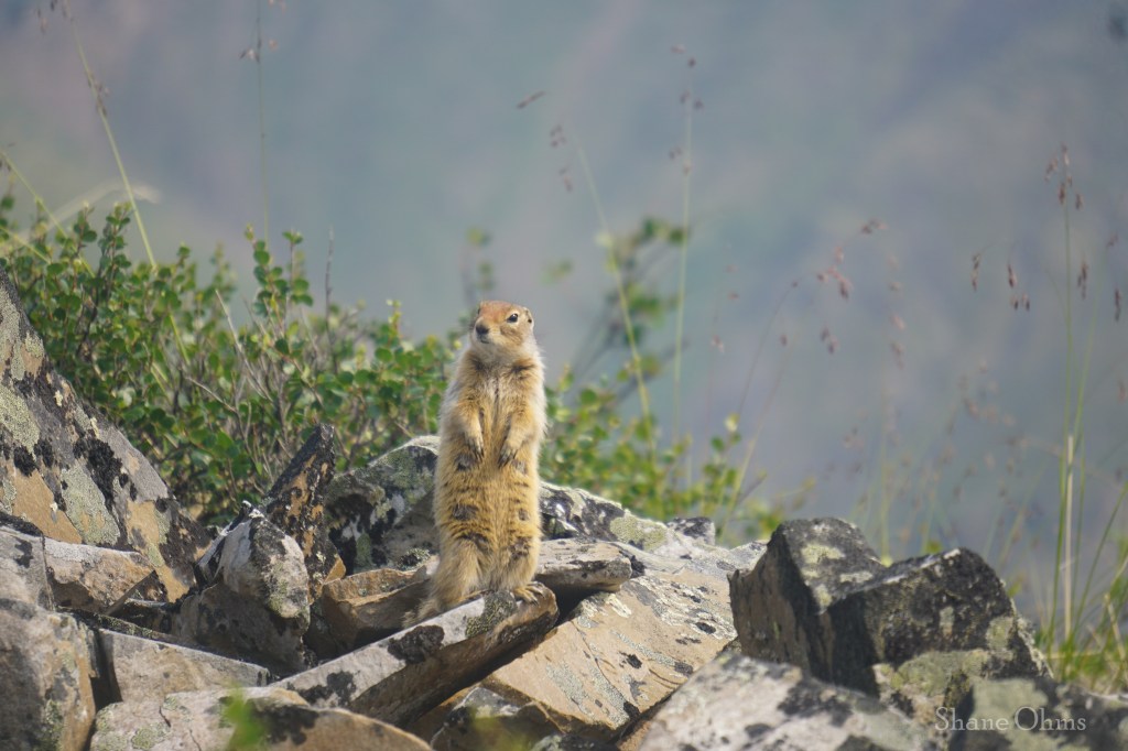
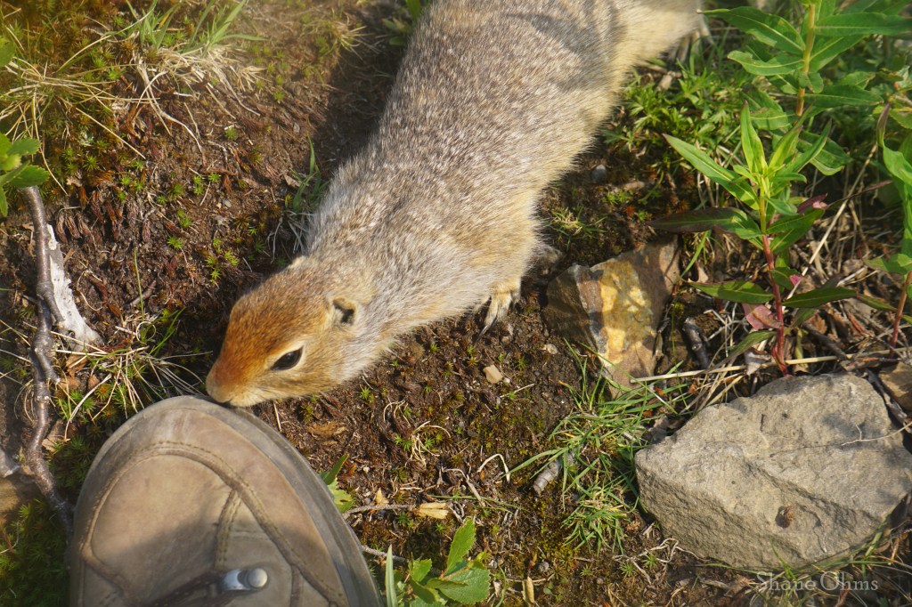
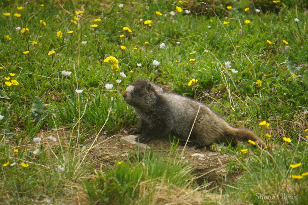
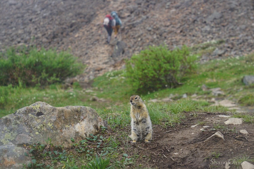
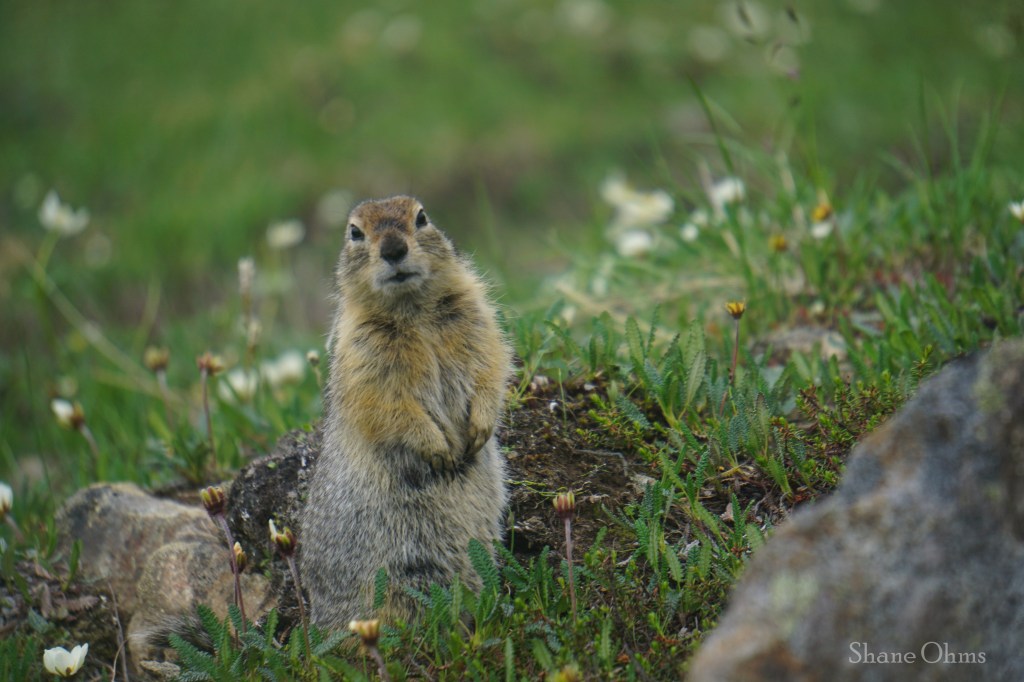
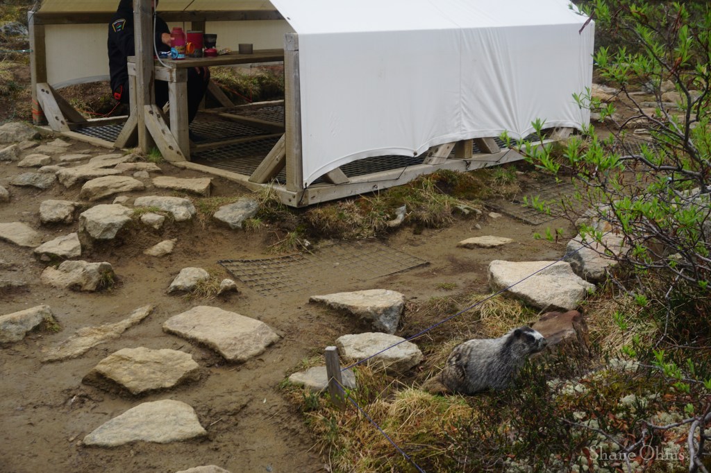
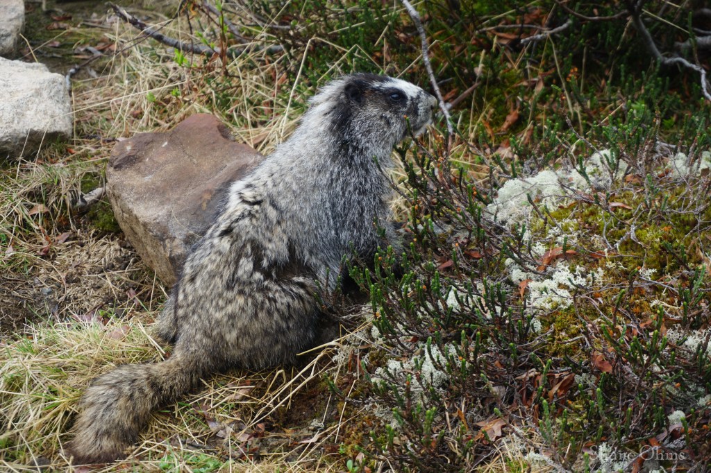
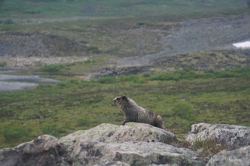
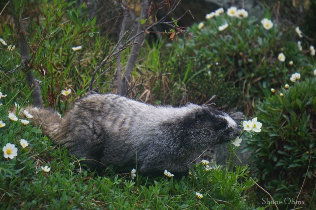
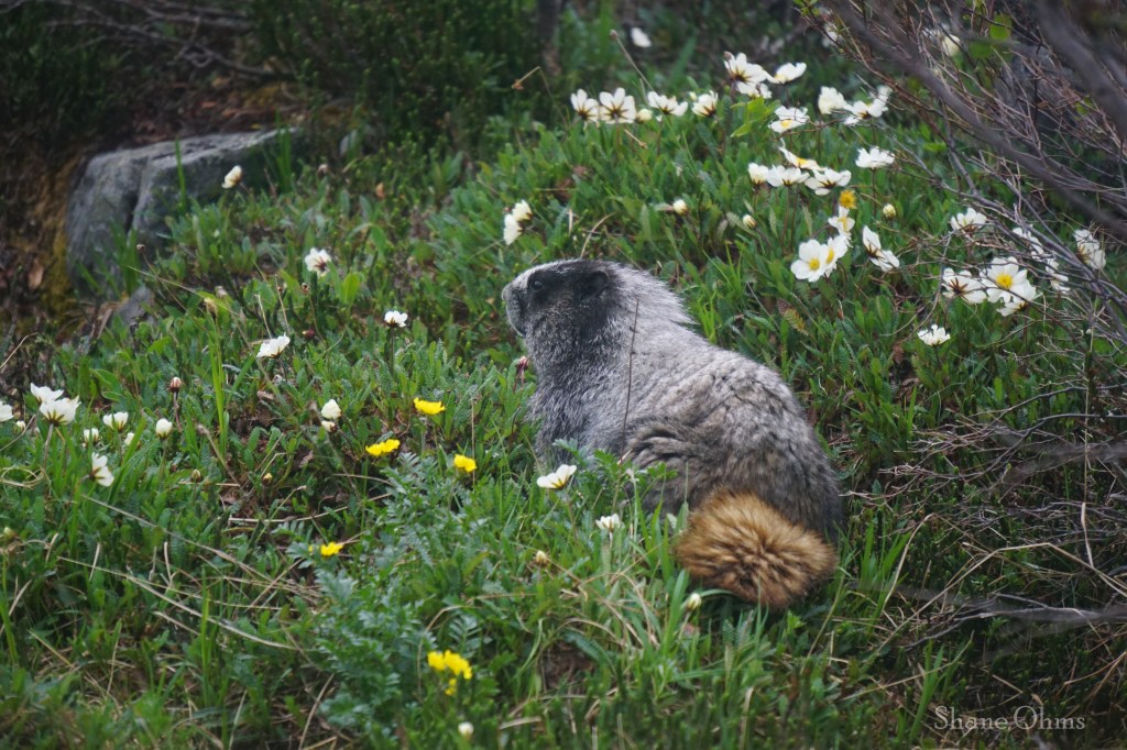
Do not feed the ground squirrels. They are a nuisance at best, and a pestilence at their worst (which their worst would be at Divide Lake). It is clear that they are not afraid of humans and are used to receiving handouts, so please don’t reward the bad habit. We heard a story from a hiker coming back from Divide Lake, who had laid his trekking poles down for just a few minutes, and in those few minutes, his foam pole handles disappeared; a ground squirrel had consumed them for the salty sweat residue left by his hands.
Here is what I did instead; I held my fingers in a chopstick formation (pretending to hold out a food treat, which they are clearly used to), and I voiced encouragement for them to take it using my best dog/baby-speak voice. Then right when the critter put its nose inches from my fingers, I pulled the Uno reverse card and scared the living daylights out of ’em, chasing it off into the bushes. Instead of rewarding their bad behavior with food, I taught them a good lesson in natural fear. Besides it was pretty hilarious when the critter sat at distance angrily chirping at us for the remainder of the break.
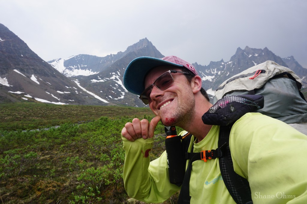
The trail coming into Grizzlly Lake gets a little boulder hoppy which is actually slick when wet. A small shower wetted it for us, and I was walking complacently because the trail had been so mindless to follow up until this point, and I slipped and fell flat on my face! I had had a GoPro in my hand since I was trying to capture the sound of the thunder, and when I fell, I smashed my chin on the GoPro instead of the rock beneath it. I’m not sure if that helped my chin to fare better in the fall, or if it just smashed the GoPro screen, but alas; a good reminder to watch your steps.

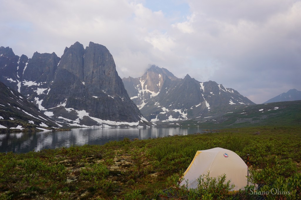
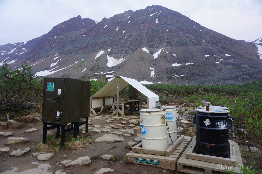
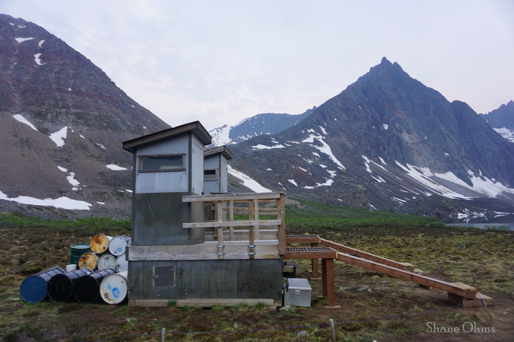
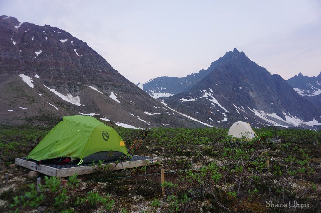
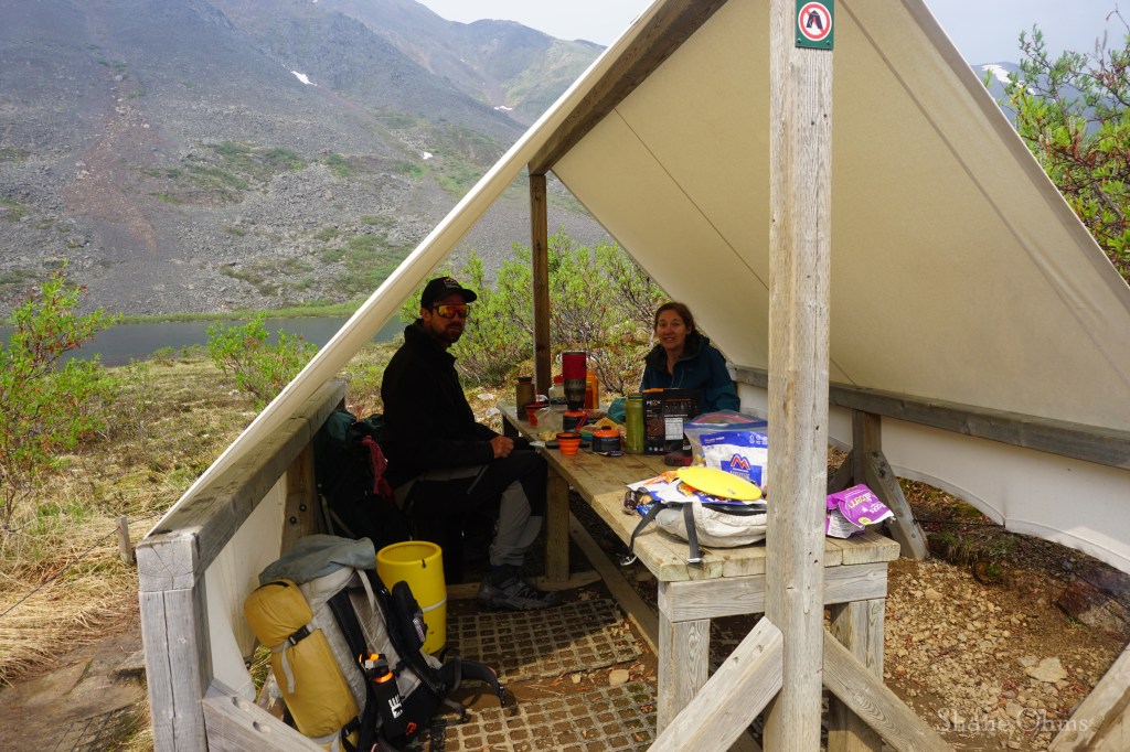
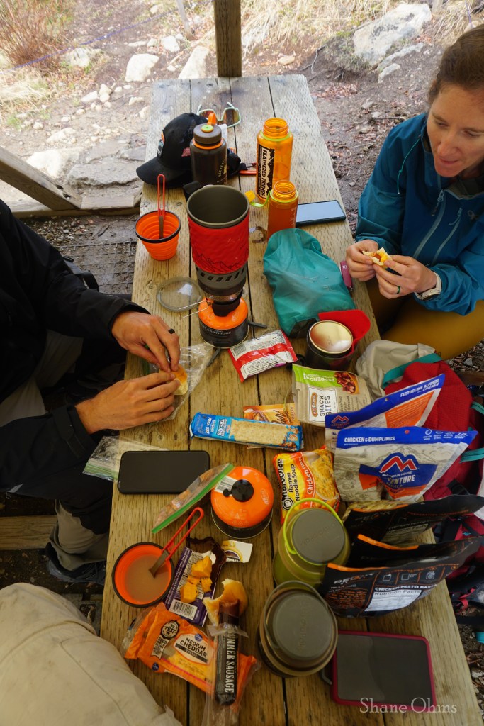
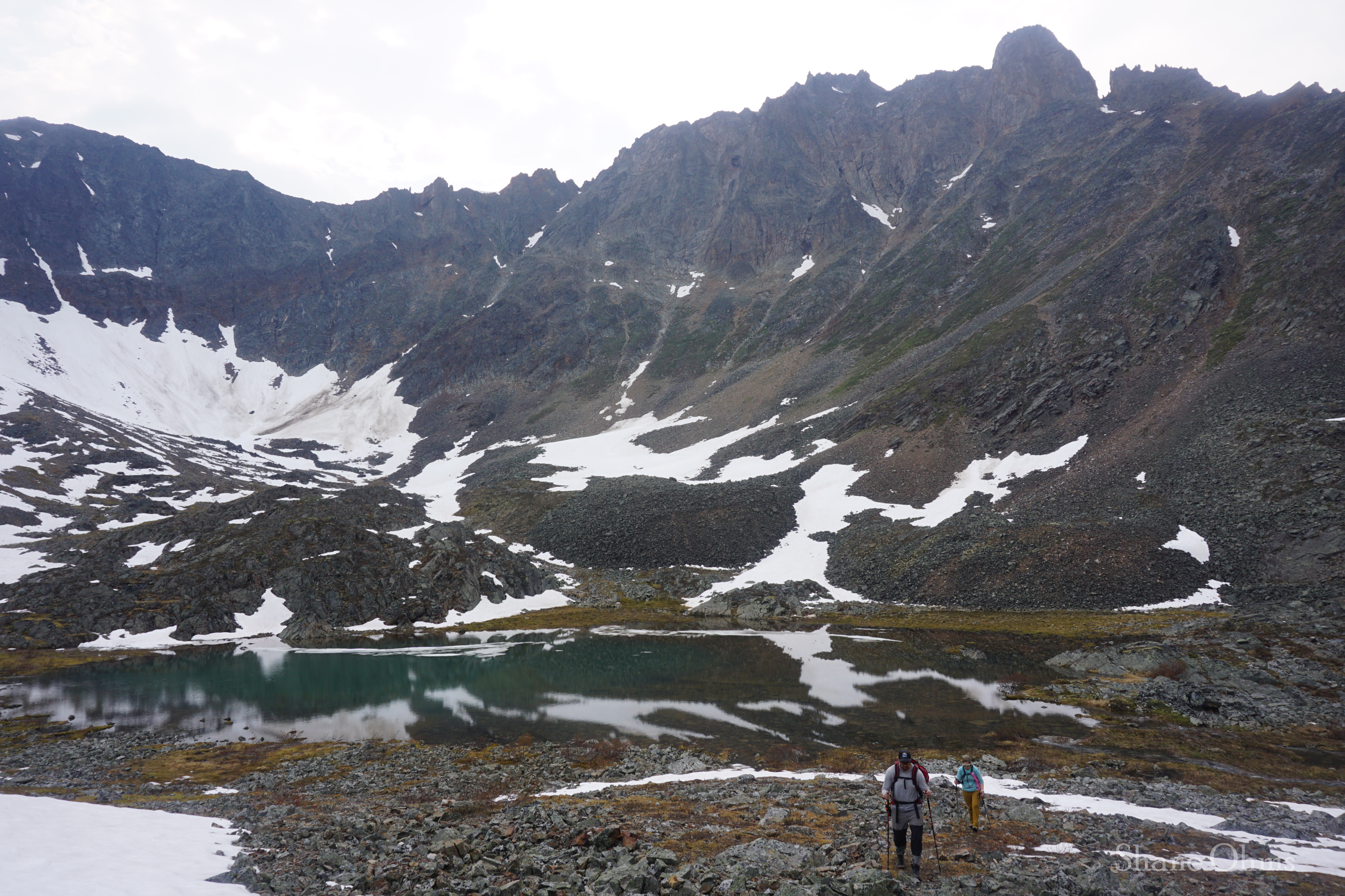
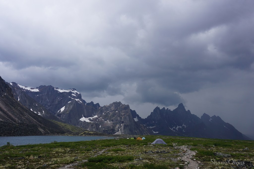
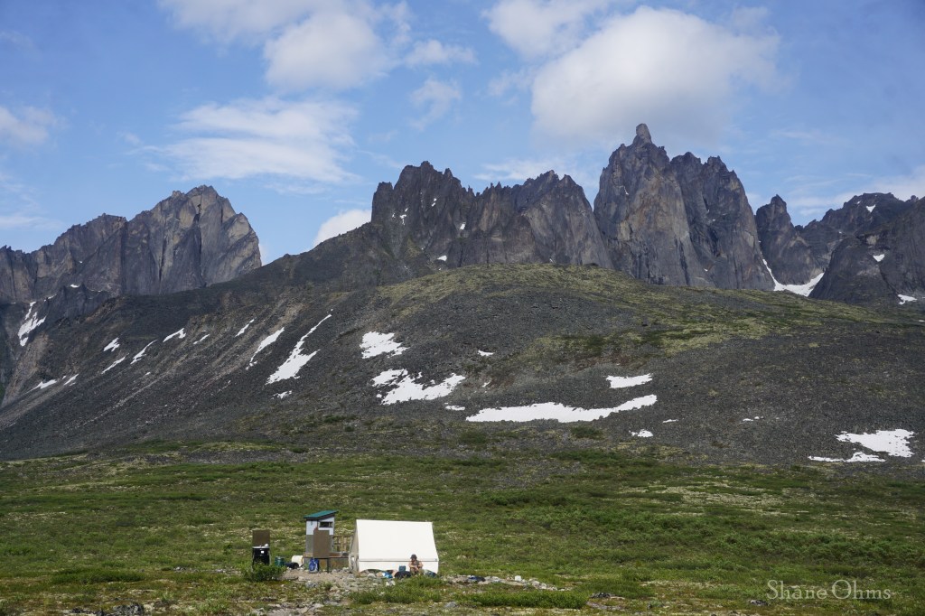
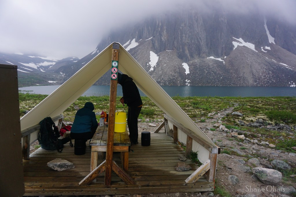
When we got to Grizzly Lake we had a light meal under the canvas tent whilst waiting for a rain shower to pass, and after it passed, we picked out our tent pads and set up the tents. These pads are basically an elevated grid/mat that is a little weird at first, but after sleeping on it (haha), they start to make a lot of sense. The one tip with them that I would’ve liked to know beforehand, would be to bring small carabiners instead of tent stakes; carabiners could simply clip into the grids, whereas the tent stakes I had packed went unused all trip. I’ll discuss more on these tent pads when we get to Divide Lake, but for now, I’ll share photos of the Grizzly Lake campsite amenities (the same set-up at each of the three lakes): canvas cook tents (so simple, but soooo nice), bear proof storage boxes (they still require users bring bear barrels, but at least they make for a nice chair), greywater disposal drums, and outhouses. These amenities are found at each of the three lake camps at Tombstone, and US park systems should take note of this style; these amenities are low impact, easy and cheap to implement, simple for users to understand, and they make a world of difference.

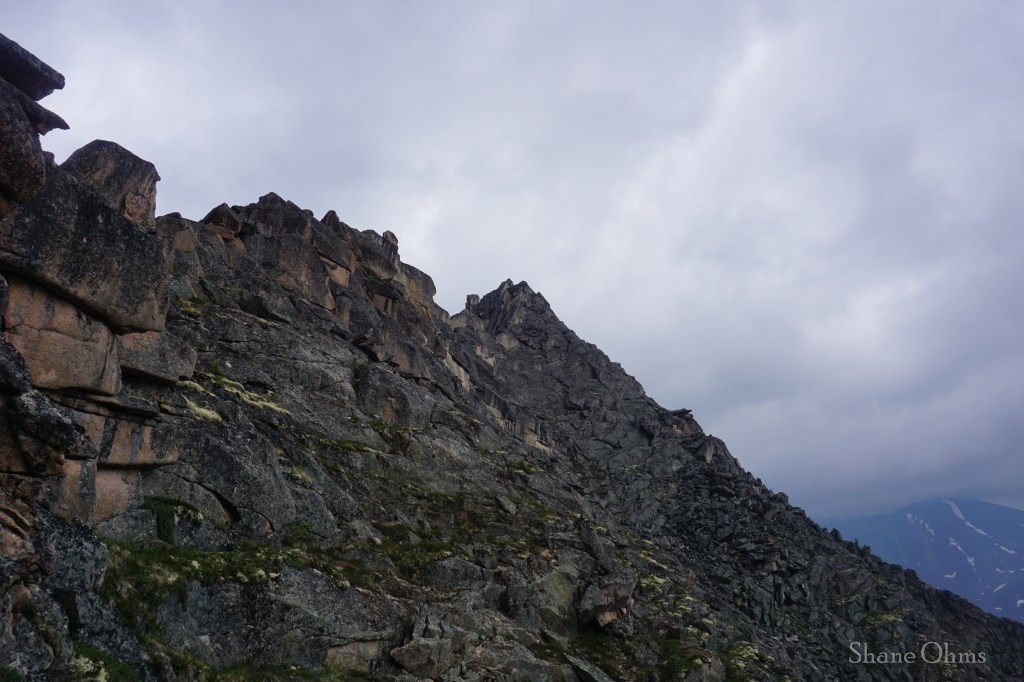
With camp made, and not being too tired from the somewhat short hike in, we went up the Twin Lakes and Mount Monolith Viewpoint Trail, which begins at the Grizzly Lake outhouses. This trail is less defined, but it goes up to a lake, and then onto a ridge.
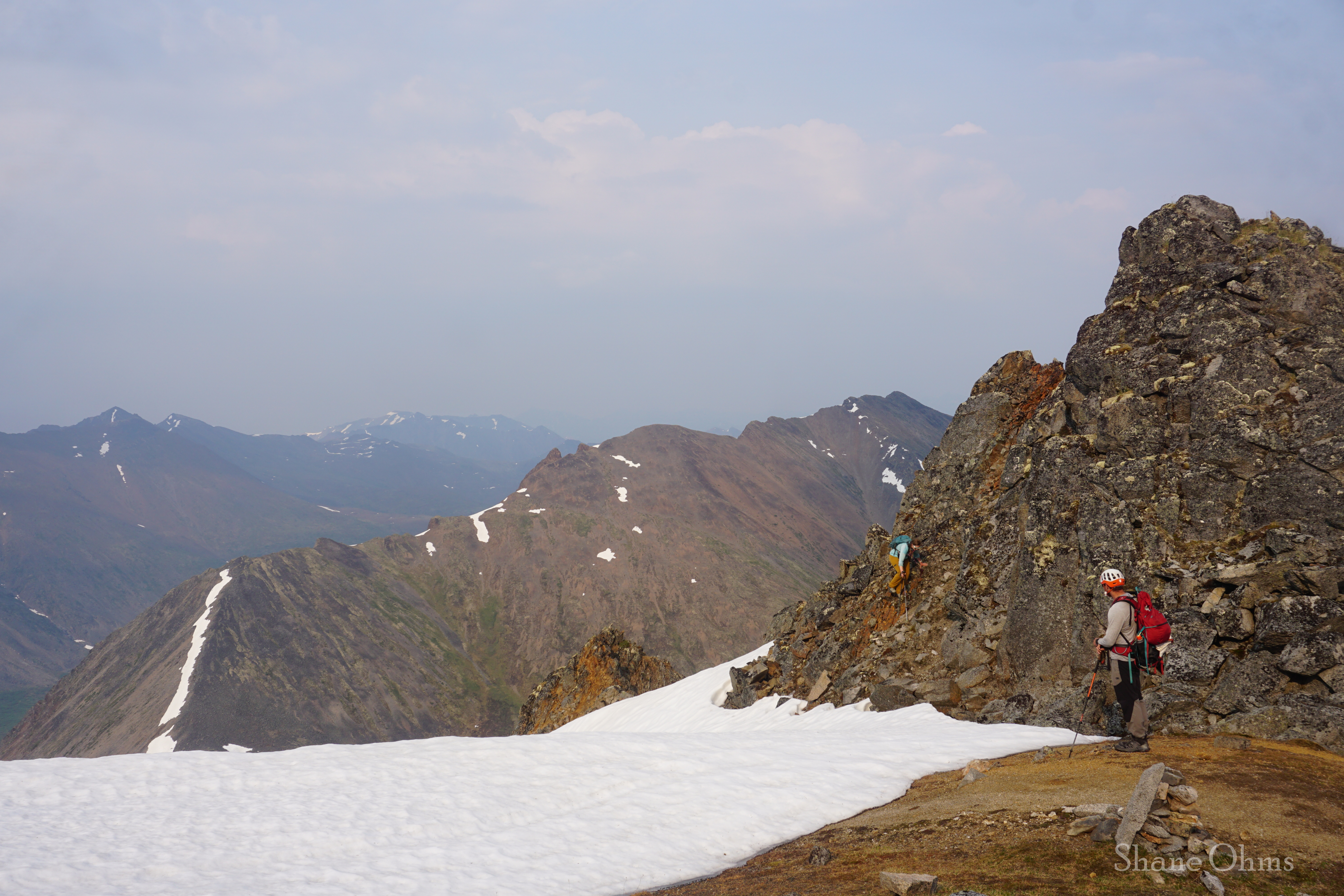

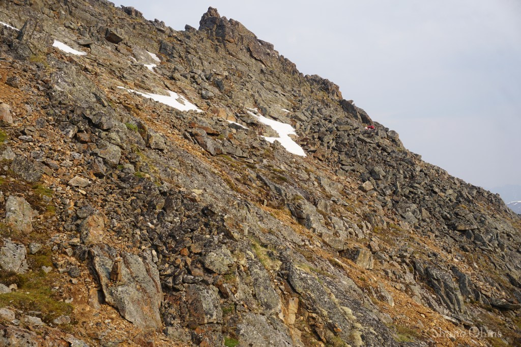
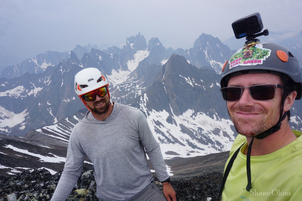
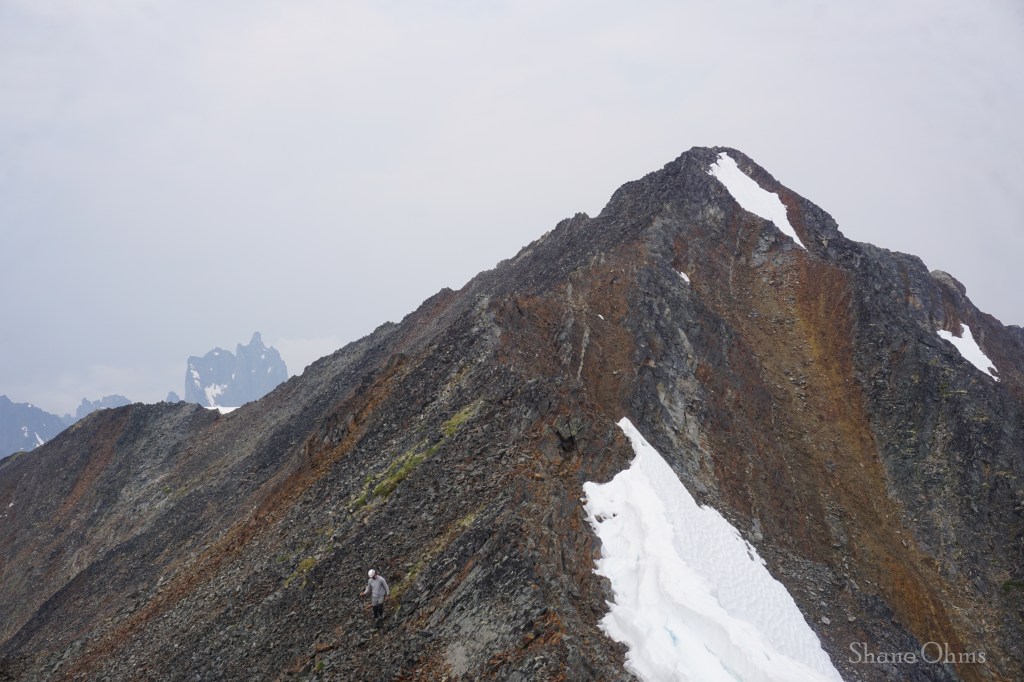
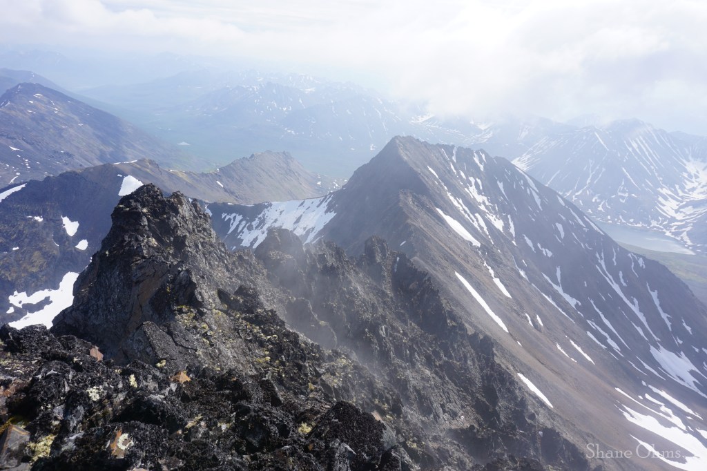
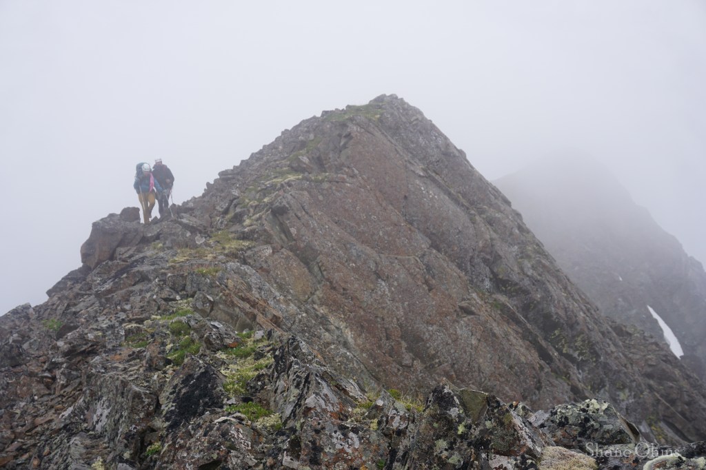
To claim a new peak, Nathan and I would continue up to the 6500′ high point that lies a ways beyond where the viewpoint trail terminates. The travel here was a pretty standard and fun ridgewalk with some light scrambling, but you’ll have to routefind on your own.
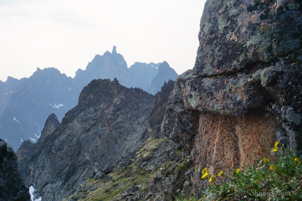
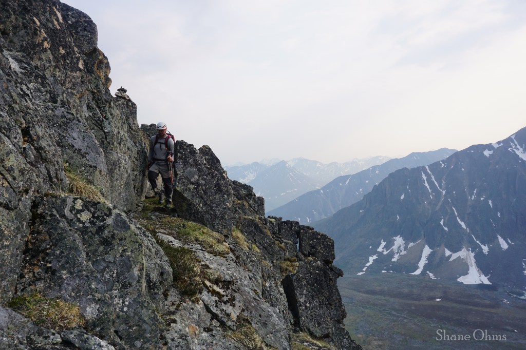
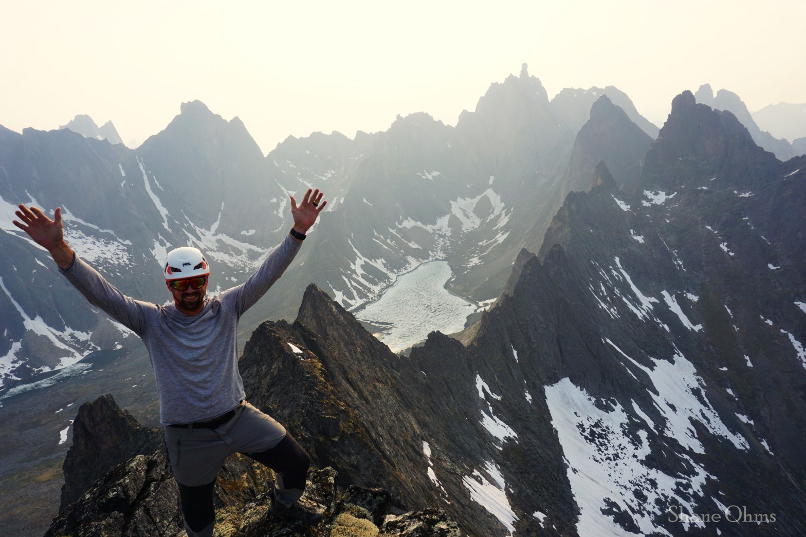
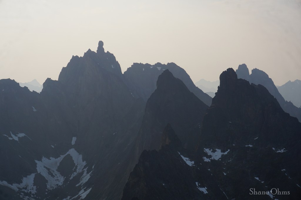
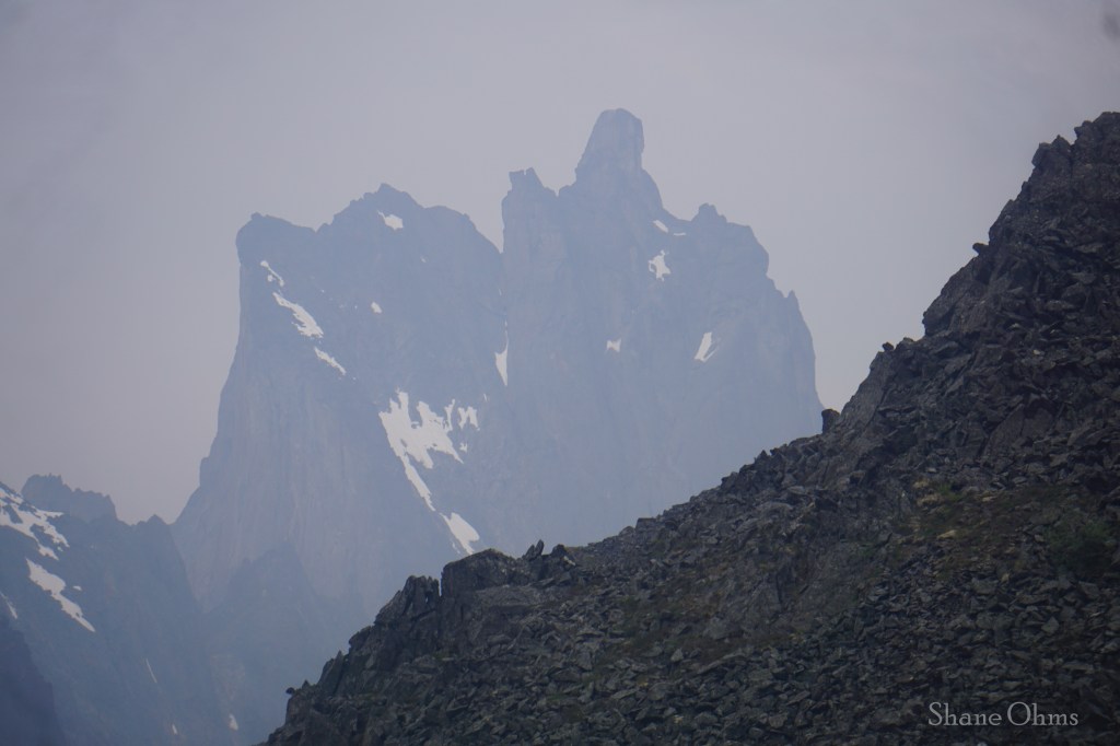
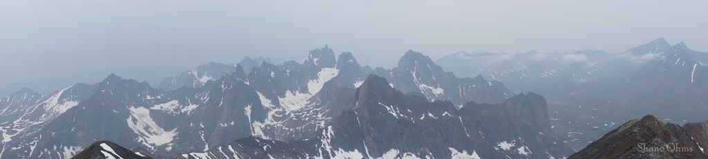
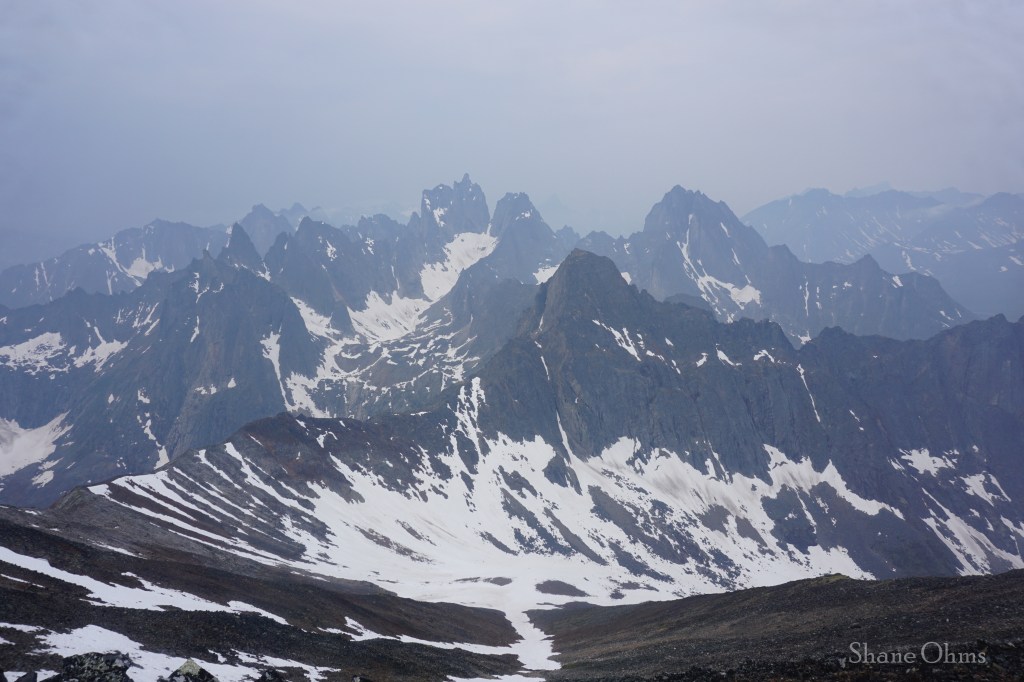
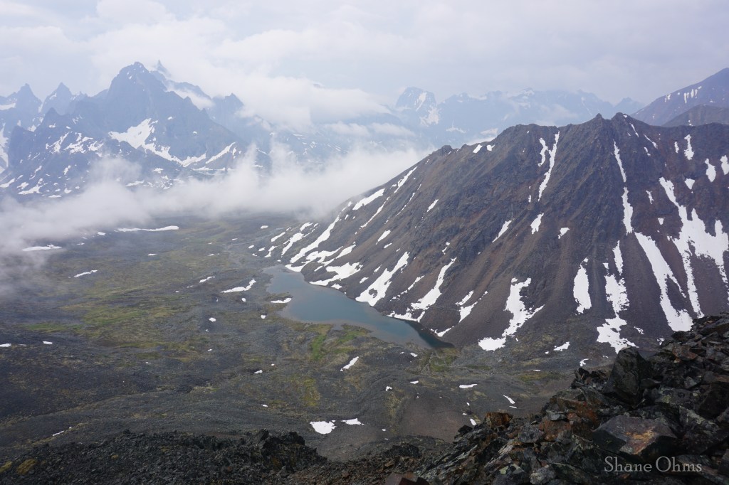
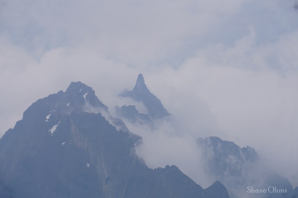
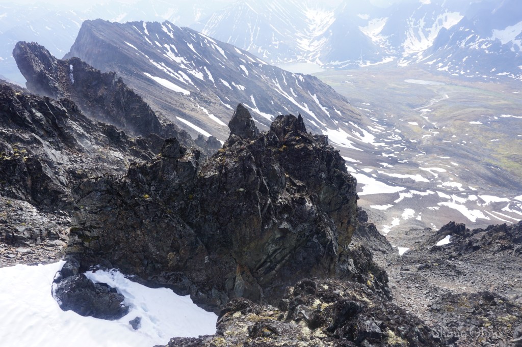
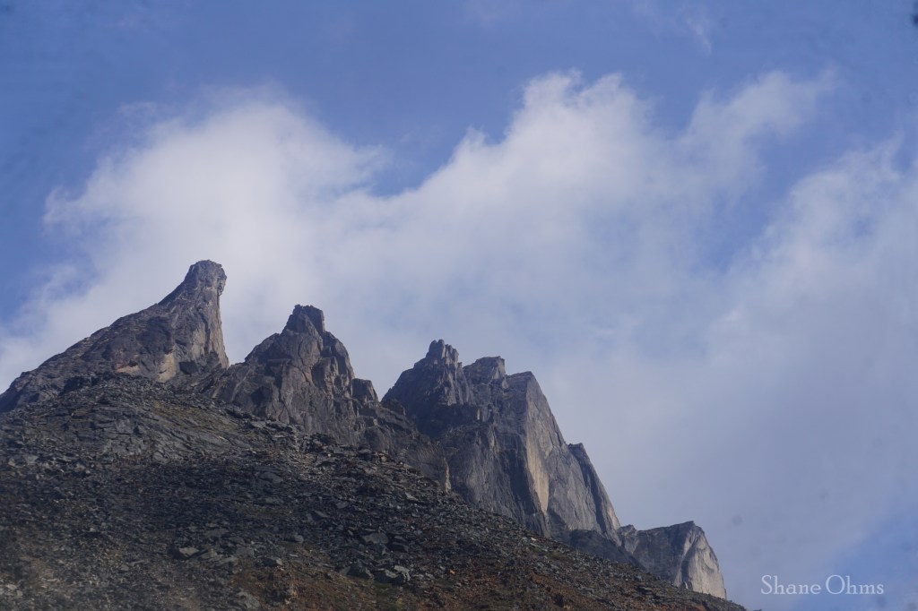
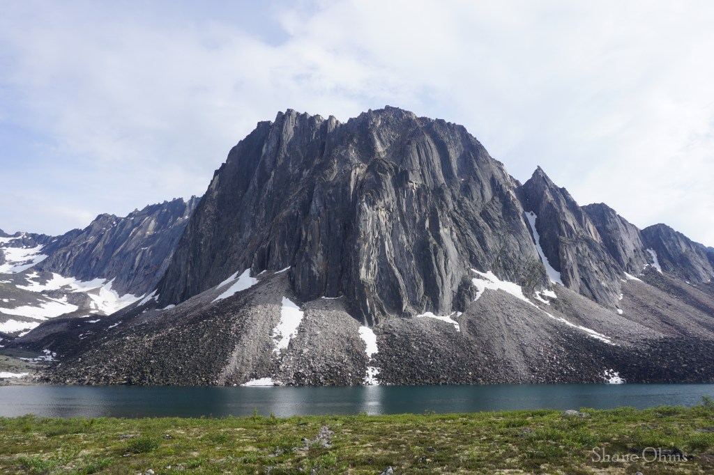
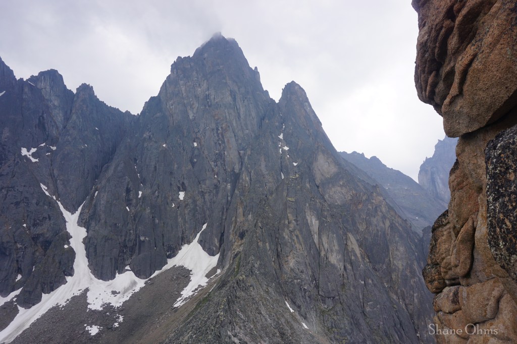
The summit was spectacular; while Peak 6500 itself is a light scramble, continuing on to anything further would surely necessitate roped shenanigans. I say shenanigans, because despite it’s looks, the rock quality in this area is actually not great for climbing; it is made up of syenite rock. And at the aptly named Talus Lake, you can hear the rocks plopping off of the face as they fall into the talus pile, and lake, below. Atop Peak 6500 I could really feel the proximity of all the jagged and gnarly spires. Had the sky not been so smoky, the pictures would’ve been so crisp. The two faces that drop to Grizzly Lake give serious feelings of vertigo, and the third face, which was our ascent route, wasn’t not steep. I remarked to Nathan how 36 hours ago we had been in Fairbanks, and now we were in an Arrigetch-esque landscape -without having to pay the Arrigetch charter flight price! The trip was already ‘worth it’ twice over… but Tombstone Territorial Park was just getting started.

The descent would have been an eventless retracing of steps, except we had an improbable event happen; Nathan’s bear spray burst open! Probably from swinging into a pointed rock. The leak must’ve been a small hole because it took a few minutes for the hissing can to run out of steam. When it was done, we reclaimed it and we caught up with Justine.
At camp we had dinner, but right before going to bed, there was group from Montreal Canada who rolled into camp at the late hour of 9pm; one of their party members had sprained his big toe a half mile into the hike, but instead of turning around, they had continued the 6 miles out to Grizzly Lake camp. What may have been lacking in discretion was more than made up for in their stoke, and to their credit; they had made it, but the uphills were painful for him and their journey was only half over with 1500′ of elevation gain still awaiting him on the way back to the trailhead the next day. We gave them some Ibuprofens, splinted his toe, helped them set up their Wallmart tents, then wished them luck as they went to make dinner and we went to bed, finally.
Monday July 1st, 2024
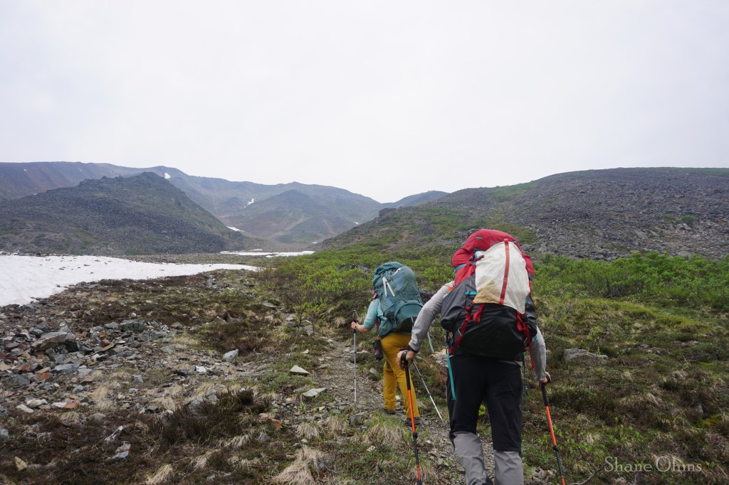
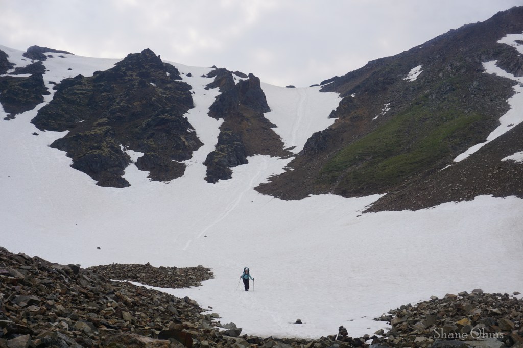
We slept in a bit after our big day 1, then we made breakfast. Today we would just be covering a measly 3.5 miles and 1500′ of gain going up and over Glisade Pass to our next camp at Divide Lake. It would be a light day, but we also hoped to go to bed earlier so that we’d have more time to hike Mount Frank Rae (the highest mountain in the Ogilvie Mountains) on day 3.
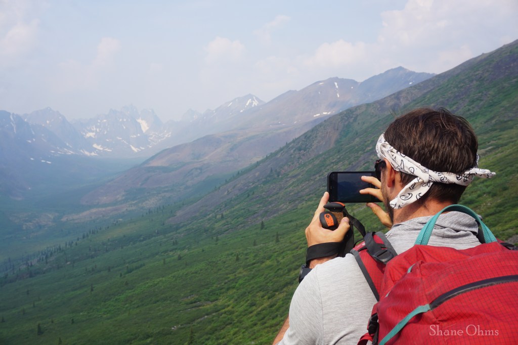
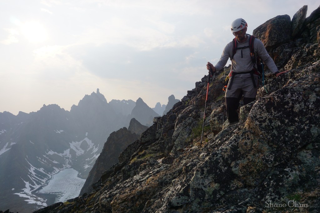
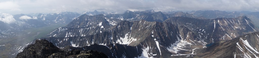
At the top of Glissade Pass and having still so much extra time, Nathan and I decided to add on another 800′ to reach the summit of the 6700′ peak to the west of Glissade Pass. It was a simple ridgewalk without any scrambling and besides bearing more good views, it also offered me a look at Mount Frank Rae that would help me flip the metaphorical coin on whether to climb it by it by its south ridge (which Caltopo and satelite imagery had suggested might be easier), instead of taking the standard route which is the east ridge. (Spoiler summary; the south ridge is easier, and more straightforward, and it should definitely become the new standard route.)

Nathan descends Peak 6700, a simple ridgewalk up from Glissade Pass, with the imposing Mount Monolith not so far in the distance.
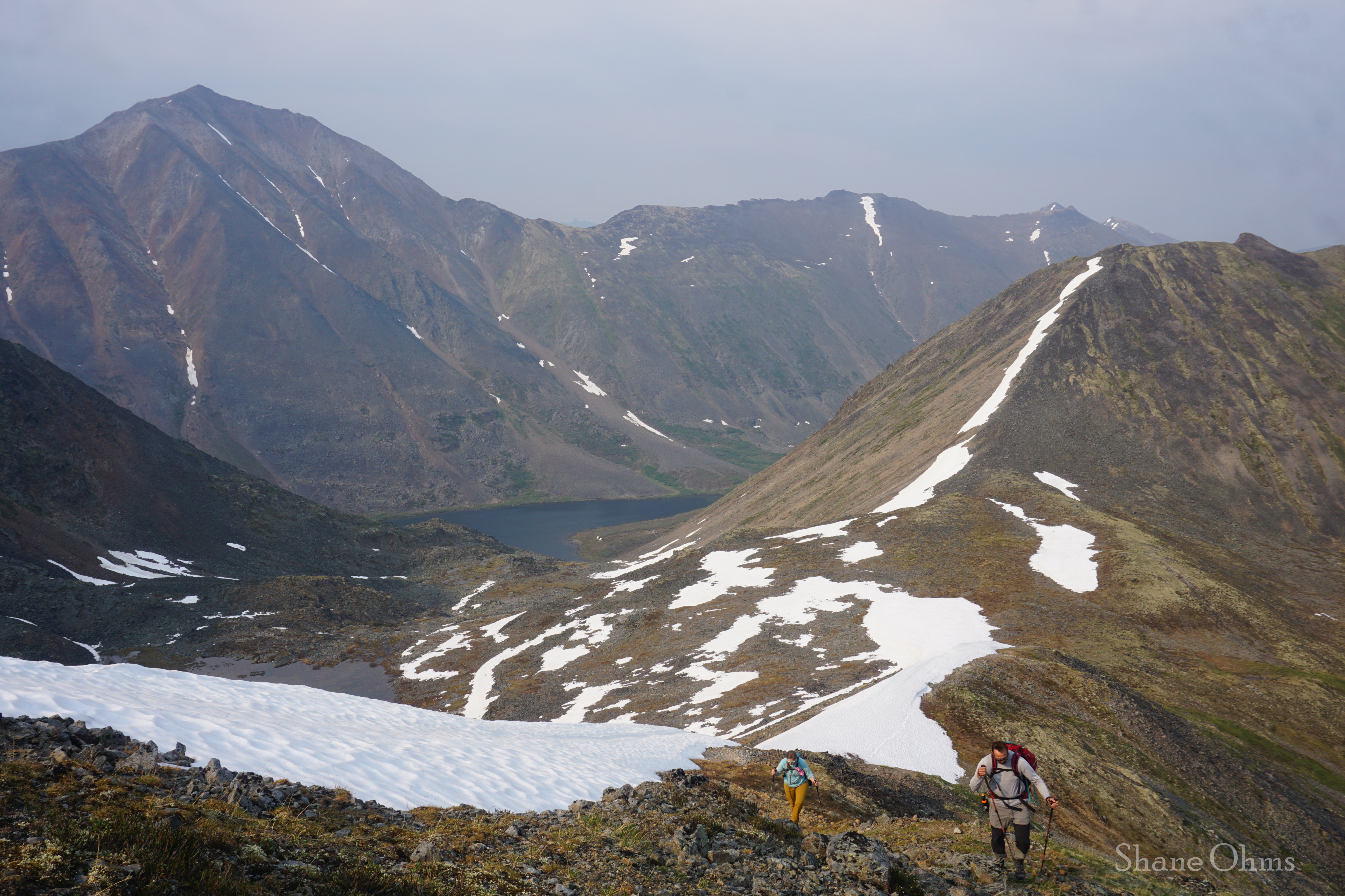
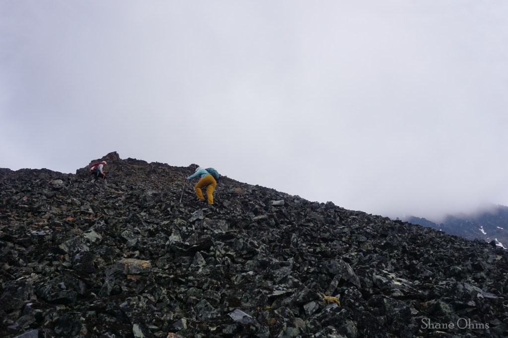
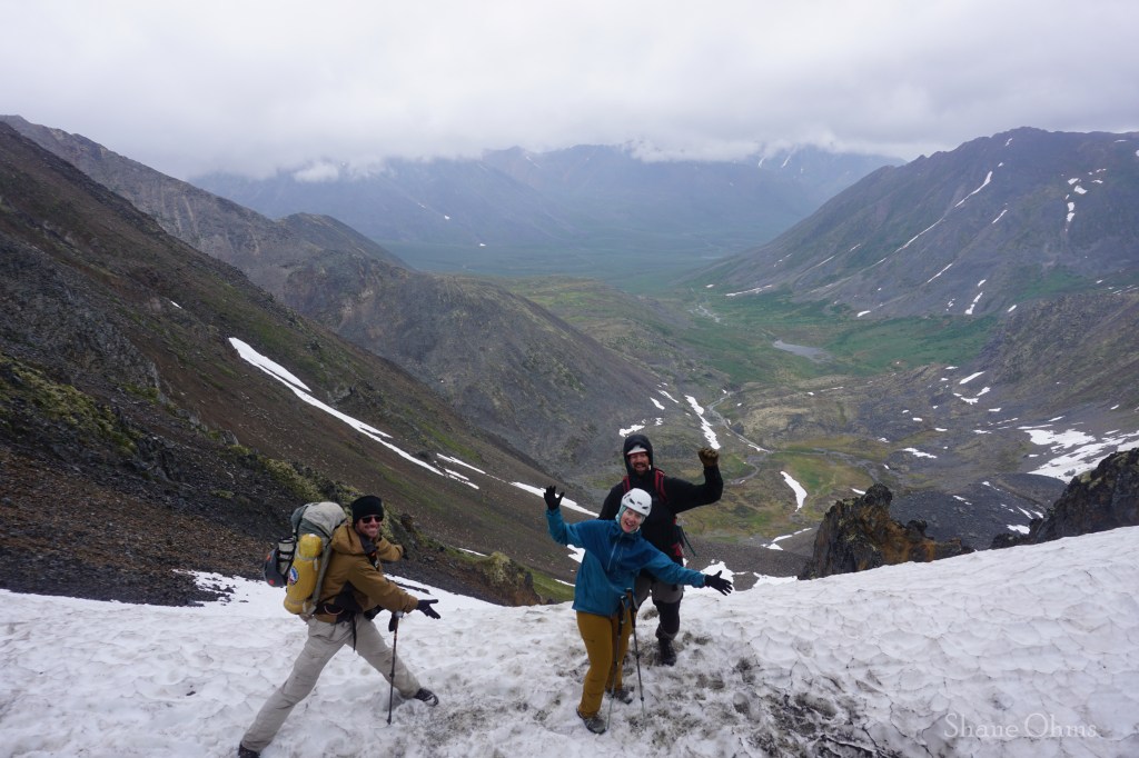
Back at Glissade Pass, we regrouped with Justine and began to make our way down Glissade Pass. To note: we were visiting during the opening week of Tombstone Territorial Park, which has a very small window of ~June 28th to ~September 8th. So Glissade Pass had more snow for us then it usually would as the summer progresses and it melts. For us avid Alaskan mountaineers it posed no problem, and was a nice boot-ski/glissade. If you do go early like us, doing the descent later in the afternoon will help the snow soften up, but go even just 2 weeks later in the year, and there would likely be scree on one side of the snow or the other to descend upon.

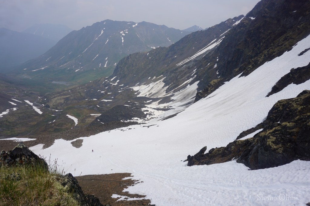
After Glissade Pass, there was a rock tongue to get off of, and then the trail does well to wrap around on an efficient contour line for a smooth, nearly-flat landing to Divide Lake.

At Divide Lake, we shared the campsite with just 1 couple from Latvia and their company was most enjoyed. It would’ve been cool to be able to say we had the place all to ourselves, but not nearly as cool as it was sharing it with the Latvians. Along the long car ride to Canada many things had gotten kicked up, and one of them was that Nathan and Justine hadn’t heard of Robert Service. So I had Nathan take screenshots of Robert Service’s poem ‘Cremation of Sam McGee‘ while we had cell service in Dawson City. Although quite distant from Lake Laberge, we were in the right territory for it (Yukon Territory), and as the sun fell, taking the temperature along with it, I figured the setting was as good as it would get. I hadn’t read the poem since some age of old like middle school, so after refreshing myself with the pentameter on the first 8 lines, I let it rip. And if I do say so myself; I nailed the delivery! The poem is somewhat of a classic up in the north, so if you haven’t heard it and you like the opening lines (teaser below), save it for a cold night around a bonfire and give it a read.
Cremation of Sam McGee, by Robert Service
There are strange things done in the midnight sun
By the men who moil for gold;
The Arctic trails have their secret tales
That would make your blood run cold;
The Northern Lights have seen queer sights,
But the queerest they ever did see
Was that night on the marge of Lake Lebarge
I cremated Sam McGee.
I promised a little more discussion on the tent platform grids and here it is; these lovely tent platforms are the only surface the bloody ground squirrels won’t touch; they will make burrows directly underneath them (we were in our tents hearing them beneath us), but they don’t go on top of the platforms. I’m sure they could, but for whatever reason they just don’t. I suspect they leave them alone because the open grid holes are difficult for them to navigate, but for whatever reason, you simply won’t catch them on top of the grids. Case in point, when we set off the next day to hike Mount Frank Rae, we left our tents set up and when we came back they were totally undisturbed. But dare to set your trekking poles on the ground and expect them to get chewed up!
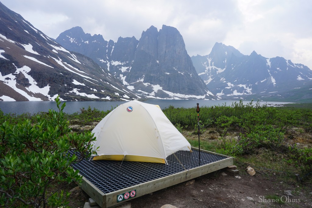
Another nice thing about these grid tent platforms is that they are always clean and never wet; water and dirt self clean by falling through the cracks. Compare this to the typical tent platforms we are all used to seeing (plywood boards or 2×4’s) which will pool with and/or absorb water and can have debris accrue atop them. I think everyone can agree that Canada is leading the way into the future of campsite construction here. (Remember to swap your tent stakes out for small carabiners that will clip into the grids!)
Tuesday July 2nd, 2024
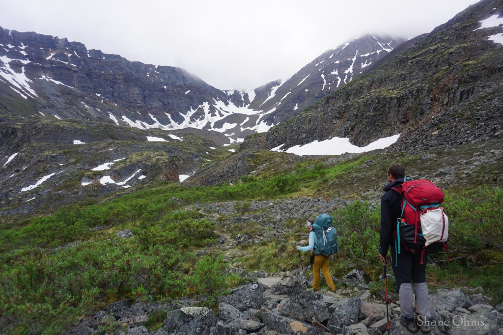
The day has come for or summit bid of Mount Frank Rae so we started early to give ourselves time for routefinding. We followed the trail to Tombstone Pass, then turned 90 degrees and made way for the bowl south of Mount Frank Rae, to put a summit bid on the peak’s south ridge.
The weather began to grow less and less optimistic the closer we got. At about 6000′ on the south ridge, Justine turned around. The weather worsened some more. It was only a light rain, but the clouds felt thick and limited the visibility. Although the rain was light, it doesn’t take much get the rock wet, and once it was wet; it was slick. It was, by every measurement, not an optimistic outlook for succeeding on a scramble route we knew nothing about. So it was no surprise when at about 6500′ Nathan turned around also.
Mount Frank Rae is the highest peak in the Ogilvie Mountains, so I was fine with not getting any summit views so long as I could summit safely. I agreed to Nathan that I would only keep poking at the mountain on terrain that I could reverse every step of in soaking wet conditions. Time did not matter, nor did comfort or aesthetics; only good decision making mattered. Those were the rules of engagement with Mount Frank Rae.
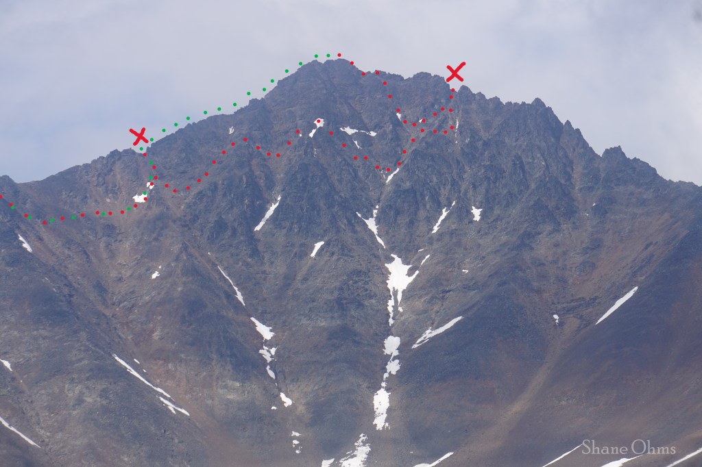
I didn’t take any pictures while it rained, but my video shows some of it. I went up to a notch on the south ridge first (red x on left). Looking over the back side of the notch was a nice ledge, which I hopped onto, but looking further up what I could see of the south ridge, I could tell that it would not go soaking wet. So I decided to go back down a ways and try traversing across the face with the hope of eventually finding a weakness that I could use to get back onto the ridge. With the limited visibility, I placed cairns to aid my ability to reverse the route (if necessary). I was not optimistic, but I wasn’t going to turn around until I had exhausted my safe options.
Ironically, my fortune ended up being that I screwed around on the face for so long in search of a route that would go soaking wet, that the rain clouds actually passed, the sky opened up, and it started to dry out! This change of fate occurred as I neared my easternmost position on the face and it enabled me to do some scrambling that I otherwise would not have done in “soaking wet” conditions. I bee-lined up to meet the east ridge (the red x on right). But I did not like the ridge here, so I went back down to search for a new way up that would skip that bad section of ridge. Some more scrambling brought me back up to the east ridge a second time, and from here I attained the summit of Mount Frank Rae.
I had pretty good faith that it wouldn’t rain again, but no promises, so after a few quick summit photos, I began my descent of the south ridge. On the ascent, I had written the south ridge off after reaching the notch only because the rock was soaking wet at the time, but now it was dry (mostly).
Once I made it back to the notch, I was on familiar ground once again and the rest of the descent was game over. I had only gotten a taste of the upper (better?) part of the ‘standard route’ east ridge and based upon that bit of experience alone, I can declare that the easiest, and most straightforward route for doing Mount Frank Rae is the south ridge, hands down. Were it completely dry, I would say it is probably just a class 3 scramble that feels a bit exposed.
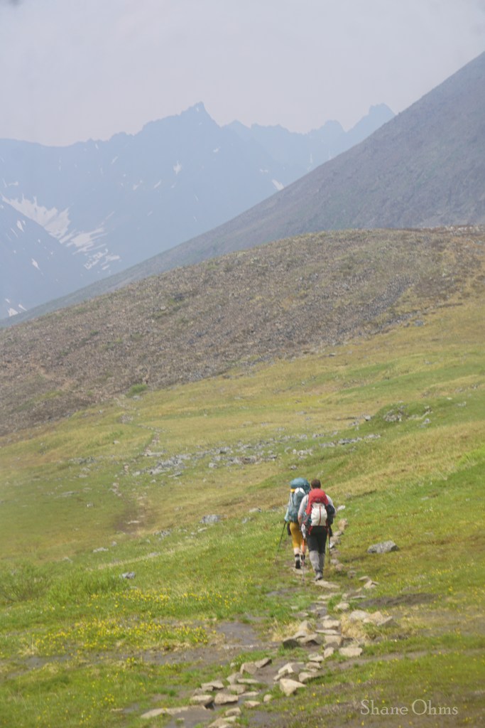
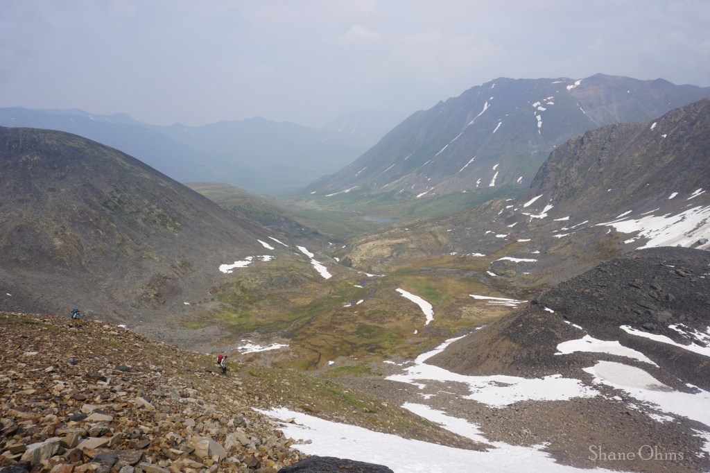
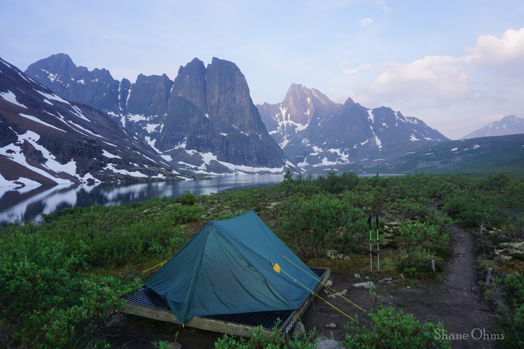
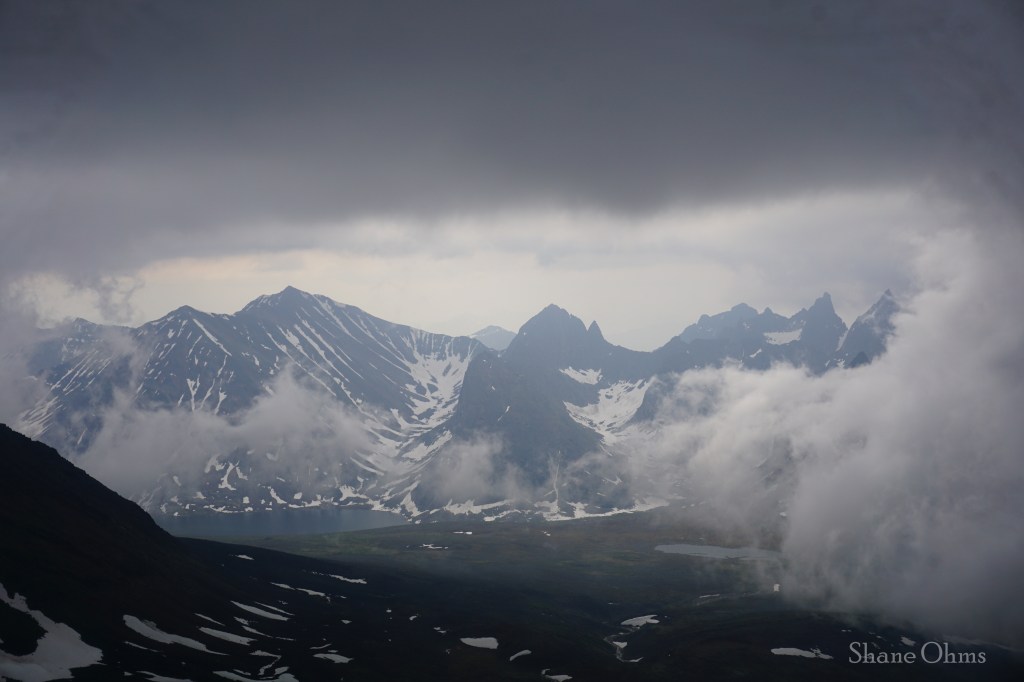
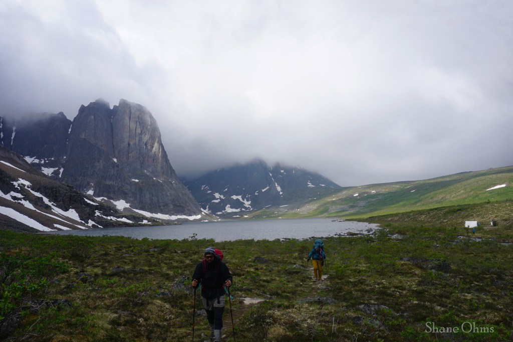
Back at Divide Lake I regrouped with Nathan and Justine and we broke camp and saddled the full weight packs for our move to Talus Lake. At Tombstone Pass, we ran into two ladies and a 10 year old, who had helicoptered in to Talus Lake, spent two nights there, and had 1 night at each of the other lake campsites ahead of them. I was reminded of myself, who, also at 10, did the Chilkoot Trail with my dad, grandpa, and uncle.
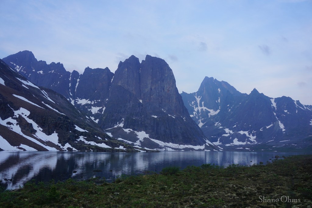
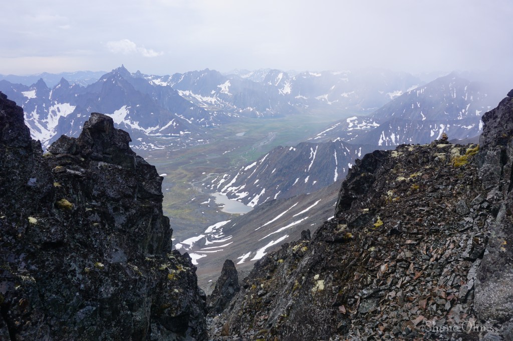
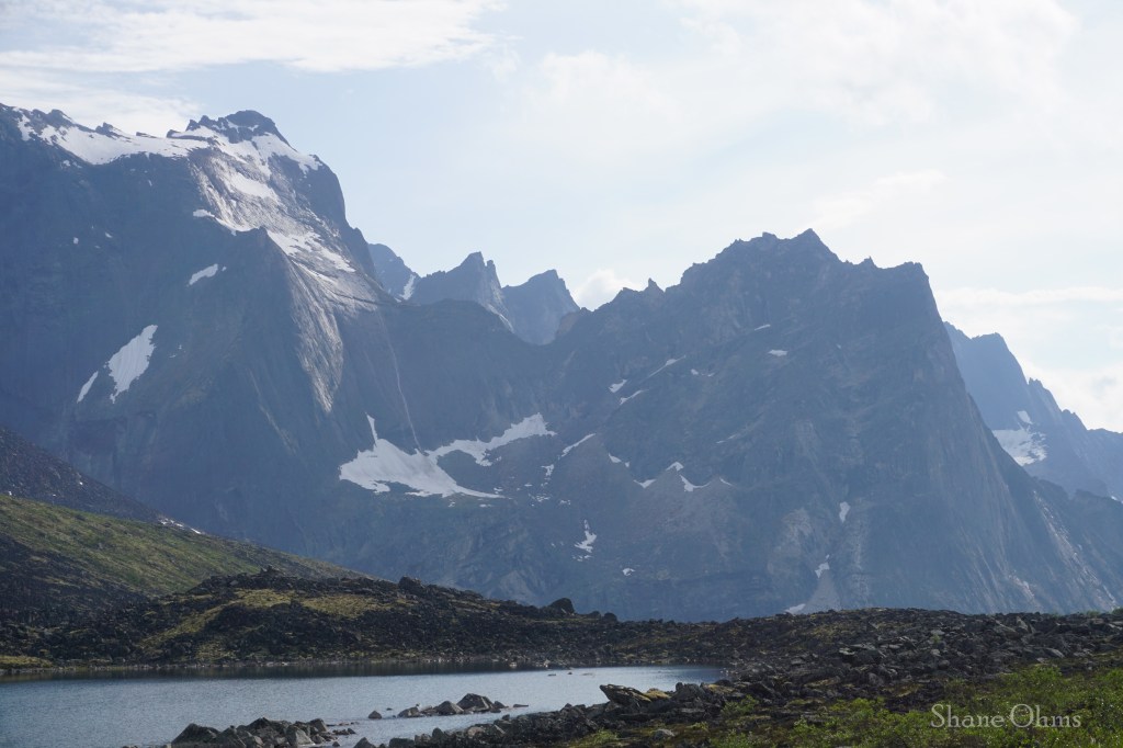
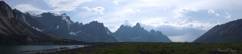
After Tombstone Pass, but before Talus Lake, we stopped at an unnamed lake which would become my favorite spot of the whole trip.
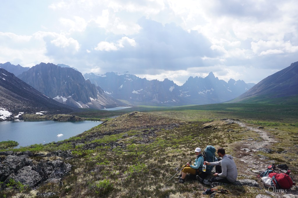
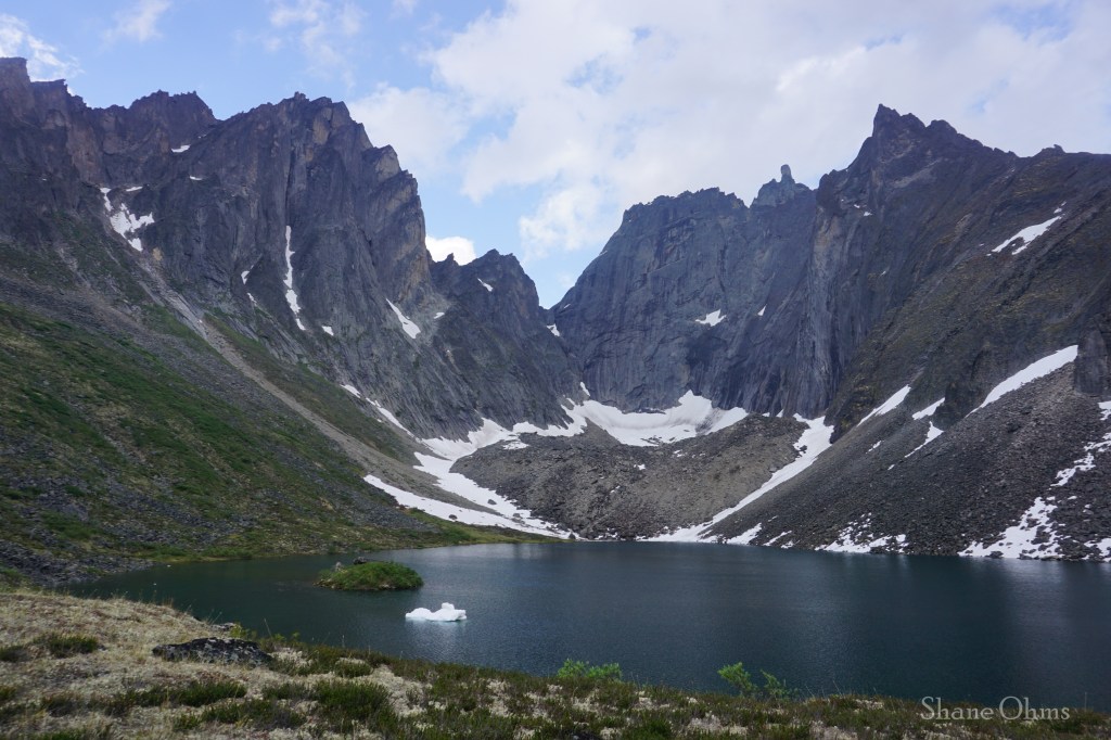
It felt like we spent an hour here, but my photo metadata says it was only a 25 minute break. We almost made it to the Talus Lake cook tent for shelter before the rain got us. The shower was worth every of the 25 minutes.
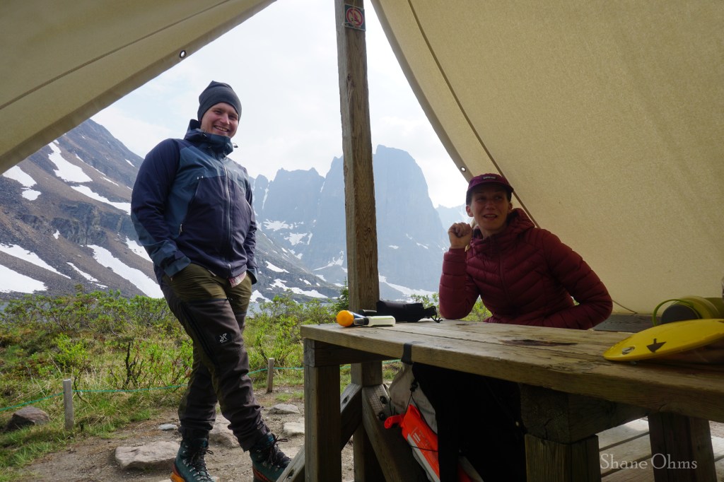
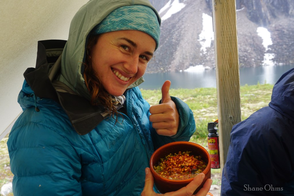
At Talus Lake, we had yet another world class camping vista, and went through the motions of camp set-up, followed by diner in the communal canvas cook tent. The nicety of this cooktent extends beyond simple rain/wind shelter and keeping smellables away from the tent platforms; it is a social mixing zone that brings together hikers from all corners of the globe (but a lot of Canadians). Current trail conditions, inspiration off future trails in different places, and general stoke and stories are exchanged under the canvas cooktent, and it became something you’d look forward to. At Talus Lake we picked up a number of neighbors coming from Grizzly Lake. There was a coupe from France, Ottawa, and elsewhere Canada and continental USA. The Ottawa couple had an itinerary that synced with ours for the remainder of the trip; two nights here at Talus, then one more at Grizzly. One of them (or so I am convinced) has broken taste buds, because she applied heaping spoonfuls of red chili pepper flakes to each of her meals.
Some recent commentaries from the Bible’s book of Hebrews had recently been shared to me by friends, and I had brought the book of Hebrews along for some further mulling over. Retiring to the tent at Talus Lake I read the book of Hebrews. Except it was actually Hebrews 3, verses 3 and 4 that captured me. “…He who built the house has more honor than the house. For every house is built by someone, but He who built all things is God.” Reading the bible doesn’t click that hard for me often, but this is what I saw:
Every house is built by someone. This is just stating a fact. Behind every house is at least one builder. Behind every work of art (paintings, songs, meals) there is an artist who made it. Beautiful creations, organized creations, creations with purpose: things like houses do not just materialize on their own accord, they have a creator.
He who built all things is God. Perhaps the most magnificent “house” we can explore is the giant one we are in right now: Earth. Earth is massive, full of countless landscapes and diversity, and each one is a unique masterpiece. No matter where you find it; nature compels in us a sense of awe and wonder. But what created nature? We know that every house is built by someone. And even if we don’t know the name of the builder, we know (by the evidence of there being a building) that there is, in fact, a builder. The name for ‘He who built all things’, just so happens to be the English word “God”. He who built all things is God.
He who built the house has more honor than the house. Compliments go to the chef, not to the food. Delicious food is delicious, but the thanks and praise belongs to the chef, not to the food itself.
So many people, myself included, go to great lengths to behold these mind-blowing, majestic vistas -such as Tombstone Territorial Park. We develop an intimate understanding of nature’s inherent majesty. If you found this website, I am probably preaching to the choir when I say being in nature is incredible and profound. But if that is as far as it goes, then it looks a lot like idolizing a “Mother Nature” and the awe and glory falls short of where it belongs. Nature is the creation, not the creator. The house of nature is outright beautiful and awesome, but it is the carpenter that deserves a higher praise because He did the work to make it. May the beautiful creation of the great outdoors be like a mirror pointing our amazement and awe back at the Creator. Our God deserves that glory! Nowhere better could this message have stood out to me, than at the end of this third day in the overwhelming, never-ending beauty of God’s Tombstone Territorial Park.
Wednesday July 3rd, 2024
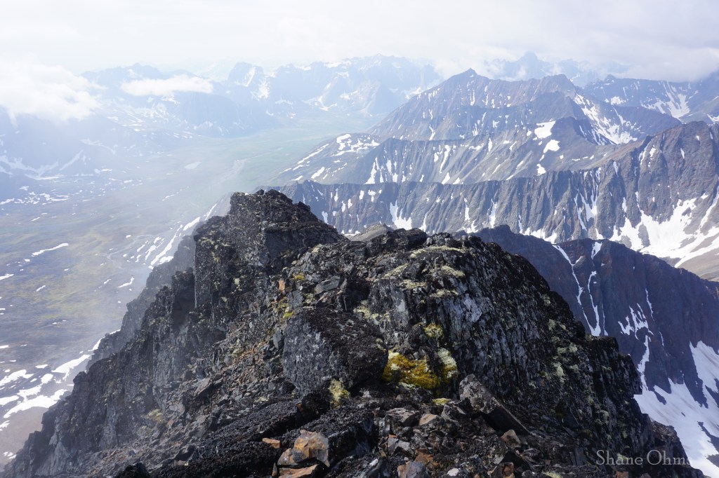
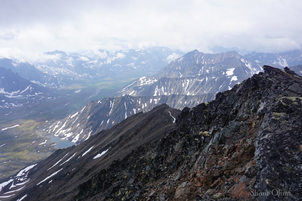
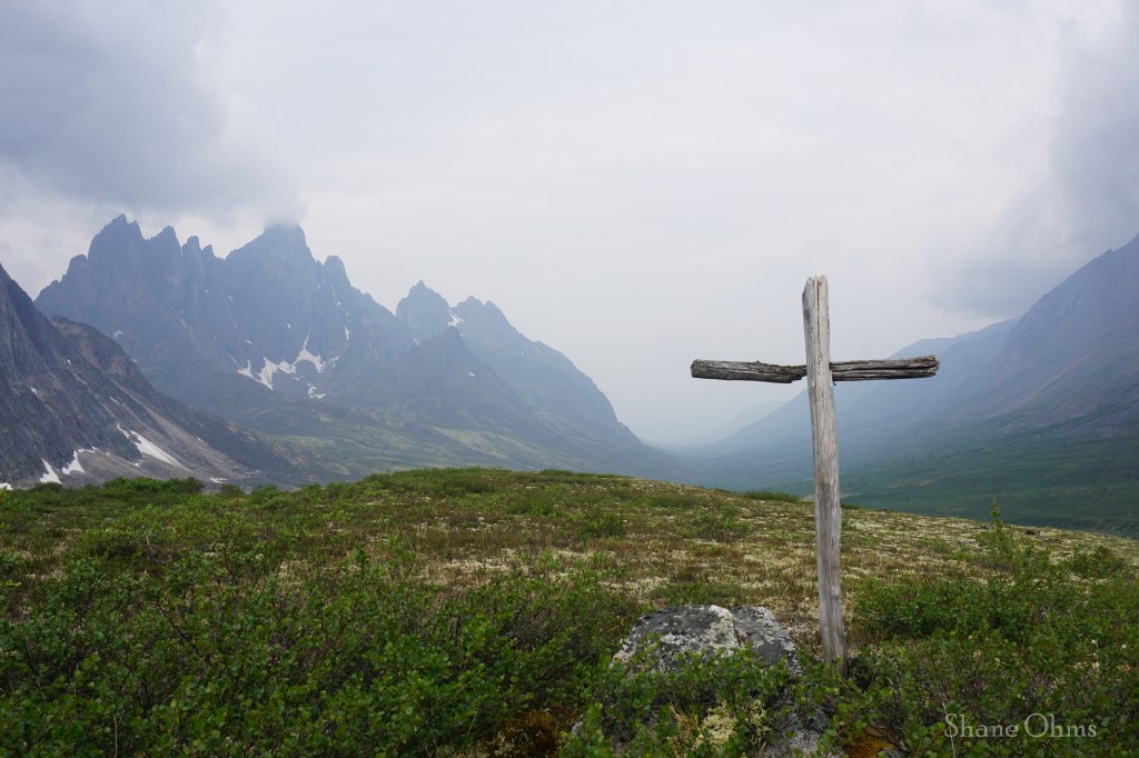
For day 4, Nathan and Justine decided to give another go at Mount Frank Rae, and I’m glad they were successful in it because it is a notable, tall mountain, and takes a bit of time and effort to pull it off. The weather on this day still had a presence of inclement about it, but it was of the windier variety. I decided to spend the day hike from Talus Lake toward Tombstone Mountain with a goal of climbing the small 5200′ prong to the northeast of Tombstone Mountain.


I got to the saddle between the 5200′ prong and Tombstone, and advanced 100 feet up it, but I decided to stop ~200 vertical feet shy, because some of the rocks I came up to reach the saddle were scrambly and I didn’t want to risk them being wet on the downclimb.
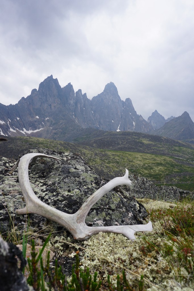
The only sign I saw that animals larger than a marmots exist out here… besides ourselves.
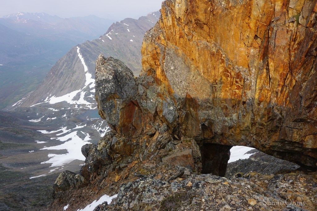
Photogenically speaking, Tombstone Mountain itself somehow becomes less interesting the closer you get to it. But having the extra day to roam gave me time stop and do photo sessions wherever I found inspiration. We probably walked past so many more photographic subjects on our previous days in Tombstone Park, this place, in the valleys below Tombstone Mountain, is just where I happened to be on the day that we had extra time to explore. It takes some effort to get to cool places, but without the extra time to enjoy them, sometimes you don’t get the full value.
Even the wind shrinks when you lay on the ground 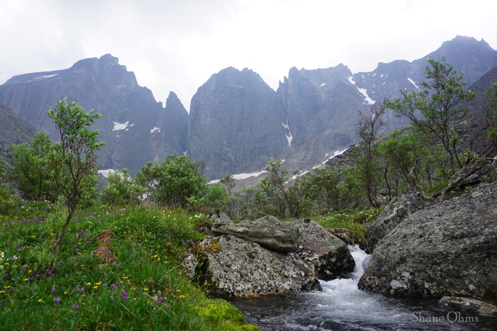
Flowers on the dark side of an impenetrable ridge 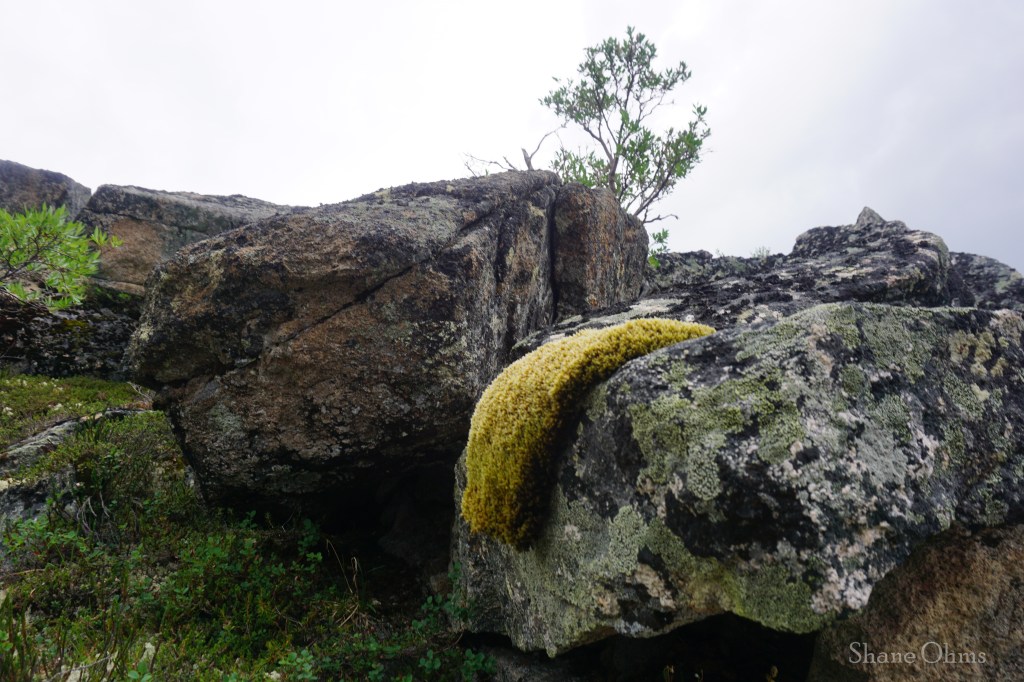
Moss falls off of a rock in Salvador Dali style. But just how long has it been slipping for? Legend has it that in 1971 this moss colony wanted to see what it would be like to leave the gold standard -and it has been slipping ever since! 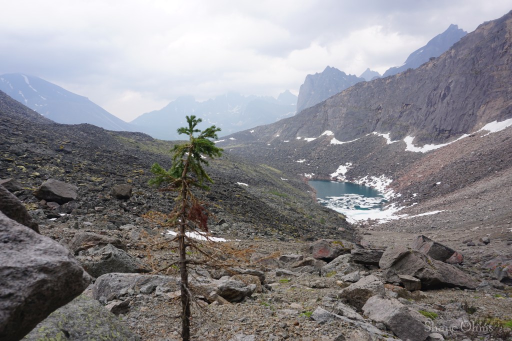
The only tree an otherwise baren valley dodges the stone meteors that fall from Tombstone Mountain 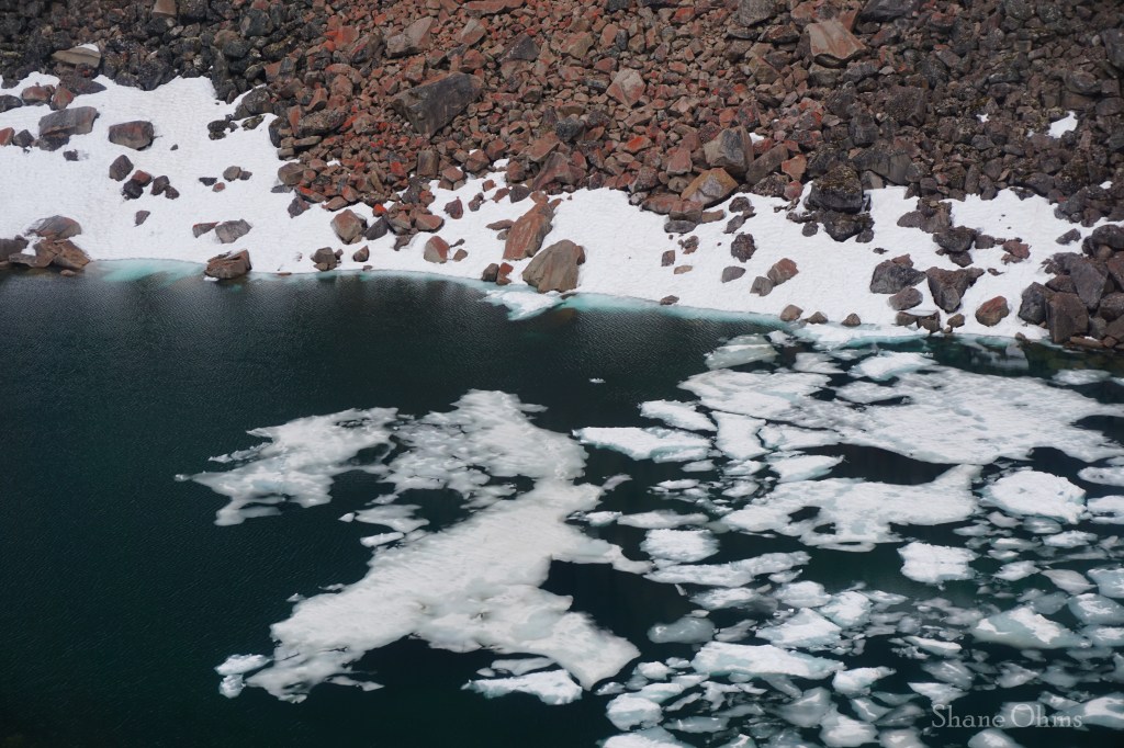
Only the rocks of Tombstone Mountain. could make the icy water look warm 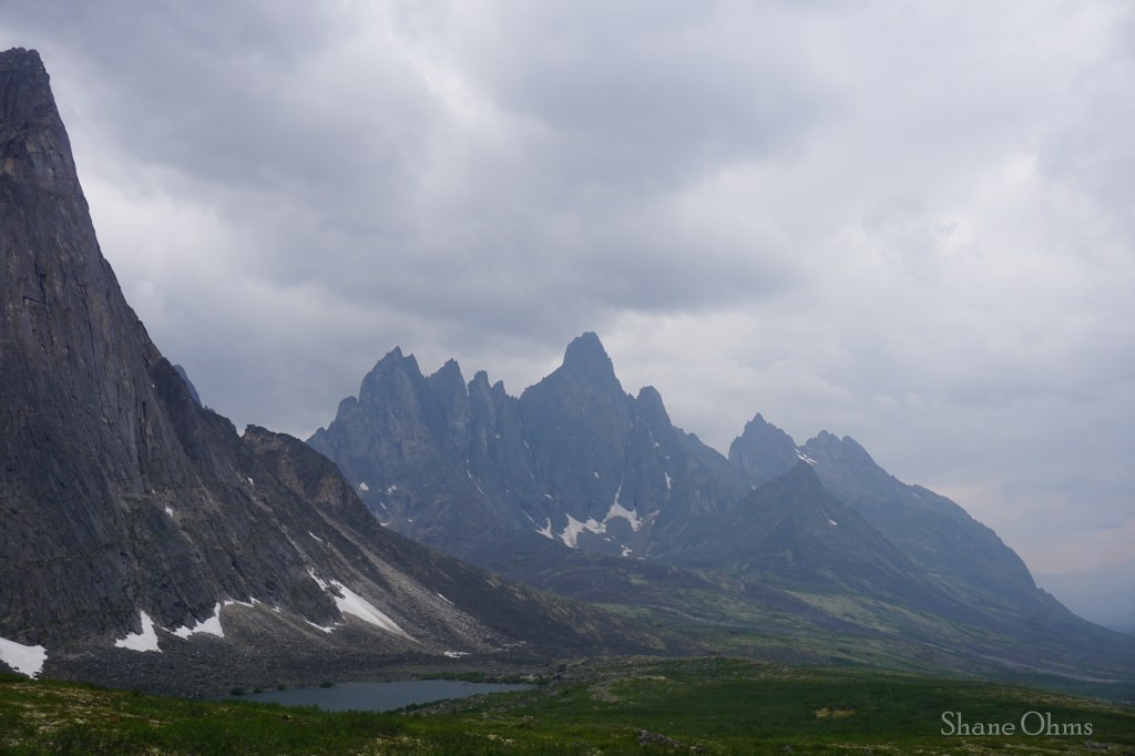
Although distant once again, the ominous Tombstone Mountain still whispers “keep your distance” 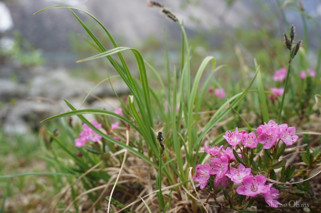
Although a similar latitude to Fairbanks, in the alpine flowers have a shorter season to bloom 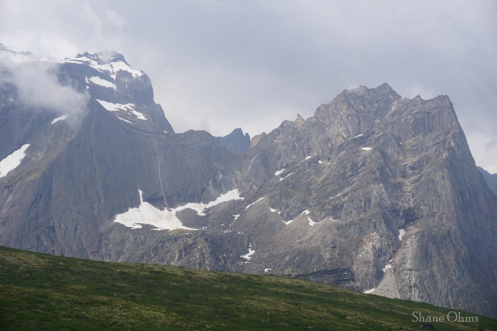
An almost extraterrestrial experience. An ice climb that, for how isolated it is; might as well exist on another planet.
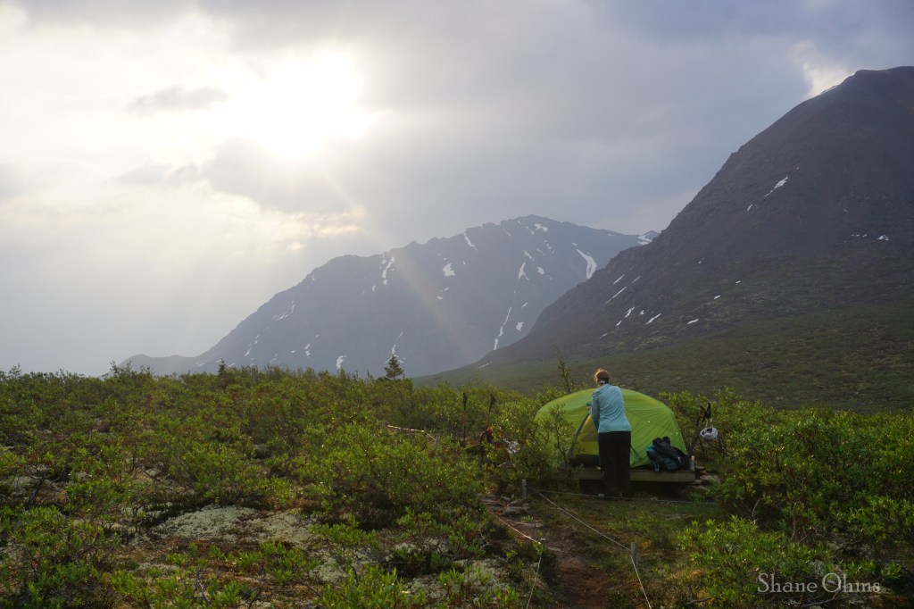
Back at camp, I checked the rudimentary weather forecast from my DeLorme InReach. The next day would be ok, but after that it called for rain. We decided to get up early the next day so that we could get to the top of Glissade Pass with enough time to choose between hiking out a day early, or keeping to our reservation plan at Grizzly Lake which would include rain the following morning. We were joined by a fresh set of campers rotating through the cook tent, notably, two Australians, one of whose ancestors was exiled to Australia from the UK for stealing a loaf of bread. That is probably the best piece of bread that money can’t… steal (Australia > England). And good luck cutting it without a kitchen knife!
The Australian’s were on a large road trip, and two weeks later I’d run into them again at the Sixmile whitewater festival on the Kenai, of all places.
Thursday July 4th, 2024
With rain incoming, us Americans felt like we’d overstayed our welcome and would decide to push back to the car today. Alright, that’s a lie; to be totally honest we were just starting to crave cheeseburgers! The trip back felt like an accelerated rewind through familiar scenes, except colder than how we had remembered them during the premier playthrough. This trip actually caught me a little off guard with how cold it got when the sun goes down. I actually wore all of the layers I brought, and I slept in my rain pants on the nights at Talus Lake.

We stopped at the Divide Lake cook tent to get out of the wind and warm up. Other parties were finishing up breakfast when we arrived, and we heard that that morning someone had dropped their phone while on the toilet, and that you could still hear the echos of the pre-downloaded sports broadcast narrating the game. I had to go see this for myself. I stared down into the abyss, but no screams rose to my ears. But I can just imagine the broadcaster yelling “goaaaaaaaaaal!” as the phone slips through the thumbs, and then the thighs, of the excited sports fan. It is comical, but also tragic. The phone is replaceable, but the photos are not. I say this as someone who has watched my own camera fall over one or two hundred feet into the abyss of a monster crevasse. Neither will ever be seen again, but if you asked me to recover one I’d ask you for a tyvek suit instead of a rope!
We led a convoy of folks up Glissade Pass, favoring the scree to climbers right instead of the snow. At the top, the Ottawanians had also decided to skip the rainy morning after at Grizzly Lake and head back to the car. I proposed that we save some marginal elevation gains by following the ridge that parallels the trail (and summits the proper summit of Rockcandy Mountain), instead of dropping to Grizzly and then regaining 1500′ on the trail out. The brilliance of this proposition is still in question to this day. We traded group photos with the Ottawanians at the top of the pass and then we said our first of three goodbyes.

Although the elevation gain was about the same, the high route was definitely more rugged. On this particular day, the views were so-so, but it was about what we expected. There was a cool multicolored lake to look at, and there was one section that felt more difficult with the heavy packs, but that’s about it. On a better day, the views of Mount Monolith are probably even better than from the Grizzly Lake Trail.
I saw some familiar clothes colors below me, so I ditched Nathan and Justine and raced down Rockcandy Mountain to the marmot meadow (which is near the high point of the Grizzly Lake Tail) just in time to say goodbye to the Ottawanians once again.They had significantly less steam taken out of them, so the main trail is unarguably more efficient.


The final descent back to the car racked the day up to almost 5000′ of descent, with heavy packs. Suffice to say the knees were not happy about it. Chicken jambalaya at the car was nice. We still had to pack up a wet tent in the morning, but at least we were at the car already.
Friday July 5th, 2024
On this day we simply drove back to Fairbanks. But first we stopped in Dawson City to return bear barrels. And in doing so, we ran into the Ottawanians on the boardwalks and said a third and final goodbye.
Back to the rewind, we took another boat ride. Justine played the song ‘I’m on a Boat’, which is perhaps the only place it makes sense to hear that song over the car speakers. Before the border crossing, I stretched my legs on 4151′ Swede Dome. After the border crossing, we had brunch with my parents who were visiting Chicken for the 4th of July weekend. And then, finally, we arrived back in Fairbanks
Tombstone Territorial Park should be on every outdoorsy Alaskans bucket list (and it should be mandatory if you reside in Fairbanks). What are you waiting on? Yukon do it!

Wow Shane… what a trip and what a write up! Was glad to see you safely back for lunch in Chicken Alaska.
LikeLiked by 1 person
I love your meaningful ending that properly wraps up the adventure. Happy explorings!
LikeLiked by 1 person
what an adventure! You go to some incredible places on this earth! Thanks for sharing with us!
LikeLiked by 1 person
Awesome write up and photos! My wife and I almost went there last summer for the first time, but we were headed to Whitehorse first and we decided to stay in that area because of the fires along the Klondike Highway. We will definitely have to get there now!
LikeLiked by 1 person