Tombstone Territorial Park has been on my “someday” list of places to visit, and it could’ve easily sat on that list for 10 years more before I’d actually have done it. But in 2024, after our plan A on the Dalton Highway was shut down by the grapefruit forest fire road closure, and as plan B to the Wrangles fell due to a dismal weather forecast; Tombstone Territorial Park materialized as a rapidly concocted plan C for Nathan, Justine, and my’s 4th of July week.
Author Archives: sdohms
Cashews River and Wiehl Mountain: an Alaskan Brooks Range Traverse

This trip report is one that I hope brings awareness of the Cashews River as a packrafting objective. Prior to testing the waters for ourselves, I had just two pieces of beta to go off of: an Ed Plumb video on youtube, and a photography website with helpful photos. I gathered that it was probably a class 3 river with two canyons to stop and scout at. With a good forecast, and a good team assembled, we did the float, and some peaks along the way, and I now have some things to share that might help future floaters of the beautiful Cashews River. I also have this cool video to contribute
Our Days in Chititu
McCarthy longtime locals were calling this the worst mosquito summer they could remember -and I don’t think they were lying. To minimize losses to our precious sanity and blood reserves, we had to wear our long-sleeve wind breakers and gloves. Which wouldn’t be that bad by itself, but under the hot summer sun these layers were way too much. The sweating was a mess. The buzz of mosquitos was incessant. And the 5 mile “road to Chititu” is anything but a road after the first mile. Alders and vegetation invade the airspace above the trail. You loose the trail and then find it because it is so difficult to distinguish. By the end of the fourth mile we were quite sweat drenched, but then a heavy flash rain for the last mile determined that every square inch of our clothing and bodies should be dripping wet. The rain, had astonishingly little effect on the mosquitos. Hoping to find shelter from the rain in Chititu, we quickened our already fast pace. We found such shelter at a horse stable in Chititu at 5:30pm. We were only 3 hours into the trip and I was already ready for it to be over. But the testing of patience was far from over.
Jumbo Mine
Additionally, the National Park Service has done the work of writing up the hiking details for those looking to reach Jumbo Mine (attached below). One tip I’ll say again, and which goes for any trip to McCarthy is to bring bikes, that way you can operate on your own timeline and not be confined to the timeline of the shuttle buses (which shut down waaayy too early in the land of the midnight sun). You can’t drive across the bridge, but you can bring bikes and bike the remaining 5 miles to Kennecott pretty easily.
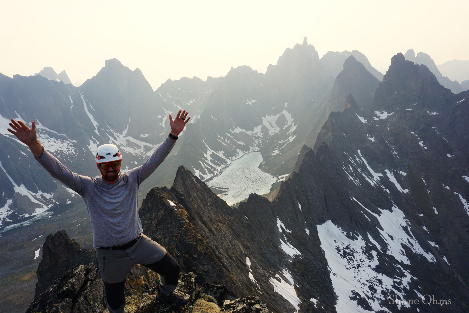
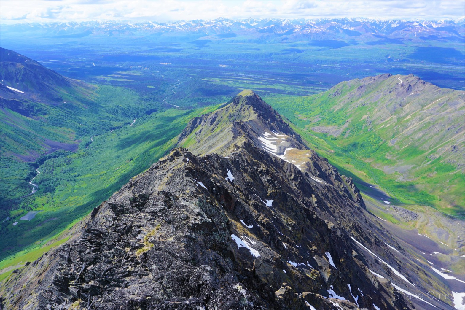
The Elementary Peaks
We wrapped around Polonium Peak and ascended up to the saddle between it and the Elementary Spires. At this saddle, we dropped our packs and traveled unweighted up Polonium’s East ridge. No signs of prior ascent were found, and I left behind a summit registrar. Over the course of the trip, the views would become ‘more of the same’, but for now they were amazing and fresh.
Institute and Minya

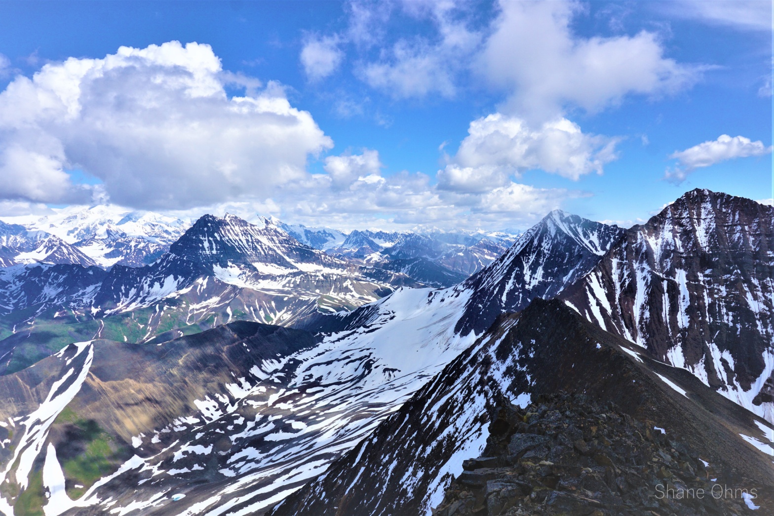
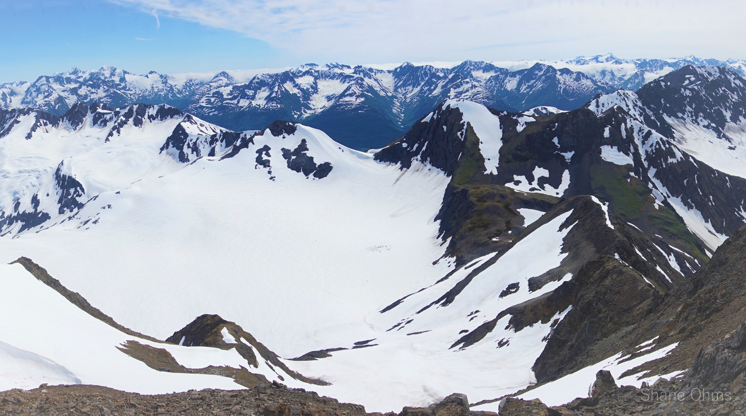
Institute and Minya: two more of the awesome Gulkana Glacier Peaks. And while my favorite Gulkana Glacier peak remains to be Icefall Peak; that doesn’t mean either of these two peaks were slouching. It just means that all the Gulkana Peaks are super amazing. And the reason for this is because the Gulkana Glacier peaksContinue reading “Institute and Minya”
Bear Peak
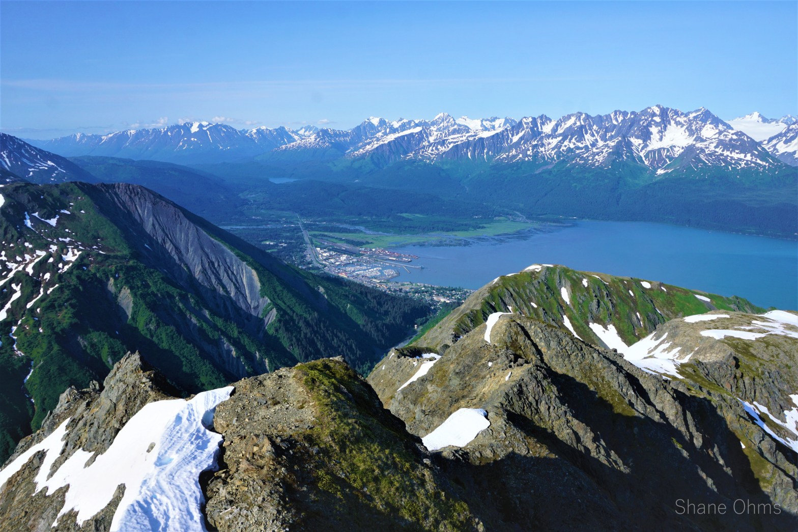
My cousins and family had come to A-town (Anchorage) for a week, and so amongst other Southcentral Alaska things such as Flat Top, Gold Chord Lake, and Crow Creek gold panning, we made arrangements to spend some time in Seward. Now; Seward is no stranger to tourism, thanks to a lovely blend of both natural beauty and the free market, however Seward is especially full of foreigners (such as myself) on 4th of July weekend. Why is 4th of July weekend in Seward such a rave, even for us Alaskans? Well, 4th of July is historically when the popular Mt. Marathon Race takes place. Fortunately (at least for this year anyways) race day was moved to Tuesday so the city wouldn’t be as overrun as it otherwise gets.
(Ok, so maybe that’s not the real reason the day changed, but that is the reason I’m happy its not held on the weekend.)
A Berry Wonderful Loop
The snow line went splendidly. Wonderful 50 degree snow, a little hard, not yet softened by the sun. But that beats the other extreme: slushy and unsupportive. Sophie was nursing a broken toe at the time so I got all the first kicks in crampons. From the top of our snow line, the summit was a little walk away, and earned at 1pm. Sophie logged into the registrar, I took lots of great pictures. The Turnagain Arm was splayed out and the views in all directions, of the countless Chugach Mountains, were pristine. I’m glad we didn’t do this one on a day with poor visibility.
The West Ridge of Benench’iltledi Peak
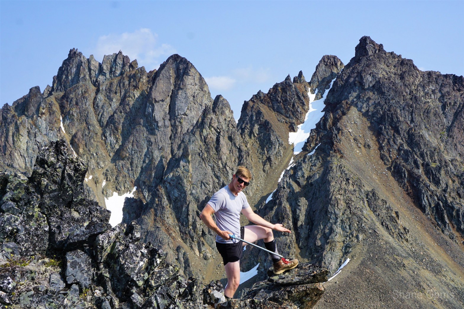
These ‘Elementary Mountains’ have made a sweet spot in my heart since I found them on google earth back in my college days. I’d made a try at skiing one of them that semester, but that didn’t work out. That was over two years ago. Furthermore, it was cloudy on that trip so I still lacked any reconnaissance photos of the area. Benench’iltledi Peak, was pretty standalone and it had a particular route I wanted to do it by; the west ridge. Additionally, I had some good beta on the approach for this peak from a Roaming Dials packrafting page
Kenny Lake and Tonsina Daytreks

You know that thing where you convince yourself the bushwhacking won’t be “thaat bad”, and then by the time you realize just how godawful it actually is, it is actually easier to keep on going through it than it is to turn around? Yeah? Well, I played that sneaky little trick on myself here and ohhohooohhoh; I fubbed me self reaaaal good this time!
